- Lucasville, Ohio
Infobox Settlement
official_name = Lucasville, Ohio
settlement_type = CDP
nickname =
motto =
imagesize =
image_caption =
image_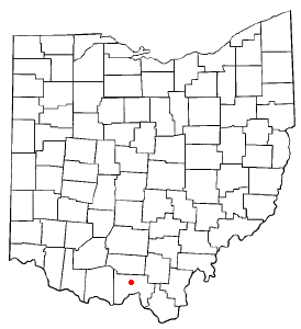
mapsize = 250px
map_caption = Location of Lucasville, Ohio
mapsize1 =
map_caption1 =subdivision_type = Country
subdivision_name =United States
subdivision_type1 = State
subdivision_name1 =Ohio
subdivision_type2 = County
subdivision_name2 = Sciotogovernment_footnotes =
government_type =
leader_title =
leader_name =
leader_title1 =
leader_name1 =
established_title =
established_date =unit_pref = Imperial
area_footnotes =area_magnitude =
area_total_km2 = 6.6
area_land_km2 = 6.5
area_water_km2 = 0.1
area_total_sq_mi = 2.6
area_land_sq_mi = 2.5
area_water_sq_mi = 0.0population_as_of = 2000
population_footnotes =
population_total = 1588
population_density_km2 = 243.8
population_density_sq_mi = 631.4timezone = Eastern (EST)
utc_offset = -5
timezone_DST = EDT
utc_offset_DST = -4
elevation_footnotes = GR|3
elevation_m = 167
elevation_ft = 548
latd = 38 |latm = 52 |lats = 49 |latNS = N
longd = 82 |longm = 59 |longs = 40 |longEW = Wpostal_code_type =
ZIP code s
postal_code = 45648, 45699
area_code = 740
blank_name = FIPS code
blank_info = 39-45304GR|2
blank1_name = GNIS feature ID
blank1_info = 1061449GR|3
website =
footnotes =Lucasville is a
census-designated place (CDP) in Scioto County,Ohio ,United States . The population was 1,588 at the 2000 census. The village of Lucasville was laid out by CaptainJohn Lucas in June 1819 and recorded August 7, 1819. Captain Lucas built the first tavern in the village and kept it until his death in 1825. His house for a long time was headquarters for the Democratic leaders ofSouthern Ohio .cite news|title=Portsmouth Area Resource Guide, 2007-2008|publisher="The Community Common"|page=7|date=2007-07-29|accessdate=2007-07-29]Lucasville is the location of the Scioto County Fairgrounds. In addition, the
Southern Ohio Correctional Facility , Ohio's only maximum security prison and the location of Ohio's death house wheredeath row inmates are executed, is located just outside Lucasville.Lucasville is served by the
Portsmouth Public Library as well as the Valley Local School District and Northwest Local School DistrictGeography
Lucasville is located at coor dms|38|52|49|N|82|59|40|W|city (38.880234, -82.994439)GR|1.
According to the
United States Census Bureau , the CDP has a total area of 2.5square mile s (6.6km² ), of which, 2.5 square miles (6.5 km²) of it is land and 0.04 square miles (0.1 km²) of it (1.57%) is water.Demographics
As of the
census GR|2 of 2000, there were 1,588 people, 589 households, and 448 families residing in the CDP. Thepopulation density was 631.4 people per square mile (243.3/km²). There were 672 housing units at an average density of 267.2/sq mi (103.0/km²). The racial makeup of the CDP was 97.10% White, 0.13% African American, 0.25% Native American, 0.25% Asian, 0.06% Pacific Islander, 0.06% from other races, and 2.14% from two or more races. Hispanic or Latino of any race were 0.31% of the population.There were 589 households out of which 33.8% had children under the age of 18 living with them, 57.2% were married couples living together, 14.1% had a female householder with no husband present, and 23.8% were non-families. 21.2% of all households were made up of individuals and 10.4% had someone living alone who was 65 years of age or older. The average household size was 2.70 and the average family size was 3.08.
In the CDP the population was spread out with 26.8% under the age of 18, 9.8% from 18 to 24, 26.6% from 25 to 44, 25.3% from 45 to 64, and 11.5% who were 65 years of age or older. The median age was 37 years. For every 100 females there were 90.6 males. For every 100 females age 18 and over, there were 87.4 males.
The median income for a household in the CDP was $25,313, and the median income for a family was $37,443. Males had a median income of $30,125 versus $21,174 for females. The
per capita income for the CDP was $13,569. About 6.8% of families and 8.5% of the population were below thepoverty line , including 6.4% of those under age 18 and none of those age 65 or over.Notable natives
*
Ted Strickland (1941- ) - currentGovernor of Ohio and former member of theUnited States House of Representatives (1993-2006)
*Roy Rogers References
External links
Wikimedia Foundation. 2010.