- Wheelersburg, Ohio
Infobox Settlement
official_name = Wheelersburg, Ohio
other_name =
native_name =
nickname = "The Burg"
settlement_type = CDP
motto =
imagesize =
image_caption =
flag_size =
image_
seal_size =
image_shield =
shield_size =
image_blank_emblem =
blank_emblem_size =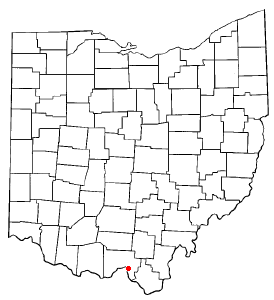
mapsize = 250px
map_caption = Location of Wheelersburg, Ohio
mapsize1 =
map_caption1 =
image_dot_
dot_mapsize =
dot_map_caption =
dot_x =
dot_y =
pushpin_
pushpin_label_position =
pushpin_map_caption =
pushpin_mapsize =
subdivision_type = Country
subdivision_name =United States
subdivision_type1 = State
subdivision_name1 =Ohio
subdivision_type2 = County
subdivision_name2 = Scioto
subdivision_type3 =
subdivision_name3 =
subdivision_type4 =
subdivision_name4 =
government_footnotes =
government_type =
leader_title =
leader_name =
leader_title1 =
leader_name1 =
leader_title2 =
leader_name2 =
leader_title3 =
leader_name3 =
leader_title4 =
leader_name4 =
established_title =
established_date =
established_title2 =
established_date2 =
established_title3 =
established_date3 =
area_magnitude =
unit_pref = Imperial
area_footnotes =
area_total_km2 = 15.3
area_land_km2 = 15.1
area_water_km2 = 0.2
area_total_sq_mi = 5.9
area_land_sq_mi = 5.8
area_water_sq_mi = 0.1
area_water_percent =
area_urban_km2 =
area_urban_sq_mi =
area_metro_km2 =
area_metro_sq_mi =
population_as_of = 2000
population_footnotes =
population_note =
population_total = 6,471
population_density_km2 = 429.7
population_density_sq_mi = 1112.9
population_metro =
population_density_metro_km2 =
population_density_metro_sq_mi =
population_urban =
population_density_urban_km2 =
population_density_urban_sq_mi =
population_blank1_title =
population_blank1 =
population_density_blank1_km2 =
population_density_blank1_sq_mi =
timezone = EST
utc_offset = -5
timezone_DST = EDT
utc_offset_DST = -4
latd = 38 |latm = 44 |lats = 2 |latNS = N
longd = 82 |longm = 50 |longs = 33 |longEW = W
elevation_footnotes =
elevation_m = 169
elevation_ft = 554
postal_code_type =ZIP code
postal_code = 45694
area_code = 740
blank_name = FIPS code
blank_info = 39-84588GR|2
blank1_name = GNIS feature ID
blank1_info = 1077173GR|3
website =
footnotes =Wheelersburg is a
census-designated place (CDP) in Scioto County,Ohio ,United States . It was founded in 1820 and was originally known as Concord.cite news|title=Portsmouth Area Resource Guide, 2007-2008|publisher="The Community Common"|page=7|date=2007-07-29|accessdate=2007-07-29] It lies along the northern banks of theOhio River inSouthern Ohio . Wheelersburg is approximately 7 miles east of Portsmouth and 14 miles west of Ironton in Lawrence County. It is in Porter Township. The population was 6,471 at the 2000 census.Geography
Wheelersburg is located at coor dms|38|44|2|N|82|50|33|W|city (38.733779, -82.842411)GR|1.
According to the
United States Census Bureau , the CDP has a total area of 5.9square mile s (15.3km² ), of which, 5.8 square miles (15.0 km²) of it is land and 0.1 square miles (0.2 km²) of it (1.36%) is water.Climatic conditions
Even though Wheelersburg suffered a category 5 (maximum wind speeds of 261-318 miles per hour) tornado on
April 23 ,1968 , in which seven people were killed and 93 people injured, costing nearly $5 million in damages, Wheelersburg is below the Ohio state average for tornado activity.cite news|title=Comparing Wheelersburg to state averages|publisher="The Scioto Voice"|accessdate=2007-07-11|date=2007-06-14|page=A4]Demographics
As of the
census GR|2 of2000 , there were 6,471 people, 2,558 households, and 1,826 families residing in the CDP. Thepopulation density was 1,112.9 people per square mile (430.0/km²). There were 2,755 housing units at an average density of 473.8/sq mi (183.1/km²). The racial makeup of the CDP was 97.90% White, 0.28% African American, 0.63% Native American, 0.14% Asian, 0.02% Pacific Islander, 0.15% from other races, and 0.88% from two or more races. Hispanic or Latino of any race were 0.45% of the population.There were 2,558 households out of which 33.4% had children under the age of 18 living with them, 55.8% were married couples living together, 12.8% had a female householder with no husband present, and 28.6% were non-families. 25.4% of all households were made up of individuals and 12.4% had someone living alone who was 65 years of age or older. The average household size was 2.43 and the average family size was 2.91.
In the CDP the population was spread out with 24.1% under the age of 18, 8.6% from 18 to 24, 26.2% from 25 to 44, 23.3% from 45 to 64, and 17.9% who were 65 years of age or older. The median age was 39 years. For every 100 females there were 83.9 males. For every 100 females age 18 and over, there were 78.0 males.
The median income for a household in the CDP was $33,970 in 2000. In 2005, it was $34,400 compared with the state average of $43,493. The median income for a family was $41,200. Males had a median income of $35,000 versus $22,472 for females. The
per capita income for the CDP was $18,787. About 10.7% of families and 14.2% of the population were below thepoverty line , including 22.5% of those under age 18 and 6.6% of those age 65 or over.Public services
Wheelersburg residents are served by the
Portsmouth Public Library -Wheelersburg Branch, the Wheelersburg Local School District, and by a full-time as well as avolunteer fire department .Miscellanea
Wheelersburg is the home of the 2001 11-12 year old, the 2003 13-14 year old, the 2003 15-16 year old and the 2007 9-10 year oldcite web|url=http://portsmouth-dailytimes.com/articles/2007/08/02/news/sports/1sports_burg.txt|title=Burg takes the state title|author=John Stegman|publisher="Portsmouth Daily Times"|accessdate=2007-08-02|date=2007-08-02] state girls' softball champions. Wheelersburg is also the home of the 2007 11-12 year old boys little league team that was invited to play an exhibition game in
Williamsport, Pennsylvania during theLittle League World Series festivities.cite web|url=http://portsmouth-dailytimes.com/articles/2007/08/03/news/sports/1sports_burg.txt|title=Burg All-stars off to Williamsport|author=Jeff Taepke|publisher="Portsmouth Daily Times|accessdate=2007-08-03|date=2007-08-03]Notable natives
*
Josh Newman , Major League Baseball pitcher
*Dave Pyles ,National Football League player with theOakland Raiders cite web|url=http://www.raiders.com/Common/Article.aspx?id=10578|title=Oakland Raiders: All-Time Roster|author=Oakland Raiders|accessdate=2007-07-27|date]ee also
*
List of cities and towns along the Ohio River References
External links
[http://www.burg.k12.oh.us/ Wheelersburg Local School District]
Wikimedia Foundation. 2010.