- West Portsmouth, Ohio
Infobox Settlement
official_name = West Portsmouth, Ohio
settlement_type = CDP
nickname =
motto =
imagesize =
image_caption =
image_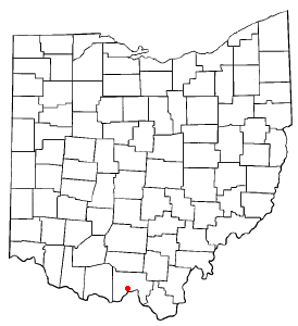
mapsize = 250x200px
map_caption = Location of West Portsmouth, Ohio
mapsize1 =
map_caption1 =subdivision_type = Country
subdivision_name =United States
subdivision_type1 = State
subdivision_name1 =Ohio
subdivision_type2 = County
subdivision_name2 = Sciotogovernment_footnotes =
government_type =
leader_title =
leader_name =
leader_title1 =
leader_name1 =
established_title =
established_date =unit_pref = Imperial
area_footnotes =area_magnitude =
area_total_km2 = 12.3
area_land_km2 = 12.3
area_water_km2 = 0.0
area_total_sq_mi = 4.7
area_land_sq_mi = 4.7
area_water_sq_mi = 0.0population_as_of = 2000
population_footnotes =
population_total = 3458
population_density_km2 = 281.3
population_density_sq_mi = 728.5timezone = Eastern (EST)
utc_offset = -5
timezone_DST = EDT
utc_offset_DST = -4
elevation_footnotes = GR|3
elevation_m = 188
elevation_ft = 617
latd = 38 |latm = 45 |lats = 30 |latNS = N
longd = 83 |longm = 1 |longs = 55 |longEW = Wpostal_code_type =
ZIP code
postal_code = 45663
area_code = 740
blank_name = FIPS code
blank_info = 39-84140GR|2
blank1_name = GNIS feature ID
blank1_info = 1061750GR|3
website =
footnotes =West Portsmouth is a
census-designated place (CDP) in Scioto County,Ohio ,United States . The population was 3,458 at the 2000 census. The citizens of West Portsmouth are served by the Washington-Nile Local School District (Portsmouth West High School ).Geography
West Portsmouth is located at coor dms|38|45|30|N|83|1|55|W|city (38.758427, -83.031863)GR|1.
According to the
United States Census Bureau , the CDP has a total area of 4.8square mile s (12.3km² ), all of it land.Demographics
As of the
census GR|2 of 2000, there were 3,458 people, 1,368 households, and 995 families residing in the CDP. Thepopulation density was 728.5 people per square mile (281.1/km²). There were 1,472 housing units at an average density of 310.1/sq mi (119.7/km²). The racial makeup of the CDP was 96.99% White, 0.09% African American, 1.47% Native American, 0.06% Asian, 0.14% from other races, and 1.24% from two or more races. Hispanic or Latino of any race were 0.09% of the population.There were 1,368 households out of which 32.8% had children under the age of 18 living with them, 53.1% were married couples living together, 14.6% had a female householder with no husband present, and 27.2% were non-families. 23.1% of all households were made up of individuals and 11.4% had someone living alone who was 65 years of age or older. The average household size was 2.53 and the average family size was 2.96.
In the CDP the population was spread out with 25.9% under the age of 18, 8.8% from 18 to 24, 28.9% from 25 to 44, 22.4% from 45 to 64, and 14.0% who were 65 years of age or older. The median age was 36 years. For every 100 females there were 90.1 males. For every 100 females age 18 and over, there were 88.1 males.
The median income for a household in the CDP was $27,668, and the median income for a family was $31,281. Males had a median income of $27,193 versus $17,644 for females. The
per capita income for the CDP was $12,345. About 18.9% of families and 22.1% of the population were below thepoverty line , including 31.7% of those under age 18 and 17.0% of those age 65 or over.Notable natives
*
Earl Thomas Conley : Country singerReferences
External links
* [http://www.west.k12.oh.us/ Washington-Nile Local School District]
Wikimedia Foundation. 2010.