- South Webster, Ohio
Infobox Settlement
official_name = South Webster, Ohio
settlement_type = Village
nickname =
motto =
imagesize =
image_caption =
image_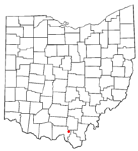
mapsize = 250x200px
map_caption = Location of South Webster, Ohio
mapsize1 =
map_caption1 =subdivision_type = Country
subdivision_name =United States
subdivision_type1 = State
subdivision_name1 =Ohio
subdivision_type2 = County
subdivision_name2 = Sciotogovernment_footnotes =
government_type =
leader_title =
leader_name =
leader_title1 =
leader_name1 =
established_title =
established_date =unit_pref = Imperial
area_footnotes =area_magnitude =
area_total_km2 = 3.4
area_land_km2 = 3.4
area_water_km2 = 0.0
area_total_sq_mi = 1.3
area_land_sq_mi = 1.3
area_water_sq_mi = 0.0population_as_of = 2000
population_footnotes =
population_total = 764
population_density_km2 = 225.8
population_density_sq_mi = 584.8timezone = Eastern (EST)
utc_offset = -5
timezone_DST = EDT
utc_offset_DST = -4
elevation_footnotes = GR|3
elevation_m = 218
elevation_ft = 715
latd = 38 |latm = 48 |lats = 56 |latNS = N
longd = 82 |longm = 43 |longs = 34 |longEW = Wpostal_code_type =
ZIP code
postal_code = 45682
area_code = 740
blank_name = FIPS code
blank_info = 39-73824GR|2
blank1_name = GNIS feature ID
blank1_info = 1084066GR|3
website =
footnotes =South Webster is a village in northeast Scioto County,
Ohio ,United States . It lies along State Route 140, and the population was 764 at the 2000 census. [ [http://www.osuedc.org/profiles/population/places.php?sid=41&fips=390145 Scioto County, Ohio — Population by Places Estimates]Ohio State University , 2007. Accessed 15 May 2007.] South Webster was platted byJohn Bennett in 1853.cite news|title=Portsmouth Area Resource Guide, 2007-2008|publisher="The Community Common"|page=7|date=2007-07-29|accessdate=2007-07-29] South Webster hosts the Cornhole World Championship.cite web|url=http://portsmouth-dailytimes.com/articles/2007/07/29/news/sports/1sports_cornhole.txt|title=King of Corn: Competition fierce at Cornhole Championships|author=Jeff Taepke|date=2007-07-29|accessdate=2007-07-29|publisher="Portsmouth Daily Times"]Geography
South Webster is located at coor dms|38|48|56|N|82|43|34|W|city (38.815454, -82.726091)GR|1.
According to the
United States Census Bureau , the village has a total area of 1.3square mile s (3.4km² ), of which, 1.3 square miles (3.4 km²) of it is land and 0.04 square miles (0.1 km²) of it (1.52%) is water.Demographics
As of the
census GR|2 of 2000, there were 764 people, 312 households, and 224 families residing in the village. Thepopulation density was 584.8 people per square mile (225.2/km²). There were 338 housing units at an average density of 258.7/sq mi (99.6/km²). The racial makeup of the village was 98.30% White, 0.65% Native American, 0.39% Pacific Islander, 0.13% from other races, and 0.52% from two or more races. Hispanic or Latino of any race were 0.65% of the population.There were 312 households out of which 31.1% had children under the age of 18 living with them, 56.4% were married couples living together, 11.9% had a female householder with no husband present, and 27.9% were non-families. 26.0% of all households were made up of individuals and 15.1% had someone living alone who was 65 years of age or older. The average household size was 2.45 and the average family size was 2.91.
In the village the population was spread out with 24.6% under the age of 18, 10.1% from 18 to 24, 26.2% from 25 to 44, 24.7% from 45 to 64, and 14.4% who were 65 years of age or older. The median age was 38 years. For every 100 females there were 87.7 males. For every 100 females age 18 and over, there were 81.1 males.
The median income for a household in the village was $26,818, and the median income for a family was $40,938. Males had a median income of $31,583 versus $22,727 for females. The
per capita income for the village was $15,047. About 13.0% of families and 16.4% of the population were below thepoverty line , including 21.7% of those under age 18 and 14.1% of those age 65 or over.Public services
South Webster is home to the Bloom-Vernon Local School District. The district includes Bloom-Vernon Elementary School, South Webster Jr.-Sr. High School, South Webster Headstart, and Vernon Adult Learning Center. South Webster's mascot is the Jeeps. They were the 2006
Ohio High School Athletic Association Division IV basketball champions.cite web|url=http://www.ohsaa.org/|title=Ohio High School Athletic Association Web site|accessdate=2006-12-31|author=OHSAA ] South Webster is served by thePortsmouth Public Library -South Webster Branch.References
External links
* [http://www.playcornhole.org/ American Cornhole Association]
""'Mapit-US-cityscale|38.815454|-82.726091
Wikimedia Foundation. 2010.