- Ohio State Route 140
-
State Route 140
Route information Maintained by ODOT Length: 20.74 mi[3] (33.38 km) Existed: 1923[1][2] – present Major junctions West end:  US 52 in Portsmouth
East end:  SR 93 near Oak Hill
Location Counties: Scioto, Lawrence, Jackson Highway system Ohio highways
Interstates • U.S. Routes • State Routes←  SR 139
SR 141  →
→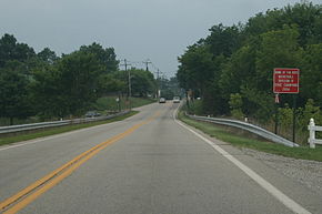 A view of SR 140 entering South Webster from the northeast
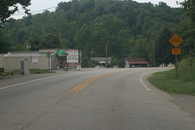
 A view of SR 140 entering Scioto Furnace from the northeast
State Route 140 (SR 140, OH 140) is an east–west state highway in the southern portion of the U.S. state of Ohio. The highway has its western terminus in Portsmouth at a diamond interchange with U.S. Route 52. Its eastern terminus is at State Route 93 approximately 2.75 miles (4.43 km) south of Oak Hill.State Route 140 first appeared in the mid 1920s. The two-lane highway passes through three counties along its path: Scioto, Lawrence and Jackson. It begins at an interchange with U.S. Route 52 and, immediately following the interchange, leaves the Portsmouth corporation limits and heads east. The route makes a quick hilly climb upward and downward to the former Teays River Valley near Slocum; it then traverses primarily wooded areas as it passes through Ashley Corner, Scioto Furnace, South Webster, and Eifort. It retains the forested area up until its eastern terminus. For most of its alignment, State Route 140 parallels an abandoned Baltimore and Ohio Railroad line.
Contents
Route description
Along its way, State Route 140 travels through eastern Scioto County, clips the northwestern corner of Lawrence County and then sneaks into southern Jackson County. State Route 140 is not a part of the National Highway System, a system of highways deemed most important for the nation's economy, mobility and defense.[4]
History
State Route 140 was established in 1923. The original routing of the highway is the one which it still utlizes to this day through Scioto, Lawrence and Jackson Counties. The highway has not experienced any major changes since its inception, excepting the highways that it intersects at its endpoints. Its western terminus, which is now U.S. Route 52, was originally a part of State Route 7. Meanwhile, its eastern terminus, which is currently State Route 93, was originally designated as State Route 75.[1][2]
Major intersections
County Location Mile[3] Destinations Notes Scioto Portsmouth 0.00 US 52Western terminus at diamond interchange. Lawrence No major junctions Jackson Jefferson Township 20.74 SR 93Eastern terminus. 1.000 mi = 1.609 km; 1.000 km = 0.621 mi References
- ^ a b Ohio Department of Highways and Public Works (April 1922) (MrSID). Map of Ohio State Highways (Map). Cartography by ODHPW. http://www.dot.state.oh.us/Divisions/TransSysDev/Innovation/prod_services/Documents/StateMaps/otm1922a.sid. Retrieved 2011-01-10.
- ^ a b Ohio Department of Highways and Public Works (July 1923) (MrSID). Map of Ohio Showing State Routes (Map). Cartography by ODHPW. http://www.dot.state.oh.us/Divisions/TransSysDev/Innovation/prod_services/Documents/StateMaps/otm1923a.sid. Retrieved 2011-01-10.
- ^ a b Ohio Department of Transportation. "Technical Services Straight Line Diagrams". http://www.odotonline.org/techservapps/SLD/default.htm. Retrieved 2011-01-10.
- ^ Federal Highway Administration (December 2003) (PDF). National Highway System: Ohio (Map). http://www.fhwa.dot.gov/planning/nhs/maps/oh/oh_Ohio.pdf. Retrieved 2011-01-10.
Categories:- State highways in Ohio
- Transportation in Scioto County, Ohio
- Transportation in Lawrence County, Ohio
- Transportation in Jackson County, Ohio


Wikimedia Foundation. 2010.