- Ohio State Route 103
-
State Route 103
Route information Maintained by ODOT Length: 76.99 mi[1] (123.90 km) Existed: 1924 – present Major junctions West end:  I-75 in Bluffton I-75 in and near Bluffton
East end:  SR 61 near Willard
Location Counties: Allen, Hancock, Wyandot, Crawford, Huron Highway system Ohio highways
Interstates • U.S. Routes • State Routes←  SR 101
SR 104  →
→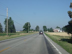 Along State Route 103 in Orange Township, Hancock County.
State Route 103 (SR 103) is an east–west highway in the northern part of the U.S. state of Ohio. Its western terminus is at its interchange with Interstate 75 near Bluffton, and its eastern terminus is at State Route 61 just east of Willard. It passes through or close to the towns of Bluffton, Jenera, Arlington, Mount Blanchard, Carey, Sycamore, Chatfield, New Washington, and Willard.
Route 103 has two separate interchanges with Interstate 75. The first interchange is at Route 103's western terminus (I-75 Exit 140), south of downtown Bluffton. Route 103 traverses north and east from here, servicing downtown Bluffton, before its second interchange with the freeway (I-75 Exit 142). The two interchanges are 2½ miles (via Route 103) apart from each other.
State Route 103 is an original state highway that originally ran from Bluffton to Carey. In 1938, the eastern terminus of the route was extended to State Route 4 at Chatfield. In 1969, its eastern terminus was extended to its current location, replacing the now defunct route numbers 194 and 298.
References
External links
Categories:- State highways in Ohio
- Transportation in Allen County, Ohio
- Transportation in Hancock County, Ohio
- Transportation in Wyandot County, Ohio
- Transportation in Crawford County, Ohio
- Transportation in Huron County, Ohio


Wikimedia Foundation. 2010.