- Ohio State Route 15
-
"OH 15" redirects here. OH 15 may also refer to Ohio's 15th congressional district.
State Route 15
Route information Maintained by ODOT Length: 102.32 mi[1] (164.67 km) Existed: 1926 – present Major junctions East end: 
 US 23 / SR 103 near Carey
 I-75 in Findlay
 US 224 in Findlay
 US 127 near Bryan
 US 6 near Bryan
 US 20A near Montpelier


 I-80 / I-90 / Ohio Tpk. near Montpelier
 US 20 in Pioneer
North end:  M-99 near Pioneer
Location Counties: Williams, Defiance, Putnam, Hancock, Wyandot Highway system Ohio highways
Interstates • U.S. Routes • State Routes←  SR 14
SR 14SR 16  →
→State Route 15 is a north–south/east–west route in northwestern Ohio. Its southern (eastern) terminus is at its interchange with U.S. Route 23/State Route 103 near Carey, and its northern (western) terminus is at the Michigan state line north of Pioneer, where the route continues in Michigan as M-99. The route is bannered east–west from Carey to Bryan, and is bannered north–south from there to the Michigan state line.
State Route 15 is an expressway for its southeasternmost 19 miles: 2 miles as a concurrency with Interstate 75, 3 miles as a concurrency with U.S. Route 68, and the final 14 miles as a stand-alone freeway until its junction with U.S. Route 23. The final 17 miles are part of a heavily traveled corridor providing the most direct route between Detroit, Toledo, Findlay, Marion and Columbus.
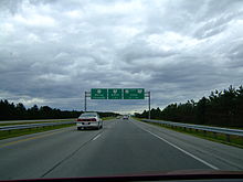 Eastern terminus near Carey
Contents
Route History
State Route 15 was certified in 1923, along the current U.S. Route 322, which replaced it in 1926.
In 1926 the designation was reapplied to a route from Carey to the Indiana state line. In 1929 it was rerouted to Bryan, replacing parts of State Route 9. It replaced the rest of State Route 9 in 1931, rerouted along its current route to the Michigan state line.
In 1966, State Route 15 was rerouted on a expressway from Interstate 75 in Findlay to U.S. Route 23 in Carey, its new southern (eastern) terminus. The highway runs a few miles south of its previous routing, which was recertified as State Route 568 the same year.
Major intersections
County Location Mile Exit Destinations Notes Wyandot Carey 0.00 US 23 / SR 103 – Columbus, ToledoEastern terminus of OH 15 Hancock Vanlue  SR 330 north
Southern terminus of OH 330 Marion Township  SR 37 – Delaware, Findlay
Findlay  US 68 south – Kenton
Eastern end of US 68 concurrency I-75 south / US 68 – Cincinnati, LimaSouthern end of I-75 concurrency; northern terminus of US 68  SR 12 I-75 north / US 224 east – Toledo, Findlay, Tiffin
Northern end of I-75 concurrency; eastern end of US 224 concurrency Blanchard Township  SR 186 north – McComb
Northern terminus of OH 186  SR 235 – Ada, McComb
Putnam Ottawa 
 US 224 west / SR 65 south / SR 109 – Van Wert, Lima
Western end of US 224 concurrency; southern end of OH 65 concurrency; southern terminus of OH 109 SR 65 north / SR 109 northNorthern end of OH 65/OH 109 concurrency Greensburg Township  SR 108 north – Napoleon
Southern terminus of OH 108 Palmer Township  SR 115 south – Kalida
Northern terminus of OH 115  SR 613
Monroe Township  SR 634 south – Continental
Northern terminus of OH 634 Defiance Defiance  SR 18 east
Eastern end of OH 18 concurrency  SR 66 south – Delphos
Southern end of OH 66 concurrency 
 SR 424 west to SR 111
Southern end of OH 424 concurrency SR 424 eastNorthern end of OH 424 concurrency SR 66 northNorthern end of OH 66 concurrency  US 24 – Toledo, Fort Wayne SR 18 west
Northern end of OH 18 concurrency Ney  SR 249 west
Eastern terminus of OH 249 Williams Pulaski Township US 127 south – Van WertSouthern end of US 127 concurrency  US 6 / SR 2 west – Edgerton, Napoleon
Southern end of OH 2 concurrency Bryan  SR 2 east / SR 34
Northern end of OH 2 concurrency US 127 north – West UnityNorthern end of US 127 concurrency Jefferson Township  US 20A east / SR 107 west – Toledo, Montpelier
Southern end of US 20A concurrency; eastern terminus of OH 107 Holiday City I-80 / I-90 / Ohio Tpk. – Toledo, South BendMadison Township US 20A eastNorthern end of US 20A concurrency Pioneer US 20 – Toledo, AngolaMadison Township M-99 north – HillsdaleMichigan state line 1.000 mi = 1.609 km; 1.000 km = 0.621 mi
Concurrency terminus • Closed/Former • Incomplete access • UnopenedReferences
- ^ Mileages retrieved from Technical Services Straight Line Diagrams unless otherwise noted.
External links
Categories:- State highways in Ohio


Wikimedia Foundation. 2010.