- McComb, Ohio
-
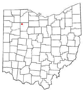
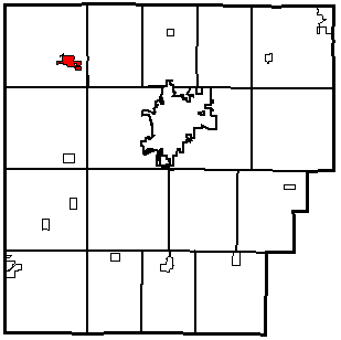
McComb, Ohio — Village — Location of McComb, Ohio Location within Hancock County
Coordinates: 41°6′33″N 83°47′32″W / 41.10917°N 83.79222°WCoordinates: 41°6′33″N 83°47′32″W / 41.10917°N 83.79222°W Country United States State Ohio County Hancock Area – Total 0.9 sq mi (2.5 km2) – Land 0.9 sq mi (2.4 km2) – Water 0.0 sq mi (0.1 km2) Elevation[1] 771 ft (235 m) Population (2000) – Total 1,676 – Density 1,835.3/sq mi (708.6/km2) Time zone Eastern (EST) (UTC-5) – Summer (DST) EDT (UTC-4) ZIP code 45858 Area code(s) 419 FIPS code 39-45808[2] GNIS feature ID 1061491[1] McComb is a village in Hancock County, Ohio, United States. The population was 1,676 at the 2000 census. It is in the McComb Local School District.
Contents
Geography
McComb is located at 41°6′33″N 83°47′32″W / 41.10917°N 83.79222°W (41.109134, -83.792191)[3].
According to the United States Census Bureau, the village has a total area of 0.9 square miles (2.3 km2), of which, 0.9 square miles (2.3 km2) of it is land and 0.04 square miles (0.10 km2) of it (4.21%) is water.
History
Despite its spelling, McComb, Ohio is named for Alexander Macomb (American general).[4] (The reason for the spelling, "McComb" instead of "Macomb", is that the village was named by a Scotsman who fought under Macomb at the Battle of Plattsburg, and he used the Scottish manner of pronunciation and spelling.)[5]
Demographics
As of the census[2] of 2000, there were 1,676 people, 587 households, and 466 families residing in the village. The population density was 1,835.3 people per square mile (711.1/km²). There were 633 housing units at an average density of 693.2 per square mile (268.6/km²). The racial makeup of the village was 96.24% White, 0.24% African American, 0.12% Native American, 0.60% Asian, 0.89% from other races, and 1.91% from two or more races. Hispanic or Latino of any race were 3.58% of the population.
There were 587 households out of which 44.8% had children under the age of 18 living with them, 60.5% were married couples living together, 14.1% had a female householder with no husband present, and 20.6% were non-families. 17.9% of all households were made up of individuals and 6.6% had someone living alone who was 65 years of age or older. The average household size was 2.86 and the average family size was 3.19.
In the village the population was spread out with 33.9% under the age of 18, 6.7% from 18 to 24, 31.0% from 25 to 44, 19.6% from 45 to 64, and 8.8% who were 65 years of age or older. The median age was 31 years. For every 100 females there were 97.2 males. For every 100 females age 18 and over, there were 92.2 males.
The median income for a household in the village was $40,688, and the median income for a family was $43,333. Males had a median income of $31,189 versus $23,512 for females. The per capita income for the village was $17,043. About 7.6% of families and 8.6% of the population were below the poverty line, including 11.3% of those under age 18 and 7.7% of those age 65 or over.
Places of interest
McComb Public Library has historical displays containing artifacts and information relating to the Civil War.
Shady Acres is McComb's nine hole golf course.
Churches in town include the Church of Christ, the Presbyterian Church, St. Johns Lutheran, and McComb United Methodist Church.
McComb also houses a Great Scot Community Markets grocery store, gas station, two pizza places, a park, and historic Bennett's furniture store. McComb Union Cemetery features a small Civil War monument to remember McComb's Civil War heroes, including the graves of two of the first Medal of Honor recipients, who were involved in the Great Locomotive Chase.
The Consolidated Biscuit Company (CBC) has a factory in McComb. "The Cookie Factory", as it's better known to residents, manufactures cookies, crackers, and other edible items. It is also the inspiration for the annual "Cookie Festival" in McComb. The festival, which takes place in August, includes a parade, rides, games, and food.
References
- ^ a b "US Board on Geographic Names". United States Geological Survey. 2007-10-25. http://geonames.usgs.gov. Retrieved 2008-01-31.
- ^ a b "American FactFinder". United States Census Bureau. http://factfinder.census.gov. Retrieved 2008-01-31.
- ^ "US Gazetteer files: 2010, 2000, and 1990". United States Census Bureau. 2011-02-12. http://www.census.gov/geo/www/gazetteer/gazette.html. Retrieved 2011-04-23.
- ^ Historical Marker, McComb Ohio
- ^ McComb, Ohio history.
Mr. Pitney's Science Class
External links
- McComb's Website: www.McCombOH.com
- McComb Local Schools
- McComb Public Library
- McComb United Methodist Church
- Bennett's in McComb Furniture Store History
- McComb Name History
- More About McComb
Municipalities and communities of Hancock County, Ohio Cities 
Villages Arcadia | Arlington | Benton Ridge | Bluffton‡ | Jenera | McComb | Mount Blanchard | Mount Cory | Rawson | Van Buren | Vanlue
Townships Unincorporated
communitiesFootnotes ‡This populated place also has portions in an adjacent county or counties
Blanchard Valley Conference Arcadia (Redskins) • Arlington (Red Devils) • Cory-Rawson (Hornets) • Hardin-Northern (Polar Bears) • Leipsic (Vikings) • Liberty-Benton (Eagles)
McComb (Panthers) • Pandora-Gilboa (Rockets) • Van Buren (Black Knights) • Vanlue (Wildcats)Categories:- Villages in Ohio
- Populated places in Hancock County, Ohio

Wikimedia Foundation. 2010.