- Orange Township, Hancock County, Ohio
-
Orange Township, Hancock County, Ohio — Township — Farmland in northeastern Orange Township Location of Orange Township in Hancock County
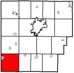
Coordinates: 40°51′48″N 83°50′41″W / 40.86333°N 83.84472°WCoordinates: 40°51′48″N 83°50′41″W / 40.86333°N 83.84472°W Country United States State Ohio County Hancock Area – Total 36.3 sq mi (94.0 km2) – Land 36.3 sq mi (93.9 km2) – Water 0.0 sq mi (0.1 km2) Elevation[1] 869 ft (265 m) Population (2000) – Total 1,290 – Density 35.6/sq mi (13.7/km2) Time zone Eastern (EST) (UTC-5) – Summer (DST) EDT (UTC-4) FIPS code 39-58632[2] GNIS feature ID 1086250[1] Orange Township is one of the seventeen townships of Hancock County, Ohio, United States. The 2000 census found 1,290 people in the township, 1,113 of whom lived in the unincorporated portions of the township.[3]
Contents
Geography
Located in the southwestern corner of the county, it borders the following townships:
- Union Township - north
- Eagle Township - northeast corner
- Van Buren Township - east
- Washington Township, Hardin County - southeast corner
- Liberty Township, Hardin County - south
- Jackson Township, Allen County - southwest corner
- Richland Township, Allen County - west
Part of the village of Bluffton is located in northwestern Orange Township.
Name and history
It is one of six Orange Townships statewide.[4]
Government
The township is governed by a three-member board of trustees, who are elected in November of odd-numbered years to a four-year term beginning on the following January 1. Two are elected in the year after the presidential election and one is elected in the year before it. There is also an elected township fiscal officer,[5] who serves a four-year term beginning on April 1 of the year after the election, which is held in November of the year before the presidential election. Vacancies in the fiscal officership or on the board of trustees are filled by the remaining trustees.
References
- ^ a b "US Board on Geographic Names". United States Geological Survey. 2007-10-25. http://geonames.usgs.gov. Retrieved 2008-01-31.
- ^ "American FactFinder". United States Census Bureau. http://factfinder.census.gov. Retrieved 2008-01-31.
- ^ Hancock County, Ohio — Population by Places Estimates Ohio State University, 2007. Accessed 15 May 2007.
- ^ "Detailed map of Ohio" (PDF). United States Census Bureau. 2000. http://www2.census.gov/geo/maps/general_ref/cousub_outline/cen2k_pgsz/oh_cosub.pdf. Retrieved 2007-02-16.
- ^ §503.24, §505.01, and §507.01 of the Ohio Revised Code. Accessed 4/30/2009.
External links
Municipalities and communities of Hancock County, Ohio Cities 
Villages Arcadia | Arlington | Benton Ridge | Bluffton‡ | Jenera | McComb | Mount Blanchard | Mount Cory | Rawson | Van Buren | Vanlue
Townships Unincorporated
communitiesFootnotes ‡This populated place also has portions in an adjacent county or counties
Categories:- Townships in Hancock County, Ohio


Wikimedia Foundation. 2010.