- Mount Blanchard, Ohio
-
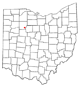
Mount Blanchard, Ohio — Village — Location of Mount Blanchard, Ohio Location within Hancock County
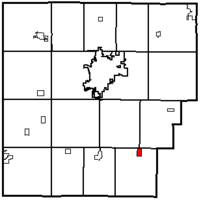
Coordinates: 40°54′00″N 83°33′26″W / 40.9°N 83.55722°W Country United States State Ohio County Hancock Area – Total 0.5 sq mi (1.4 km2) – Land 0.5 sq mi (1.4 km2) – Water 0.0 sq mi (0.0 km2) Elevation[1] 846 ft (258 m) Population (2000) – Total 484 – Density 895.8/sq mi (345.9/km2) Time zone Eastern (EST) (UTC-5) – Summer (DST) EDT (UTC-4) ZIP code 45867 Area code(s) 419 FIPS code 39-52598[2] GNIS feature ID 1043538[1] Mount Blanchard is a village in Hancock County, Ohio, United States. The population was 484 at the 2000 census.
Contents
Geography
Mount Blanchard is located at 40°54′00″N 83°33′26″W / 40.899942°N 83.557126°WCoordinates: 40°54′00″N 83°33′26″W / 40.899942°N 83.557126°W (40.899942, -83.557126).[3]
According to the United States Census Bureau, the village has a total area of 0.5 square miles (1.3 km2), all of it land.
Demographics
As of the census[2] of 2000, there were 484 people, 192 households, and 134 families residing in the village. The population density was 895.8 people per square mile (346.1/km²). There were 204 housing units at an average density of 377.5 per square mile (145.9/km²). The racial makeup of the village was 98.14% White, 0.21% African American, 0.83% from other races, and 0.83% from two or more races. Hispanic or Latino of any race were 1.24% of the population.
There were 192 households out of which 36.5% had children under the age of 18 living with them, 55.2% were married couples living together, 10.4% had a female householder with no husband present, and 30.2% were non-families. 25.0% of all households were made up of individuals and 10.4% had someone living alone who was 65 years of age or older. The average household size was 2.52 and the average family size was 2.99.
In the village the population was spread out with 28.3% under the age of 18, 7.2% from 18 to 24, 30.0% from 25 to 44, 21.7% from 45 to 64, and 12.8% who were 65 years of age or older. The median age was 35 years. For every 100 females there were 93.6 males. For every 100 females age 18 and over, there were 88.6 males.
The median income for a household in the village was $38,929, and the median income for a family was $45,000. Males had a median income of $34,250 versus $25,500 for females. The per capita income for the village was $16,410. About 2.3% of families and 4.8% of the population were below the poverty line, including none of those under age 18 and 9.9% of those age 65 or over.
References
- ^ a b "US Board on Geographic Names". United States Geological Survey. 2007-10-25. http://geonames.usgs.gov. Retrieved 2008-01-31.
- ^ a b "American FactFinder". United States Census Bureau. http://factfinder.census.gov. Retrieved 2008-01-31.
- ^ "US Gazetteer files: 2010, 2000, and 1990". United States Census Bureau. 2011-02-12. http://www.census.gov/geo/www/gazetteer/gazette.html. Retrieved 2011-04-23.
External links
Municipalities and communities of Hancock County, Ohio Cities 
Villages Arcadia | Arlington | Benton Ridge | Bluffton‡ | Jenera | McComb | Mount Blanchard | Mount Cory | Rawson | Van Buren | Vanlue
Townships Unincorporated
communitiesFootnotes ‡This populated place also has portions in an adjacent county or counties
Categories:- Villages in Ohio
- Populated places in Hancock County, Ohio


Wikimedia Foundation. 2010.