- Ohio State Route 37
-
State Route 37
Route information Maintained by ODOT Length: 174.14 mi[1] (280.25 km) Existed: 1924 – present Major junctions West end:  SR 12 in Findlay
 I-71 near Sunbury
 I-70 near Hebron
East end:  SR 78 near Malta
Location Counties: Hancock, Hardin, Wyandot, Marion, Union, Delaware, Licking, Fairfield, Perry, Morgan Highway system Ohio highways
Interstates • U.S. Routes • State Routes←  SR 34
SR 34SR 38  →
→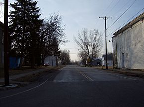 Along State Route 37 at Marseilles in Wyandot County.
State Route 37 is a northwest-southeast highway (signed west–east) in Ohio. Its western terminus is at State Route 12 in Findlay, and its eastern terminus is at State Route 78 near Malta.
History
State Route 37 is an original state highway that went from Lancaster to Marietta. In 1932, the route was extended to Findlay along its current route. In 1935, its eastern terminus was shortened to its current terminus, giving that route to State Route 78 and the now defunct State Route 77 (now part of State Route 60).
References
Categories:- State highways in Ohio
- Transportation in Hancock County, Ohio
- Transportation in Hardin County, Ohio
- Transportation in Wyandot County, Ohio
- Transportation in Marion County, Ohio
- Transportation in Union County, Ohio
- Transportation in Delaware County, Ohio
- Transportation in Licking County, Ohio
- Transportation in Fairfield County, Ohio
- Transportation in Perry County, Ohio
- Transportation in Morgan County, Ohio


Wikimedia Foundation. 2010.