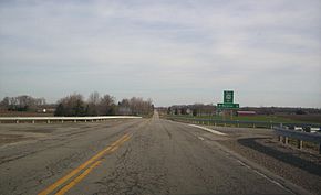
- Ohio State Route 602
-
State Route 602 Route information Maintained by ODOT Length: 14.47 mi[3] (23.29 km) Existed: 1937[1][2] – present Major junctions South end:  SR 19 near Galion
 US 30 near Galion
North end:  SR 103 in New Washington
Location Counties: Crawford Highway system Ohio highways
Interstates • U.S. Routes • State Routes←  SR 601
SR 603  →
→State Route 602 (SR 602, OH 602) is a 14.47-mile (23.29 km) long north–south state highway in the northern portion of the U.S. state of Ohio. Its southern terminus is at a T-intersection with SR 19 approximately 2.50 miles (4.02 km) northwest of Galion, and its northern terminus is at SR 103 in New Washington.
Contents
Route description
All of SR 602 is situated within the eastern portion of Crawford County. No portion of this state route is included within the National Highway System (NHS). The NHS is a network of highways identified as being most important for the nation's economy, mobility and defense.[4]
History
The SR 602 designation was created in 1937. Originally, the highway ran from its present southern terminus at SR 19 to its intersection with Old Lincoln Highway north of North Robinson. Old Lincoln Highway was designated as U.S. Route 30N (US 30N) at the time, and later became US 30 prior to that route being moved to its present freeway routing.[1][2]
SR 602 would remain as such until 1969, when the highway was extended north along a previously un-numbered roadway to its present northern endpoint at SR 103 in New Washington.[5][6]
Major intersections
The entire route is in Crawford County.
Location Mile[3] Destinations Notes Polk Township 0.00  SR 19
SR 19Southern terminus at T-intersection Jefferson Township 0.76  US 30
US 30Diamond interchange Sandusky Township 6.25  SR 96
SR 969.20  SR 98
SR 98New Washington 14.47  SR 103
Northern terminus 1.000 mi = 1.609 km; 1.000 km = 0.621 mi References
- ^ a b Ohio Department of Highways (1936) (MrSID). Official Ohio Highway Map (Map). Cartography by ODOH. http://www.dot.state.oh.us/Divisions/TransSysDev/Innovation/prod_services/Documents/StateMaps/otm1936a.sid. Retrieved 2011-09-17.
- ^ a b Ohio Department of Highways (1937) (MrSID). Official Ohio Highway Map (Map). Cartography by ODOH. http://www.dot.state.oh.us/Divisions/TransSysDev/Innovation/prod_services/Documents/StateMaps/otm1937a.sid. Retrieved 2011-09-17.
- ^ a b Ohio Department of Transportation. "Technical Services Straight Line Diagrams: SR 602, Crawford County". http://www.odotonline.org/techservapps/SLD/pdf_files/crasr0602r.pdf. Retrieved 2011-08-26.
- ^ Federal Highway Administration (December 2003) (PDF). National Highway System: Ohio (Map). http://www.fhwa.dot.gov/planning/nhs/maps/oh/oh_Ohio.pdf. Retrieved 2011-09-17.
- ^ Ohio Department of Highways (1967) (MrSID). Official Ohio Highway Map (Map). Cartography by ODOH. http://www.dot.state.oh.us/Divisions/TransSysDev/Innovation/prod_services/Documents/StateMaps/otm1967a.sid. Retrieved 2011-09-17.
- ^ Ohio Department of Highways (1969) (MrSID). Official Ohio Highway Map (Map). Cartography by ODOH. http://www.dot.state.oh.us/Divisions/TransSysDev/Innovation/prod_services/Documents/StateMaps/otm1969a.sid. Retrieved 2011-09-17.
Categories:- State highways in Ohio
- Transportation in Crawford County, Ohio
Wikimedia Foundation. 2010.


