- Ohio State Route 231
-
State Route 231
Route information Maintained by ODOT Length: 35.77 mi[3][4][5] (57.57 km) Existed: 1923[1][2] – present Major junctions South end: East St in Morral  US 23 near Morral
 US 30 near Nevada
North end: 

 SR 18 / SR 100 / SR 101 in Tiffin
Location Counties: Marion, Wyandot, Seneca Highway system Ohio highways
Interstates • U.S. Routes • State Routes←  SR 229
SR 232  →
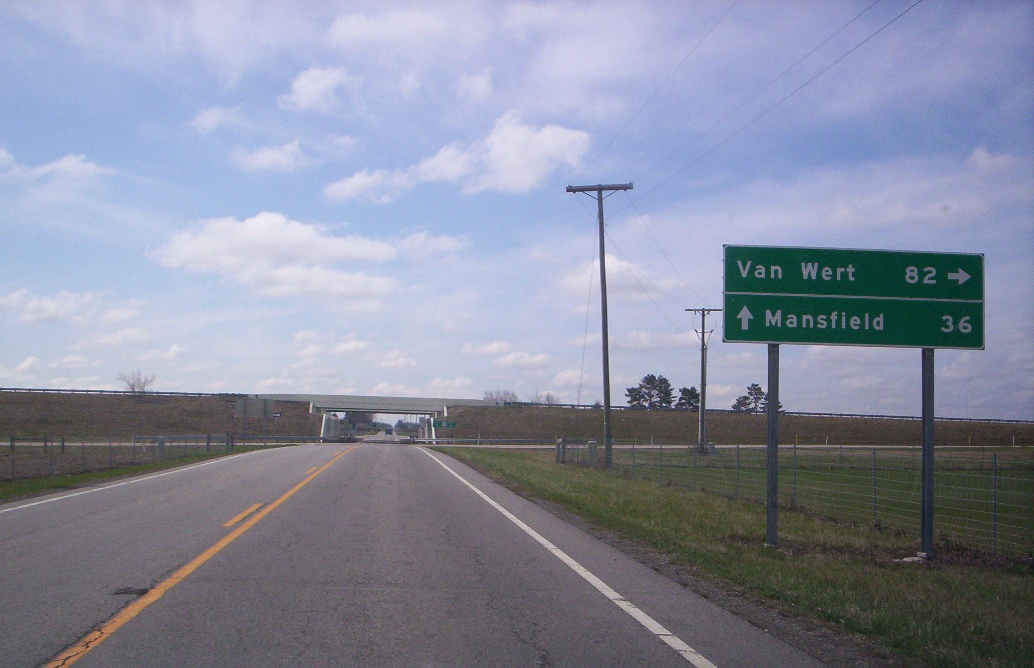
→ SR 231 heading south at the junction of US 30 near Nevada, Ohio.
 SR 231 (North Main Street) in downtown Nevada, Ohio looking south near the Norfolk Southern Railway.
State Route 231 (SR 231, OH 231) is a 35.77-mile (57.57 km) long north–south state highway in the northwestern quadrant of the U.S. state of Ohio. SR 231 has its southern terminus at its intersection with East Street in the village of Morral. Its northern terminus is in downtown Tiffin at a signalized intersection with the duplex of SR 18 and SR 101, following a 0.35 miles (0.56 km) long concurrency with SR 100, which continues north as a solo route north of this point.
Contents
Route description
The path of SR 231 takes it through northern Marion County, eastern Wyandot County and southern Seneca County. There are no segments of SR 231 that are included within the National Highway System (NHS). The NHS is a network of highways identified as being most important for the economy, mobility and defense of the nation.[6]
History
SR 231 was applied in 1923. The highway was originally a short connector route in the Nevada vicinity, running between the former SR 182, now County Road 182, CR 182, in Nevada and the old two-lane alignment of U.S. Route 30 (US 30), now designated as CR 330, north of the village. [1][2]
In 1932, SR 231 was extended south along the routing that it presently utilizes south of Nevada to its current southern terminus in Morral.[7][8] Five years after being extended on the south ended, SR 231 was lengthened on the north end, following its present alignment along a previously county-maintained roadway to a new northern terminus at its present eastern junction with SR 103 east of Sycamore.[9][10] Then, in 1939, SR 231 was extended to the north one more time, via a concurrency with SR 103 and SR 67 and then along a previously un-numbered roadway to its present northern terminus in Tiffin.[11][12]
Major intersections
County Location Mile[3][4][5] Destinations Notes Marion Morral 0.00 East St Southern terminus; Morral–Kirkpatrick Rd continues west Grand Prairie Township 3.13  SR 423 south
Northern terminus of SR 423 3.43 US 23Diamond interchange Wyandot Marseilles Township 5.67  SR 294 east
T-intersection marking southern split of SR 231/SR 294 duplex;
SR 294 joins from the east7.38 SR 294 westNorthern split of SR 231/SR 294 duplex; SR 294 departs to the west Nevada 12.33 US 30Diamond interchange Sycamore Township 22.24  SR 103 east
Eastern split of SR 103/SR 231 duplex; SR 103 joins from the east Sycamore 24.26  SR 67 west
SR 103 westSouthern split of SR 67/SR 231 duplex, and western split of SR 103/SR 231 duplex;
SR 67 and SR 103 duplex heading west24.92 SR 67 eastT-intersection marking northern split of SR 67/SR 231 duplex;
SR 67 departs to the northeastSeneca Tiffin 33.81  US 224
Signalized intersection 35.42 SR 100 southSignalized intersection marking southern split of SR 100/SR 231 duplex;
SR 100 joins from the southeast35.77 SR 18
SR 100 north
SR 101Northern terminus at signalized intersection with SR 18/SR 101 duplex;
SR 100 continues north as a solo route1.000 mi = 1.609 km; 1.000 km = 0.621 mi
Concurrency terminus • Closed/Former • Incomplete access • UnopenedReferences
- ^ a b Ohio Department of Highways and Public Works (April 1922) (MrSID). Map of Ohio State Highways (Map). Cartography by ODHPW. http://www.dot.state.oh.us/Divisions/TransSysDev/Innovation/prod_services/Documents/StateMaps/otm1922a.sid. Retrieved 2011-05-13.
- ^ a b Ohio Department of Highways and Public Works (July 1923) (MrSID). Map of Ohio Showing State Routes (Map). Cartography by ODHPW. http://www.dot.state.oh.us/Divisions/TransSysDev/Innovation/prod_services/Documents/StateMaps/otm1923a.sid. Retrieved 2011-05-13.
- ^ a b Ohio Department of Transportation. "Technical Services Straight Line Diagrams: SR 231, Marion County". http://www.odotonline.org/techservapps/SLD/pdf_files/marsr0231r.pdf. Retrieved 2006-11-12.
- ^ a b Ohio Department of Transportation. "Technical Services Straight Line Diagrams: SR 231, Wyandot County". http://www.odotonline.org/techservapps/SLD/pdf_files/wyasr0231r.pdf. Retrieved 2006-11-12.
- ^ a b Ohio Department of Transportation. "Technical Services Straight Line Diagrams: SR 231, Seneca County". http://www.odotonline.org/techservapps/SLD/pdf_files/sensr0231r.pdf. Retrieved 2006-11-12.
- ^ Federal Highway Administration (December 2003) (PDF). National Highway System: Ohio (Map). http://www.fhwa.dot.gov/planning/nhs/maps/oh/oh_Ohio.pdf. Retrieved 2011-05-07.
- ^ Ohio Department of Highways (1931) (MrSID). Map of Ohio Showing State Highway System (Map). Cartography by ODOH. http://www.dot.state.oh.us/Divisions/TransSysDev/Innovation/prod_services/Documents/StateMaps/otm1931a.sid. Retrieved 2011-05-13.
- ^ Ohio Department of Highways (1932) (MrSID). Map of Ohio Showing State Highway System (Map). Cartography by ODOH. http://www.dot.state.oh.us/Divisions/TransSysDev/Innovation/prod_services/Documents/StateMaps/otm1932a.sid. Retrieved 2011-05-13.
- ^ Ohio Department of Highways (1936) (MrSID). Official Ohio Highway Map (Map). Cartography by ODOH. http://www.dot.state.oh.us/Divisions/TransSysDev/Innovation/prod_services/Documents/StateMaps/otm1936a.sid. Retrieved 2011-05-13.
- ^ Ohio Department of Highways (1937) (MrSID). Official Ohio Highway Map (Map). Cartography by ODOH. http://www.dot.state.oh.us/Divisions/TransSysDev/Innovation/prod_services/Documents/StateMaps/otm1937a.sid. Retrieved 2011-05-13.
- ^ Ohio Department of Highways (1938) (MrSID). Official Ohio Highway Map (Map). Cartography by ODOH. http://www.dot.state.oh.us/Divisions/TransSysDev/Innovation/prod_services/Documents/StateMaps/otm1938a.sid. Retrieved 2011-05-13.
- ^ Ohio Department of Highways (1939) (MrSID). Ohio Highway Map (Map). Cartography by ODOH. http://www.dot.state.oh.us/Divisions/TransSysDev/Innovation/prod_services/Documents/StateMaps/otm1939a.sid. Retrieved 2011-05-13.
Categories:- State highways in Ohio
- Marion County, Ohio
- Seneca County, Ohio
- Wyandot County, Ohio


Wikimedia Foundation. 2010.