- Ohio State Route 279
-
State Route 279
Route information Maintained by ODOT Length: 20.11 mi[3][4] (32.36 km) Existed: 1930[1][2] – present Major junctions West end:  SR 139 near South Webster
East end:  US 35 near Centerville
Location Counties: Jackson, Gallia Highway system Ohio highways
Interstates • U.S. Routes • State Routes←  SR 278
SR 281  →
→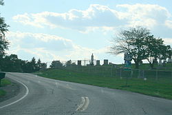 A view of SR 279 just east of Oak Hill with Ohio Byways and Welsh Byway Signs
State Route 279 (SR 279, OH 279) is a 20.11-mile (32.36 km) long east–west state highway in the southern portion of the U.S. state of Ohio. The western terminus of SR 279 is at a T-intersection with SR 139 nearly 5.25 miles (8.45 km) northwest of South Webster. Its eastern terminus is at a T-intersection with U.S. Route 35 (US 35) approximately 0.25 miles (0.40 km) east of the village of Centerville.Contents
Route description
SR 279 travels through the southern portion of Jackson County and a very small portion of western Gallia County. There are no sections of SR 279 that are included as a part of the National Highway System (NHS). The NHS is a network of highways identified as being most important for the economy, mobility and defense of the country.[5]
History
The SR 279 designation was applied in 1930. Originally, the highway was routed along much its present easternmost segment, running from Oak Hill to Centerville, which at the time was known as Thurman.[1][2] In 1939, SR 279 was extended west of Oak Hill along a previously un-numbered roadway into southwestern Jackson County to its present terminus at SR 139.[6][7]
Major intersections
County Location Mile[3][4] Destinations Notes Jackson Hamilton Township 0.00 SR 139Western terminus at T-intersection Oak Hill 11.45  SR 93 south
Southern split of SR 93/SR 279 duplex;
SR 93 joins from the south11.58  SR 233 east
Signalized intersection marking western terminus of SR 233 11.86 SR 93 northT-intersection marking northern split of SR 93/SR 279 duplex;
SR 93 departs to the northGallia Raccoon Township 20.11 US 35Eastern terminus at T-intersection 1.000 mi = 1.609 km; 1.000 km = 0.621 mi
Concurrency terminus • Closed/Former • Incomplete access • UnopenedReferences
- ^ a b Ohio Department of Highways (August 1929) (MrSID). Map of Ohio Showing State Routes (Map). Cartography by ODOH. http://www.dot.state.oh.us/Divisions/TransSysDev/Innovation/prod_services/Documents/StateMaps/otm1929a.sid. Retrieved 2011-07-03.
- ^ a b Ohio Department of Highways (1930) (MrSID). Map of Ohio Showing State Highway System (Map). Cartography by ODOH. http://www.dot.state.oh.us/Divisions/TransSysDev/Innovation/prod_services/Documents/StateMaps/otm1930a.sid. Retrieved 2011-07-03.
- ^ a b Ohio Department of Transportation. "Technical Services Straight Line Diagrams: SR 279, Jackson County". http://www.odotonline.org/techservapps/SLD/pdf_files/jacsr0279r.pdf. Retrieved 2011-07-02.
- ^ a b Ohio Department of Transportation. "Technical Services Straight Line Diagrams: SR 279, Gallia County". http://www.odotonline.org/techservapps/SLD/pdf_files/galsr0279r.pdf. Retrieved 2011-07-02.
- ^ Federal Highway Administration (December 2003) (PDF). National Highway System: Ohio (Map). http://www.fhwa.dot.gov/planning/nhs/maps/oh/oh_Ohio.pdf. Retrieved 2011-07-01.
- ^ Ohio Department of Highways (1938) (MrSID). Official Ohio Highway Map (Map). Cartography by ODOH. http://www.dot.state.oh.us/Divisions/TransSysDev/Innovation/prod_services/Documents/StateMaps/otm1938a.sid. Retrieved 2011-07-03.
- ^ Ohio Department of Highways (1939) (MrSID). Ohio Highway Map (Map). Cartography by ODOH. http://www.dot.state.oh.us/Divisions/TransSysDev/Innovation/prod_services/Documents/StateMaps/otm1939a.sid. Retrieved 2011-07-03.
Categories:- State highways in Ohio
- Transportation in Jackson County, Ohio
- Transportation in Gallia County, Ohio


Wikimedia Foundation. 2010.