- Meyersdale, Pennsylvania
-
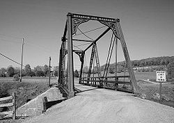
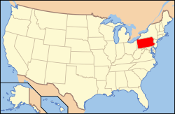
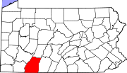
Borough of Meyersdale — Borough — Wells Creek Bollman Bridge near Meyersdale Nickname(s): Maple City USA Location of Pennsylvania within the USA Meyersdale, Somerset County, Pennsylvania, USA Coordinates: 39°48′49″N 79°01′35″W / 39.81361°N 79.02639°WCoordinates: 39°48′49″N 79°01′35″W / 39.81361°N 79.02639°W Country United States State Pennsylvania County Somerset County Settled 1844 Incorporated 1871 Area - Total 0.8 sq mi (2.1 km2) - Land 0.8 sq mi (2.1 km2) - Water 0.0 sq mi (0 km2) Population (2000) - Total 2,473 - Density 2,950.7/sq mi (1,139.3/km2) Time zone EST (UTC-5) - Summer (DST) EDT (UTC-4) Website Meyersdale.org Meyersdale is a borough in Somerset County, Pennsylvania, on the Casselman River, 73 miles (117 km) southeast of Pittsburgh. In the past, its chief industry was the mining of coal. Meyersdale was first settled as early as 1776, but the growth of the town dates from the advent of the first railroad in 1871. Coal mining began in the next year. In 1900, 3,024 people resided in Meyersdale. By 1910, 3,741 people lived in the borough. The population was 2,473 at the 2000 census. It is part of the Johnstown, Pennsylvania Metropolitan Statistical Area.
Contents
Geography
Meyersdale is located at 39°48′49″N 79°1′35″W / 39.81361°N 79.02639°W (39.813643, -79.026494)[1].
According to the United States Census Bureau, the borough has a total area of 0.8 square miles (2.1 km2), all land.
Demographics
As of the census[2] of 2000, there were 2,473 people, 1,019 households, and 666 families residing in the borough. The population density was 2,950.7 people per square mile (1,136.7/km²). There were 1,089 housing units at an average density of 1,299.3 per square mile (500.6/km²). The racial makeup of the borough was 99.35% White, 0.24% African American, 0.12% Native American, 0.16% Asian, and 0.12% from two or more races. Hispanic or Latino of any race were 0.73% of the population.
There were 1,019 households out of which 29.4% had children under the age of 18 living with them, 49.2% were married couples living together, 11.4% had a female householder with no husband present, and 34.6% were non-families. 31.0% of all households were made up of individuals and 18.1% had someone living alone who was 65 years of age or older. The average household size was 2.31 and the average family size was 2.89.
In the borough the population was spread out with 22.2% under the age of 18, 7.5% from 18 to 24, 26.4% from 25 to 44, 21.8% from 45 to 64, and 22.1% who were 65 years of age or older. The median age was 41 years. For every 100 females there were 84.7 males. For every 100 females age 18 and over, there were 80.9 males.
The median income for a household in the borough was $24,652, and the median income for a family was $29,798. Males had a median income of $26,167 versus $18,205 for females. The per capita income for the borough was $14,116. About 16.8% of families and 20.4% of the population were below the poverty line, including 31.4% of those under age 18 and 18.3% of those age 65 or over.
References
- ^ "US Gazetteer files: 2010, 2000, and 1990". United States Census Bureau. 2011-02-12. http://www.census.gov/geo/www/gazetteer/gazette.html. Retrieved 2011-04-23.
- ^ "American FactFinder". United States Census Bureau. http://factfinder.census.gov. Retrieved 2008-01-31.
External links
- Meyersdale.org
- Meyersdale Chamber of Commerce
- Meyersdale Public Library
- Pennsylvania Maple Festival
- Meyersdale History
- Area Map
- Area School District
Municipalities and communities of Somerset County, Pennsylvania County seat: Somerset Boroughs Addison | Benson | Berlin | Boswell | Callimont | Casselman | Central City | Confluence | Garrett | Hooversville | Indian Lake | Jennerstown | Meyersdale | New Baltimore | New Centerville | Paint | Rockwood | Salisbury | Seven Springs‡ | Shanksville | Somerset | Stoystown | Ursina | Wellersburg | Windber
Townships Addison | Allegheny | Black | Brothersvalley | Conemaugh | Elk Lick | Fairhope | Greenville | Jefferson | Jenner | Larimer | Lincoln | Lower Turkeyfoot | Middlecreek | Milford | Northampton | Ogle | Paint | Quemahoning | Shade | Somerset | Southampton | Stonycreek | Summit | Upper Turkeyfoot
CDPs Unincorporated
communitiesFootnotes ‡This populated place also has portions in an adjacent county or counties
Categories:- Boroughs in Somerset County, Pennsylvania
- Populated places established in 1844
Wikimedia Foundation. 2010.


