- Georgia State Route 55
Infobox road
state=GA
type=
route=55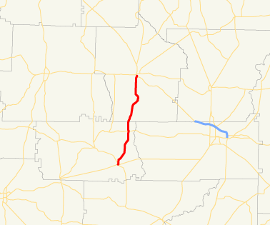
length_mi=20.56
length_ref= [http://www.dot.state.ga.us/DOT/plan-prog/transportation_data/400reports/2002/dpp444_2002.pdf]
length_round=2
established=
direction_a=South
direction_b=North
starting_terminus=
junction=
ending_terminus=
previous_route=54
next_route=56State Route 55 is a north-south state route located in the southwestern part of the
U.S. state of Georgia. The route travels from State Route 37/State Route 62 in Leary north toU.S. Route 82 /State Route 520 in Dawson.Routing
State Route 55 begins in Leary, Georgia at the intersection of State Route 37 and State Route 62. It travels north, through rural sections of Calhoun County. Shortly after intersecting State Route 234, the route continues north into Terrell County. The route then continues north to Dawson, where it meets its northern terminus at U.S. Route 82/State Route 520.
History
State Route 55 at one point continued north to Cusseta along what is now State Route 520, but was superseded, and thus replaced, upon the commissioning of State Route 520. ["Rand McNally Road Atlas", Rand McNally & Company, 1986, p. 23]
ignificance
A largely rural route, State Route 55 sees an Average Annual Daily Traffic of less than 2,000 vehicles. [http://www.dot.state.ga.us/dot/plan-prog/transportation_data/mapproducts/Documents/Trafficflow_05.pdf]
ee also
*
Georgia State Route 520 Notes
Wikimedia Foundation. 2010.