- Georgia State Route 48
Infobox road
state=GA
type=
route=48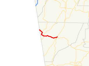
length_mi=12.52
length_ref= [http://www.dot.state.ga.us/DOT/plan-prog/transportation_data/400reports/2002/dpp444_2002.pdf]
length_round=2
established=
direction_a=West
direction_b=East
starting_terminus=
junction=
ending_terminus=
previous_route=47
next_route=49State Route 48 is a short west-east state route located entirely in Chattooga County in the northwestern part of the
U.S. state of Georgia. The route travels fromState Route 117 (Alabama) at theAlabama state line northwest of Menlo toU.S. Route 27 /State Route 1 in Summerville.Routing
From its western terminus at the Alabama state line, where Alabama State Route 117 crosses the state line into Georgia, State Route 48 travels southeast, across
Lookout Mountain . The route intersects State Route 157 at S.R. 157's southern terminus in the community of Cloudland. State Route 48 then descends from Lookout Mountain into the town of Menlo, where it intersects State Route 337. State Route 48 continues east to Summerville, where it meets its eastern terminus at U.S. Route 27/State Route 1 in downtown.ignificance
While the route is short, State Route 48 is a somewhat important route in the area. Between Menlo and Summerville, the route sees an Average Annual Daily Traffic over 5,000 vehicles. [http://www.dot.state.ga.us/dot/plan-prog/transportation_data/mapproducts/Documents/Trafficflow_05.pdf]
References
Wikimedia Foundation. 2010.