- Grady County, Georgia
Infobox U.S. County
county = Grady County
state = Georgia
seallink =
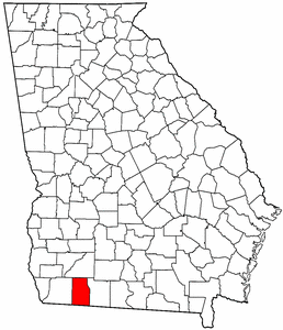
map size = 225
founded = August 17,1905
seat = Cairo
largest city = Cairo
area_total_sq_mi = 460
area_total_km2 = 1192
area_land_sq_mi = 458
area_land_km2 = 1187
area_water_sq_mi = 2
area_water_km2 = 6
area percentage = 0.48%
census estimate yr = 2005
pop = 24466
density_sq_mi = 52
density_km2 = 20
time zone = Eastern
UTC offset = -5
DST offset = -4
web =Grady County is a
county located in theU.S. state of Georgia. As of 2000, the population was 23,659. The 2007 Census Estimate shows a population of 25,042 [http://www.census.gov/popest/counties/tables/CO-EST2007-01-13.xls] . Thecounty seat is Cairo, GeorgiaGR|6.History
Grady County was created by an act of the
Georgia General Assembly onAugust 17 ,1905 , from portions of Decatur and Thomas counties.The County is named for
Henry W. Grady , editor of the "Atlanta Constitution " and notedorator .Geography
According to the
U.S. Census Bureau , the county has a total area of 460square mile s (1,192km² ), of which, 458 square miles (1,187 km²) of it is land and 2 square miles (6 km²) of it (0.48%) is water.Major highways
*
*
*
*
*
*
*
*Adjacent counties
*Mitchell County, Georgia - north
*Thomas County, Georgia - east
*Leon County,Florida - south
*Gadsden County,Florida - southwest
*Decatur County, Georgia - westDemographics
As of the
census GR|2 of 2000, there were 23,659 people, 8,797 households, and 6,509 families residing in the county. Thepopulation density was 52 people per square mile (20/km²). There were 9,991 housing units at an average density of 22 per square mile (8/km²). The racial makeup of the county was 64.61% White, 30.15% Black or African American, 0.92% Native American, 0.30% Asian, 0.01% Pacific Islander, 3.20% from other races, and 0.81% from two or more races. 5.17% of the population were Hispanic or Latino of any race.There were 8,797 households out of which 34.10% had children under the age of 18 living with them, 53.10% were married couples living together, 16.20% had a female householder with no husband present, and 26.00% were non-families. 22.40% of all households were made up of individuals and 10.70% had someone living alone who was 65 years of age or older. The average household size was 2.66 and the average family size was 3.08.
In the county the population was spread out with 27.30% under the age of 18, 9.00% from 18 to 24, 27.90% from 25 to 44, 22.60% from 45 to 64, and 13.20% who were 65 years of age or older. The median age was 36 years. For every 100 females there were 90.60 males. For every 100 females age 18 and over, there were 87.40 males.
The median income for a household in the county was $28,656, and the median income for a family was $34,253. Males had a median income of $27,181 versus $20,128 for females. The
per capita income for the county was $14,278. About 16.70% of families and 21.30% of the population were below thepoverty line , including 29.90% of those under age 18 and 19.80% of those age 65 or over.Cities and towns
Incorporated
Unincorporated
*Akridge
*Beachton
*Boydville
*Brownlee
*Calvary
*Capel
*Duncanville
*Elpino
*Lime Sink
*Moncrief
*Nickleville
*Peoples Still
*Pine Park
*Reno
*Rocky Hill
*Roddenberry
*SpenceReferences
* [http://www.cviog.uga.edu/Projects/gainfo/courthouses/gradyCH.htm GeorgiaInfo Grady County Courthouse history]
* [http://www.georgiaencyclopedia.org/nge/Article.jsp?path=/CitiesCounties/Counties&id=h-2339 The New Georgia Encyclopedia entry for Grady County]
Wikimedia Foundation. 2010.