- Wilkinson County, Georgia
Infobox U.S. County
county = Wilkinson County
state = Georgia
seallink =
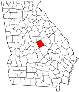
map size = 225
founded = 1803
seat = Irwinton
largest city = Gordon
area_total_sq_mi = 452
area_total_km2 = 1171
area_land_sq_mi = 447
area_land_km2 = 1157
area_water_sq_mi = 5
area_water_km2 = 14
area percentage =
census estimate yr = 2005
pop = 10143
density_sq_mi = 23
density_km2 = 9
time zone = Eastern
UTC offset = -5
DST offset = -4
footnotes =
web = |Wilkinson County is a
county located in theU.S. state of Georgia. It was created on May 11, 1803. As of 2000, the population is 10,220. The 2007 Census Estimate shows a population of 10,064 [http://www.census.gov/popest/counties/tables/CO-EST2007-01-13.xls] . Thecounty seat is Irwinton, GeorgiaGR|6.Geography
According to the
U.S. Census Bureau , the county has a total area of 452square mile s (1,171km² ), of which, 447 square miles (1,157 km²) of it is land and 5 square miles (14 km²) of it (1.21%) is water.Major highways
*
*
*
*
*Adjacent counties
*Baldwin County (north)
*Washington County (northeast)
*Johnson County (east)
*Laurens County (southeast)
*Twiggs County (southwest)
*Jones County (northwest)Demographics
As of the
census GR|2 of 2000, there were 10,220 people, 3,827 households, and 2,805 families residing in the county. Thepopulation density was 23 people per square mile (9/km²). There were 4,449 housing units at an average density of 10 per square mile (4/km²). The racial makeup of the county was 57.96% White, 40.70% Black or African American, 0.21% Native American, 0.07% Asian, 0.40% from other races, and 0.66% from two or more races. 0.99% of the population were Hispanic or Latino of any race.There were 3,827 households out of which 33.70% had children under the age of 18 living with them, 50.60% were married couples living together, 18.40% had a female householder with no husband present, and 26.70% were non-families. 24.10% of all households were made up of individuals and 10.40% had someone living alone who was 65 years of age or older. The average household size was 2.65 and the average family size was 3.13.
In the county the population was spread out with 27.20% under the age of 18, 9.00% from 18 to 24, 28.10% from 25 to 44, 22.70% from 45 to 64, and 13.10% who were 65 years of age or older. The median age was 36 years. For every 100 females there were 90.60 males. For every 100 females age 18 and over, there were 88.10 males.
The median income for a household in the county was $32,723, and the median income for a family was $39,349. Males had a median income of $31,814 versus $21,461 for females. The
per capita income for the county was $14,658. About 14.60% of families and 17.90% of the population were below thepoverty line , including 24.90% of those under age 18 and 18.00% of those age 65 or over.Cities
Wikimedia Foundation. 2010.