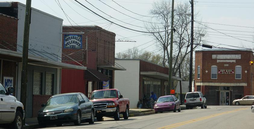
- Notasulga, Alabama
-
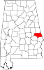
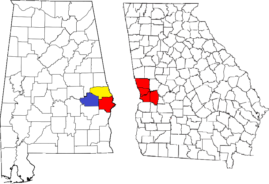
Notasulga, Alabama — Town —  Location in Lee County & Macon County, Alabama
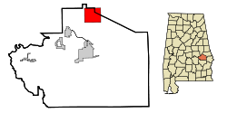
Coordinates: 32°33′39″N 85°40′3″W / 32.56083°N 85.6675°W Country United States State Alabama Counties Macon, Lee Area – Total 14 sq mi (36.1 km2) – Land 13.9 sq mi (36 km2) – Water 0.1 sq mi (0.1 km2) Elevation 512 ft (512 m) Population (2000) – Total 916 Time zone CST (UTC-6) – Summer (DST) CDT (UTC-5) ZIP code 36866 Area code(s) 334 FIPS code 01-55440 GNIS feature ID 0152715 Notasulga is a town in Lee and Macon Counties in the U.S. state of Alabama. As of the 2000 census, the population of the town is 916. The portion in Lee County is part of the Auburn Metropolitan Area. Author Zora Neale Hurston was born in Notasulga in 1891.
Contents
Geography
Notasulga is located at 32°33′39″N 85°40′3″W / 32.56083°N 85.6675°W (32.560821, -85.667631)[1].
According to the U.S. Census Bureau, the town has a total area of 13.9 square miles (36 km2), of which, 13.9 square miles (36 km2) of it is land and 0.1 square miles (0.26 km2) of it (0.43%) is water.
Demographics
As of the census[2] of 2000, there were 916 people, 393 households, and 260 families residing in the town. The population density was 65.9 people per square mile (25.4/km²). There were 446 housing units at an average density of 32.1 per square mile (12.4/km²). The racial makeup of the town was 66.27% White, 32.42% Black or African American, 0.22% Native American, 0.55% from other races, and 0.55% from two or more races. 0.76% of the population were Hispanic or Latino of any race.
There were 393 households out of which 26.2% had children under the age of 18 living with them, 48.6% were married couples living together, 14.0% had a female householder with no husband present, and 33.6% were non-families. 29.5% of all households were made up of individuals and 11.5% had someone living alone who was 65 years of age or older. The average household size was 2.33 and the average family size was 2.87.
In the town the population was spread out with 23.4% under the age of 18, 7.8% from 18 to 24, 24.8% from 25 to 44, 28.2% from 45 to 64, and 15.9% who were 65 years of age or older. The median age was 40 years. For every 100 females there were 86.6 males. For every 100 females age 18 and over, there were 81.9 males.
The median income for a household in the town was $31,307, and the median income for a family was $34,479. Males had a median income of $27,500 versus $18,684 for females. The per capita income for the town was $17,115. About 10.7% of families and 17.8% of the population were below the poverty line, including 20.8% of those under age 18 and 11.2% of those age 65 or over.
Government
Notasulga elects a mayor and five city council members every four years. As of the 2008 election: Mayor, Frank Tew Council District 1 David Waldrop, Council District 2 Terry Broach, Council District 3 Coy Bass, Council District 4 Richard Peek, Council District 5 Robin Collins,
City Clerk Wanda Ingram, Water Department Superintendent Tony McCarty, Fire Chief Michael Whitman, Police Chief, JW Tapley
Photo gallery
-

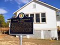
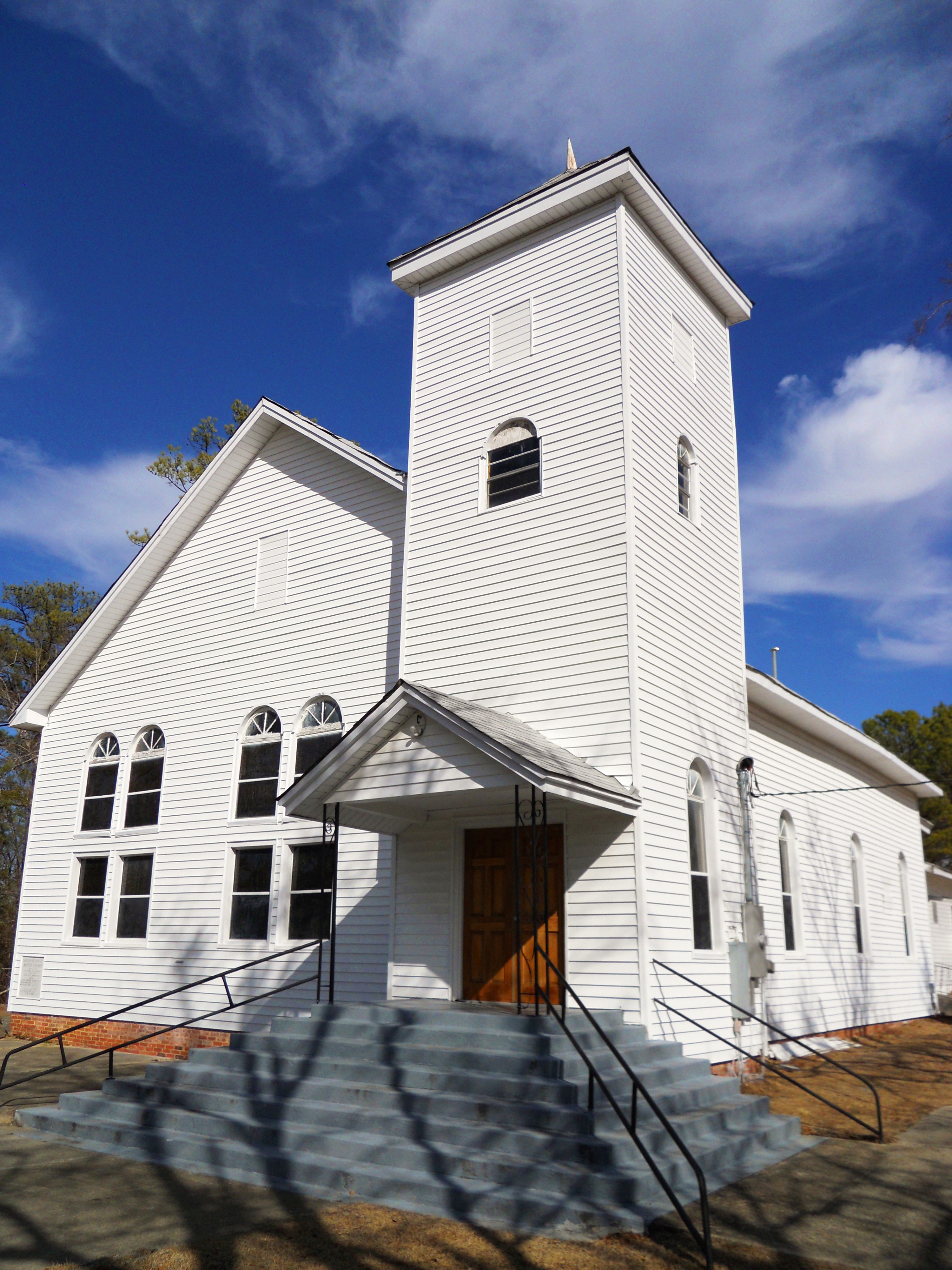
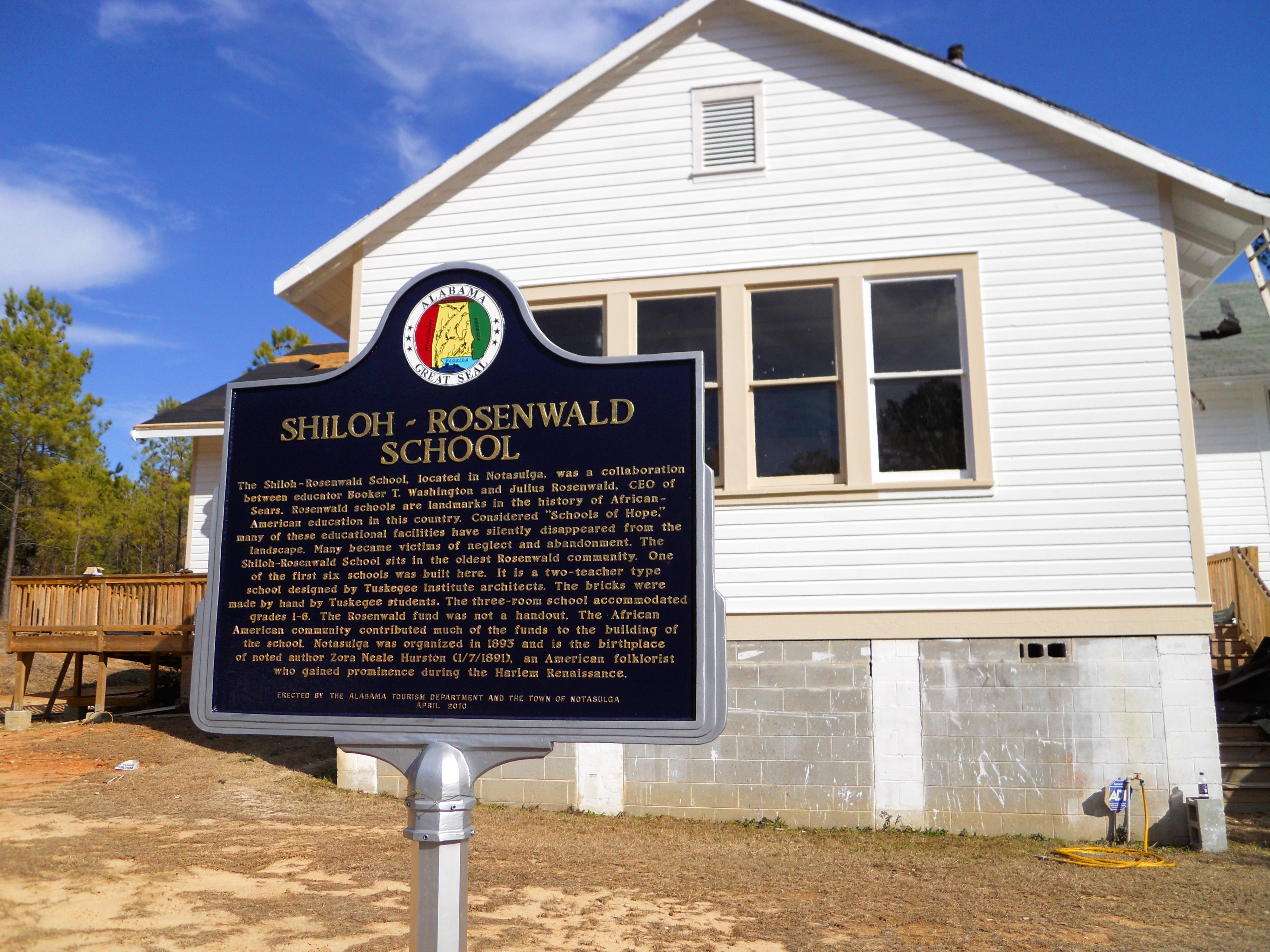
The Shiloh Missionary Baptist Church and Rosenwald School were both used as meeting and testing places for participants in the Tuskegee Syphilis Study (also known as the "Tuskegee Experiments"). The buildings are located in Notasulga, and both are listed on the National Register of Historic Places.
-
The Shiloh-Rosenwald School
-
One of the historic homes near Downtown Notasulga
-
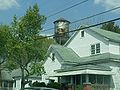
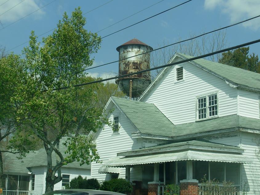
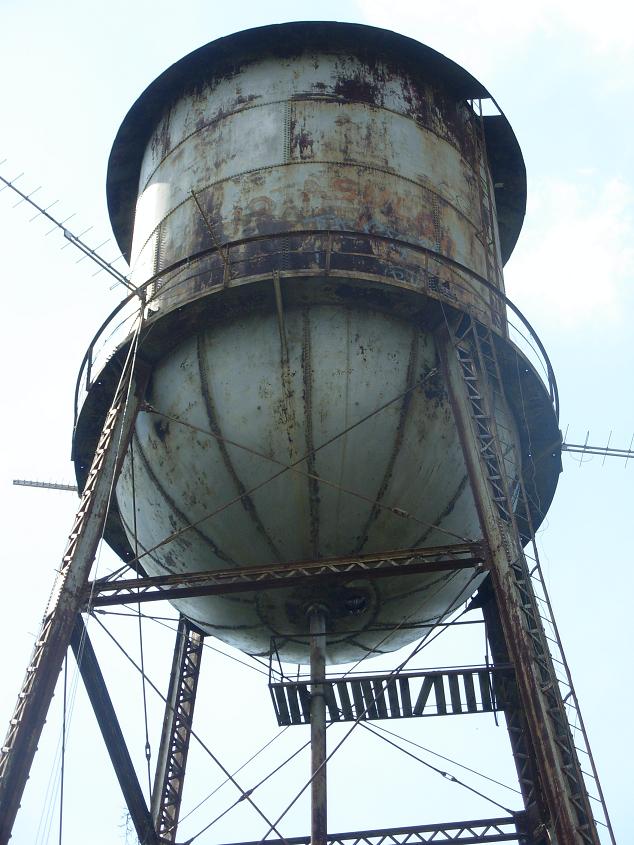
Old water tower located across from the Methodist church in Notasulga
-
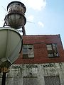
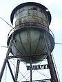
The Notasulga Water Works
-
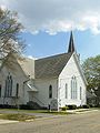
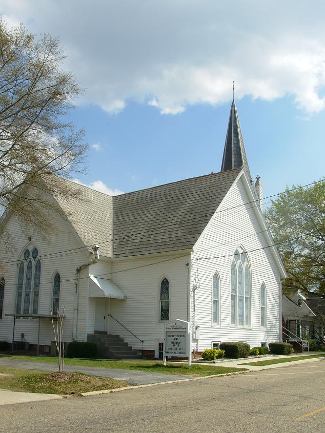
Notasulga United Methodist Church
References
- ^ "US Gazetteer files: 2010, 2000, and 1990". United States Census Bureau. 2011-02-12. http://www.census.gov/geo/www/gazetteer/gazette.html. Retrieved 2011-04-23.
- ^ "American FactFinder". United States Census Bureau. http://factfinder.census.gov. Retrieved 2008-01-31.
Coordinates: 32°33′39″N 85°40′03″W / 32.560821°N 85.667631°W
Municipalities and communities of Lee County, Alabama Cities Auburn | Opelika | Phenix City‡ | Smiths Station
Towns Loachapoka | Notasulga‡ | Waverly‡
Unincorporated
communitiesFootnotes ‡This populated place also has portions in an adjacent county or counties
Municipalities and communities of Macon County, Alabama City 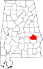
Towns Unincorporated
communityFootnotes ‡This populated place also has portions in an adjacent county or counties
Greater Columbus, Georgia Central cities/Largest cities  Location of the Columbus, Georgia-Auburn, Alabama CSA and its counties:
 Columbus, Georgia Metropolitan Statistical AreaAuburn, Alabama Metropolitan Statistical AreaTuskegee, Alabama Micropolitan Statistical Area
Cities in Georgia Bibb City · Buena Vista · Cataula · Columbus · Cusseta · Custer Terrace · Fort Benning South · Fortson · Hamilton · Hopewell · Juniper · Midland · Mountain Hill · Mulberry Grove · Pine Mountain · Rehobeth · Ridgeway · Shiloh · Upatoi · Waverly Hall · West Point · WhitesvilleCities in Alabama Beauregard · Bee Hive · Beulah · Creek Stand · Fort Mitchell · Franklin · Glenville · Gold Hill · Holy Trinity · Hurtsboro · Ladonia · Loachapoka · Marvyn · Notasulga · Opelika · Phenix City · Roxana · Salem · Seale · Shorter · Smiths Station · The Bottle · Tuskegee · WaverlyCounties in Georgia Counties in Alabama Categories:- Populated places in Lee County, Alabama
- Populated places in Macon County, Alabama
- Towns in Alabama
- Columbus, Georgia metropolitan area
- Auburn metropolitan area
- Place names in Alabama of Native American origin
-


Wikimedia Foundation. 2010.