- Ladonia, Alabama
Infobox Settlement
official_name = Ladonia, Alabama
settlement_type = CDP
imagesize =
image_caption =
image_
imagesize =
image_caption =
image_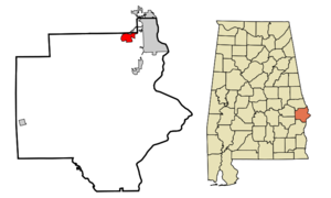
mapsize = 250px
map_caption = Location in Russell County and the state ofAlabama
mapsize1 =
map_caption1 =
subdivision_type = Country
subdivision_type1 = State
subdivision_type2 = County
subdivision_name =United States
subdivision_name1 =Alabama
subdivision_name2 = Russell
government_type =
leader_title =
leader_name =
established_date =
area_magnitude =
area_total_km2 = 8.3
area_total_sq_mi = 3.2
area_land_km2 = 8.3
area_land_sq_mi = 3.2
area_water_km2 = 0
area_water_sq_mi = 0
elevation_ft = 469
elevation_m = 143
population_as_of = 2000
population_footnotes =
population_total = 3229
population_metro =
population_density_km2 = 389
population_density_sq_mi = 1009.1
timezone = Central (CST)
utc_offset = -6
latd = 32 |latm = 27 |lats = 56 |latNS = N
longd = 85 |longm = 5 |longs = 20 |longEW = W
timezone_DST = CDT
utc_offset_DST = -5
postal_code_type =
postal_code =
area_code =
blank_name = FIPS code
blank_info = 01-40648
blank1_name = GNIS feature ID
blank1_info = 0121309
footnotes =
website =Ladonia is an
unincorporated community andcensus-designated place in Russell County,Alabama ,United States . At the 2000 census the population was 3,229. It is part of the Columbus, Georgia-Alabama, Metropolitan Statistical Area.Geography
Ladonia is located at coor dms|32|27|56|N|85|5|21|W|city (32.465666, -85.089046)GR|1.
According to the
U.S. Census Bureau , the community has a total area of 3.2square mile s (8.3km² ), all of it land.Demographics
As of the
census GR|2 of 2000, there were 3,229 people, 1,258 households, and 904 families residing in the community. Thepopulation density was 1,008.6 people per square mile (389.6/km²). There were 1,407 housing units at an average density of 439.5/sq mi (169.8/km²). The racial makeup of the community was 91.82% White, 5.23% Black or African American, 0.65% Native American, 0.22% Asian, 0.31% from other races, and 1.77% from two or more races. 1.46% of the population were Hispanic or Latino of any race.There were 1,258 households out of which 34.2% had children under the age of 18 living with them, 56.4% were married couples living together, 10.2% had a female householder with no husband present, and 28.1% were non-families. 23.0% of all households were made up of individuals and 7.8% had someone living alone who was 65 years of age or older. The average household size was 2.57 and the average family size was 3.02.
In the community the population was spread out with 25.8% under the age of 18, 9.1% from 18 to 24, 31.9% from 25 to 44, 23.0% from 45 to 64, and 10.2% who were 65 years of age or older. The median age was 35 years. For every 100 females there were 101.2 males. For every 100 females age 18 and over, there were 99.9 males.
The median income for a household in the community was $34,214, and the median income for a family was $37,035. Males had a median income of $30,694 versus $20,227 for females. The
per capita income for the community was $16,671. About 15.6% of families and 16.1% of the population were below thepoverty line , including 20.2% of those under age 18 and 8.7% of those age 65 or over.References
External links
Wikimedia Foundation. 2010.