- Pooler, Georgia
Infobox Settlement
official_name = Pooler, Georgia
other_name =
native_name =
nickname =
settlement_type =City
motto =
imagesize =
image_caption =
flag_size =
image_
seal_size =
image_shield =
shield_size =
image_blank_emblem =
blank_emblem_type =
blank_emblem_size =
imagesize =
image_caption =
flag_size =
image_
seal_size =
image_shield =
shield_size =
image_blank_emblem =
blank_emblem_type =
blank_emblem_size =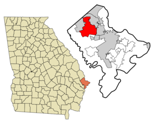
mapsize = 250px
map_caption = Location in Chatham County and the state of Georgia
mapsize1 =
map_caption1 =
image_dot_
dot_mapsize =
dot_map_caption =
dot_x =
dot_y =
pushpin_
pushpin_label_position =
pushpin_map_caption =
pushpin_mapsize =
subdivision_type = Country
subdivision_name =United States
subdivision_type1 = State
subdivision_name1 = Georgia
subdivision_type2 = County
subdivision_name2 = Chatham
subdivision_type3 =
subdivision_name3 =
subdivision_type4 =
subdivision_name4 =
government_footnotes =
government_type =
leader_title =
leader_name =
leader_title1 =
leader_name1 =
leader_title2 =
leader_name2 =
leader_title3 =
leader_name3 =
leader_title4 =
leader_name4 =
established_title =
established_date =
established_title2 =
established_date2 =
established_title3 =
established_date3 =
area_magnitude =
unit_pref = Imperial
area_footnotes =
area_total_km2 = 74.7
area_land_km2 = 74.2
area_water_km2 = 0.5
area_total_sq_mi = 28.8
area_land_sq_mi = 28.6
area_water_sq_mi = 0.2
area_water_percent =
area_urban_km2 =
area_urban_sq_mi =
area_metro_km2 =
area_metro_sq_mi =
area_blank1_title =
area_blank1_km2 =
area_blank1_sq_mi =
population_as_of = 2000
population_footnotes =
population_note =
population_total = 6239
population_density_km2 = 83.5
population_density_sq_mi = 216.6
population_metro =
population_density_metro_km2 =
population_density_metro_sq_mi =
population_urban =
population_density_urban_km2 =
population_density_urban_sq_mi =
population_blank1_title =
population_blank1 =
population_density_blank1_km2 =
population_density_blank1_sq_mi =
timezone = Eastern (EST)
utc_offset = -5
timezone_DST = EDT
utc_offset_DST = -4
latd = 32 |latm = 6 |lats = 17 |latNS = N
longd = 81 |longm = 15 |longs = 12 |longEW = W
elevation_footnotes =
elevation_m = 6
elevation_ft = 20
postal_code_type =ZIP code
postal_code = 31322
area_code = 912
blank_name = FIPS code
blank_info = 13-62104GR|2
blank1_name = GNIS feature ID
blank1_info = 0332725GR|3
website =
footnotes =Pooler is a city in Chatham County, Georgia,
United States . The population was 6,239 at the 2000 census. In 2006, the US Census estimated Pooler's total population at 11,782.Pooler is now a fast-growing city located northwest of Savannah, near Interstate 95. During the Civil War, Pooler was a railway stop called Pooler's Station—the last stop before Savannah on the
Central of Georgia Railroad . In December 1864, it was a meeting place for Union officers led byWilliam Tecumseh Sherman , who negotiated with Savannah authorities for the strategic port city's peaceful surrender.Today, Pooler is the center for commercial development in west Chatham County. Godley Station, the center for business development, has been successful in attracting large companies such as JCB to the area. Low crime, good schools, reasonable property value, and a small town community have all been factors in its explosive growth.
Geography
Pooler is located at coor dms|32|6|17|N|81|15|12|W|city (32.104618, -81.253223)GR|1.
According to the
United States Census Bureau , the city has a total area of 28.8square mile s (74.7km² ), of which, 28.6 square miles (74.2 km²) of it is land and 0.2 square miles (0.5 km²) of it (0.66%) is water.Demographics
As of the
census GR|2 of 2000, there were 6,239 people, 2,245 households, and 1,793 families residing in the city. Thepopulation density was 217.8 people per square mile (84.1/km²). There were 2,356 housing units at an average density of 82.2/sq mi (31.8/km²). The racial makeup of the city was 87.75% White, 7.85% African American, 0.18% Native American, 2.07% Asian, 0.02% Pacific Islander, 0.34% from other races, and 1.80% from two or more races. Hispanic or Latino of any race were 1.23% of the population.There were 2,245 households out of which 40.4% had children under the age of 18 living with them, 64.4% were married couples living together, 11.8% had a female householder with no husband present, and 20.1% were non-families. 16.3% of all households were made up of individuals and 5.4% had someone living alone who was 65 years of age or older. The average household size was 2.74 and the average family size was 3.06.
In the city the population was spread out with 27.6% under the age of 18, 8.2% from 18 to 24, 33.0% from 25 to 44, 21.6% from 45 to 64, and 9.6% who were 65 years of age or older. The median age was 34 years. For every 100 females there were 94.4 males. For every 100 females age 18 and over, there were 91.9 males.
The median income for a household in the city was $47,202, and the median income for a family was $50,067. Males had a median income of $41,947 versus $29,851 for females. The
per capita income for the city was $19,759. About 6.7% of families and 8.3% of the population were below thepoverty line , including 9.2% of those under age 18 and 15.2% of those age 65 or over.References
External links
Wikimedia Foundation. 2010.