Watson Mill Bridge State Park
- Watson Mill Bridge State Park
Infobox_nrhp | name =Watson Mill Covered Bridge and Mill Historic District
nrhp_type = hd
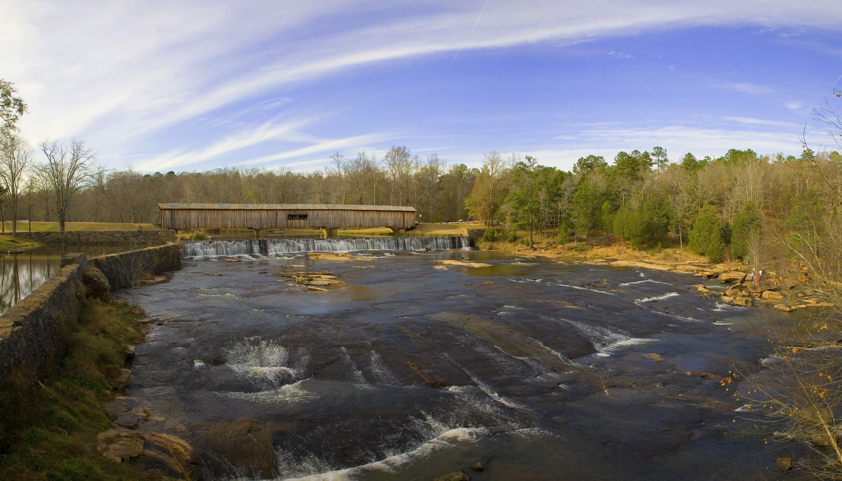
caption = Watson Mill State Park in late Fall 2005
nearest_city= Comer, Georgia
lat_degrees = 34
lat_minutes = 1
lat_seconds = 34
lat_direction = N
long_degrees = 83
long_minutes = 4
long_seconds = 23
long_direction = W
locmapin = Georgia
area =
built =1868
architect= King,W.W.
architecture= Other
added = September 05, 1991
governing_body = State
refnum=91001147[cite web|url=http://www.nr.nps.gov/|title=National Register Information System|date=2008-04-15|work=National Register of Historic Places|publisher=National Park Service] ]
Watson Mill Bridge State Park is a 1,018 acre (4.12 km²) Georgia state park located near Comer and Carlton on the South Fork of the Broad River. The park is named for the Watson Mill Bridge, the longest original-site covered bridge in Georgia, which spans 229 feet (69.73 meters) across the South Fork River. The bridge, being more than 100 years old, is supported by a town lattice truss system held firmly together with wooden pins. Georgia once had over 200 covered bridges, but only 20 now remain. The park also offers a scenic nature trail and a new hiking/horse trail that winds through the thick forests and along the river’s edge.
Facilities
*21 Tent/Trailer/RV Sites
*Pioneer Camping
*Group Shelter
*3 Picnic Shelters
*Boat Rental
References
External links
* [http://gastateparks.org/info/watson/ Watson Mill Bridge State Park]
* [http://ngeorgia.com/ang/Watson_Mill_Covered_Bridge_State_Park Watson Mill Covered Bridge State Park]
Wikimedia Foundation.
2010.
Look at other dictionaries:
State Parks in Georgia — Dies ist eine Liste der State Parks im US Bundesstaat Georgia. Cloudland Canyon State Park … Deutsch Wikipedia
Cloudland Canyon State Park — IUCN Category V (Protected Landscape/Seascape) … Wikipedia
Magnolia Springs State Park — Type Public Location Jenkins County, Georgia Area 1,071 acres (4.33 km2) Operated by Georgia Department of Natural Resources … Wikipedia
Moccasin Creek State Park — is a 32 acre (13 ha) state park located on the western shore of Lake Burton in Rabun County in the northeast corner of Georgia. The park features campgrounds; a fishing pier for the physically disabled, the elderly, and children; and walking … Wikipedia
Crooked River State Park — is a 500 acre (2.02 km²) Georgia state park located near St. Mary s on the south bank of the Crooked River, providing an excellent coastal setting. In addition to a boat ramp, the park is near the ruins of the McIntosh Sugar Works , built around… … Wikipedia
Gordonia-Alatamaha State Park — is a 462 acre (1.87 km²) Georgia state park located in Reidsville, a city on Georgia s coastal plain region. The park is known for having a dramatic history, having been previously under water for nearly 20 million years. Until about 1… … Wikipedia
Mistletoe State Park — is a 1,972 acre (7.98 km²) Georgia state park located near Phinizy on the southern shore of Lake Strom Thurmond. The park gets its name from Mistletoe Junction, a local area where people gather to pick mistletoe during the Winter holiday season.… … Wikipedia
De Leon Springs State Park — IUCN Category V (Protected Landscape/Seascape) … Wikipedia
Crystal River Archaeological State Park — Crystal River Indian Mounds U.S. National Register of Historic Places U.S. National Historic Landmark … Wikipedia
Crystal River Preserve State Park — IUCN Category Ib (Wilderness Area) … Wikipedia