- Comer, Georgia
-
Comer, Georgia — City — Location in Madison County and the state of Georgia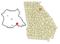
Coordinates: 34°3′47″N 83°7′30″W / 34.06306°N 83.125°WCoordinates: 34°3′47″N 83°7′30″W / 34.06306°N 83.125°W Country United States State Georgia County Madison Area – Total 3.2 sq mi (8.2 km2) – Land 3.2 sq mi (8.2 km2) – Water 0 sq mi (0 km2) Elevation 702 ft (214 m) Population (2000) – Total 1,052 – Density 328.8/sq mi (128.3/km2) Time zone Eastern (EST) (UTC-5) – Summer (DST) EDT (UTC-4) ZIP code 30629 Area code(s) 706 FIPS code 13-19084[1] GNIS feature ID 0312868[2] Comer is a city in Madison County, Georgia, United States. Incorporated in the year 1893, Comer is the largest city in Madison County based on population with an annual growth rate of approximately 3%.
Contents
Geography
Comer is located at 34°03′47″N 83°07′30″W / 34.062921°N 83.124952°W.[3] (twenty miles east of Athens) at the intersection of Georgia State Routes 72, 98, and 22.
According to the United States Census Bureau, the city has a total area of 3.2 square miles (8.3 km2). All of it is land. Watson Mill is the nearest state park.
Demographics
As of the census[1] of 2000, there were 1,052 people, 391 households, and 251 families residing in the city. The population density was 330.6 people per square mile (127.7/km²). There were 424 housing units at an average density of 133.2 per square mile (51.5/km²). The racial makeup of the city was 77.95% White, 20.25% African American, 0.19% Native American, 0.48% Asian, 0.38% from other races, and 0.76% from two or more races. Hispanic or Latino of any race were 1.05% of the population.
There were 391 households out of which 29.7% had children under the age of 18 living with them, 46.5% were married couples living together, 16.4% had a female householder with no husband present, and 35.8% were non-families. 32.0% of all households were made up of individuals and 15.9% had someone living alone who was 65 years of age or older. The average household size was 2.37 and the average family size was 3.04.
In the city the population was spread out with 22.7% under the age of 18, 5.8% from 18 to 24, 25.0% from 25 to 44, 22.2% from 45 to 64, and 24.2% who were 65 years of age or older. The median age was 43 years. For every 100 females there were 73.3 males. For every 100 females age 18 and over, there were 70.1 males.
The median income for a household in the city was $27,059, and the median income for a family was $40,750. Males had a median income of $33,333 versus $22,969 for females. The per capita income for the city was $17,742. About 12.4% of families and 16.0% of the population were below the poverty line, including 16.7% of those under age 18 and 24.1% of those age 65 or over.
Government
Comer is divided into four city districts, each represented by a single elected city council member, elected city mayor, as well as an elected county commissioner who serves one of five county districts.
- Elected Officials
- Mayor: David McMickle
- City Council Members
- District 1 Jimmy Yarbrough
- District 2 Kevin Booth
- District 3 Howard Threlkeld
- District 4 Laquita Bridges
- Country Commissioner District 5 Bruce Scogin
- State Senate District 47 Ralph Hudgens
- State House District 30 Tom McCall
- US Congressional District 10 Paul Broun
Famous residents
- Bobby Compton (singer songwriter)
See also
References
- ^ a b "American FactFinder". United States Census Bureau. http://factfinder.census.gov. Retrieved 2008-01-31.
- ^ "US Board on Geographic Names". United States Geological Survey. 2007-10-25. http://geonames.usgs.gov. Retrieved 2008-01-31.
- ^ "US Gazetteer files: 2010, 2000, and 1990". United States Census Bureau. 2011-02-12. http://www.census.gov/geo/www/gazetteer/gazette.html. Retrieved 2011-04-23.
Municipalities and communities of Madison County, Georgia Cities 
Footnotes ‡This populated place also has portions in an adjacent county or counties
Categories:- Cities in Georgia (U.S. state)
- Populated places in Madison County, Georgia
- Athens – Clarke County metropolitan area
- Elected Officials


Wikimedia Foundation. 2010.