Molalla River State Park — Grassy meadow along the walking trail … Wikipedia
York River State Park — is located near the unincorporated town of Croaker in James City County, Virginia on the south bank of the York River about 10 miles downstream from West Point. The York River is formed from the confluence of the Mattaponi River and the Pamunkey… … Wikipedia
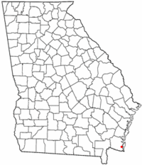
Crooked River (Georgia) — Crooked River Origin Georgia Basin countries United States The Crooked River is a 26.8 mile long (43.1 km)[1] river in Camden County in the U.S. state of Georgia. Primarily tidal, it is an inlet of Cumberland Sound … Wikipedia
Crooked River (Oregon) — Crooked River Daten Gewässerkennzahl … Deutsch Wikipedia
Crooked River High Bridge — Crooked River (High) Bridge Carries U.S. Highway 97 Crosses Crooked River Locale Jefferson County, Oregon … Wikipedia
Crooked River National Grassland — The Island , isolated by the canyons of the Deschutes and Crooked Rivers. Crooked River National Grassland is a National Grassland located in Jefferson County in the north central part of the U.S. state of Oregon. It has a land area of 112,357… … Wikipedia
Crooked River (Oregon) — Coordinates: 44°34′25″N 121°16′19″W / 44.57361°N 121.27194°W / 44.57361; 121.27194 … Wikipedia
Crooked River Gorge — Coordinates: 44°25′00″N 121°13′52″W / 44.4167°N 121.2310°W / 44.4167; 121.2310 … Wikipedia
Deschutes River State Recreation Area — Confluence of the Deschutes and the Columbia, as viewed from near the hiking trail on December 25, 2003 … Wikipedia
D River State Recreation Site — D River State Recreation Site … Wikipedia

