- New Echota
-
New Echota
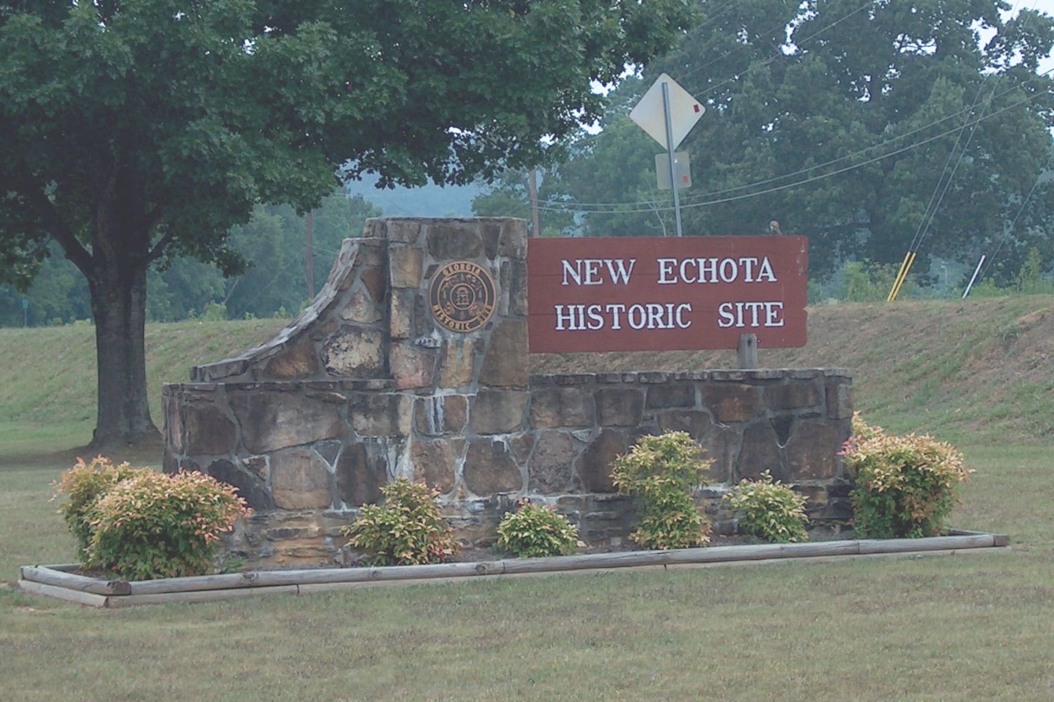
 New Echota Sign

Location: 1211 Chatsworth Hwy. Nearest city: Calhoun, Georgia and Resaca, Georgia Coordinates: 34°32′27.24″N 84°54′33.48″W / 34.5409°N 84.9093°WCoordinates: 34°32′27.24″N 84°54′33.48″W / 34.5409°N 84.9093°W Built: 1825–1849 Architect: Cherokees[1] Architectural style: Domestic style architecture[1] Governing body: State of Georgia NRHP Reference#: 70000869[1] Significant dates Added to NRHP: May 13, 1970 Designated NHL: November 7, 1973[2] New Echota was the capital of the Cherokee Nation prior to their forced removal in the 1830s. New Echota is 3.68 miles north of present-day Calhoun, Georgia, and south of Resaca, Georgia. The site is a state park and an historic site.
The site is at the confluence of the Coosawattee River and Conasauga River, which join to form the Oostanaula River, and near to Town Creek. Archeological evidence has shown that the site of New Echota was occupied by earlier villages before the Cherokee made it their capitol in 1825. A Cherokee town called Gansagiyi (abbreviated Gansagi) was present at the site before its re-establishment as New Echota.
Prior to the building of New Echota, the nearby town of Ustanali on the Coosawattee River (established by refugees from the Cherokee Lower Towns in northwestern South Carolina in 1777), had served as the seat of the Cherokee people since 1788. (That was the year in which Old Tassel and several other Cherokee leaders were murdered while on an embassy to the State of Franklin at that government's invitation —sparking an increase in attacks from warriors all across the frontier in addition to the followers of Dragging Canoe, who were already in the midst of the Chickamauga wars.) Following the murders, Little Turkey was elected chief of the Cherokee and Chota was abandoned as the seat of the council, which was moved to Ustanali.
New Echota was named after Chota, the former capitol of the Overhill Cherokee which had by that time been completely abandoned after being mostly buried by the waters of Tellico Lake, in Monroe County. The site and the entire region of the Overhill Towns had been ceded to the United States the year before. "Chota" and "Echota" were later names used for Itsati, the original name of the town. According to James Mooney, the meaning of the word is lost. Mooney apparently did not consult a Creek dictionary when making that assessment. Itsati is the name that Hitchiti Creeks call themselves, to this day. Chota is the Hitchiti-Creek and Muskogee-Creek word for "frog." In the Itsati and Itza Maya languages, applying an "E" prefix to a proper noun imparts importance or suggests that it is the principal town with that name. Chota was therefore, probably a Muskogean town in eastern Tennessee, prior to being occupied by the Cherokees.
The meaning of the Cherokee town name Gansagiyi is also lost.[verification needed] A common English name for New Echota was "Newtown" or "New Town". These names are still used for the area around the State Park. The area was also known as "The Fork" and "Fork Ferry" by Anglo-American settlers.
 The Cherokee Phoenix
By 1823 the government of the Cherokee Nation was meeting in New Echota. Its central location and easy access made the city an excellent choice for the capitol. On November 12, 1825, New Echota was officially designated capitol of the Cherokee Nation. At that time, the tribal council also began a building program that included construction of a two-story Council House, a Supreme Court, and later the office (Printer Shop) of the first Indian language and Cherokee newspaper, the Cherokee Phoenix.
Here Elias Boudinot wrote and a printer laid out the first Native American newspaper. Boudinot wrote it in English and Cherokee, using for the latter the new syllabary created by Sequoyah. Private homes, stores, a ferry and mission station were in the outlying area of New Echota. The town was quiet most of the year, but Council meetings provided the opportunity for great social gatherings. During these meetings, several hundred Cherokees filled the town, arriving by foot, on horseback or in stylish carriages.
In 1832, Georgia's Sixth Land Lottery gave Cherokee land to white settlers. The Cherokee Nation had never ceded the land to the state, however. Over the next six years, the Georgia Guard conducted a form of vigilante justice against the Cherokee. By 1834, New Echota was becoming a ghost town. Council meetings were moved to Red Clay, Cherokee Nation (now Tennessee). In May 1835, a small group of Cherokee (300–500 Cherokee known as Ridgeites or the Treaty Party) signed the Treaty of New Echota in the home of Elias Boudinot. Signers included Major Ridge, John Ridge, and Andrew Ross, brother of John Ross. They agreed to removal in exchange for lands west of the Mississippi River. This controversial document used by the American government to justify the removal influences what is now now known as the Trail of Tears.
In 1838 the U.S. Army, under the command of Winfield Scott, began the forced removal of Cherokee from the state of Georgia. A Cherokee removal fort was located at New Echota. It was called Fort Wool. The fort held Cherokee prisoners from Gordon County, Georgia and Pickens County, Georgia until their removal. As the prisoners began their exodus to Rattlesnake Springs, Cherokee Nation (4 miles south of Charleston, Tennessee), the Cherokee from counties south and east of the area also were housed here.
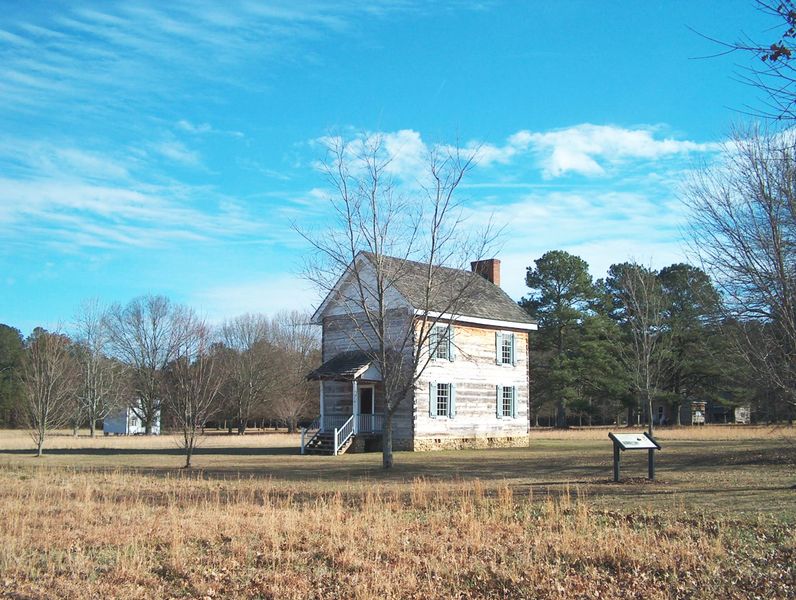
 Council House, Supreme House, and Print Shop. Three of the reconstructed buildings in New Echota, were originally owned by Cherokee.
Contents
New Echota Historic Site
After the Cherokee were removed, their capitol remained abandoned for more than 100 years. New Echota disappeared, though some of the houses continued to be used. Most notable was the house of Samuel Worcester, called "the Messenger", a missionary to the Cherokee. When the then-current landowners deeded land to the state for preservation, the Worcester house, the largest remaining structure, had been vacant for two years. The wear of the elements in that brief time was apparent.
In March 1954, Georgia Historical Commission archeologist Lewis Larsen and five men were sent to oversee the work of excavating New Echota. The team went to work slowly as they uncovered evidence not only of a Cherokee settlement in New Echota, but also of earlier Indian cultures. They asked National Park Service archeologist Joe Caldwell and two more workers to join them for the next two months as they continued excavation. The group recovered a Spanish coin dated 1802, crockery, household wares, bootery remains, a small quantity of lead, and 1700 other artifacts. They identified 600 items as having belonged to the Cherokee. In addition to the standard finds and remains of many buildings, Larsen and Caldwell astonished the world by discovering much of the type once used to print the Cherokee Phoenix.
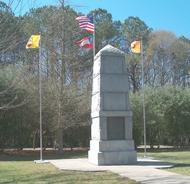
 The monument on New Echota Historic Site honored the Cherokees who died on the Trail of Tears.
On March 13, 1957, following the news of Larsen and Caldwell's archeological finds, the State of Georgia authorized the town of New Echota to be reconstructed as a Georgia State Park. They rebuilt some of the buildings of the village of New Echota (such as the Council House) where once the laws of the Cherokee Nation were enacted, the Supreme Court, the Printer Shop, a building of the Cherokee Phoenix, a Common Cherokee Cabin (representing a home of an average Cherokee family) and a Middle-Class Cherokee Home including outbuildings. Vann's Tavern, owned by Chief Vann was "original" with modern nails and replacement wooden parts, but is not the original New Echota Vann Tavern. This was relocated from Forsyth County, Georgia (Chief Vann owned 14 taverns across the state of Georgia) as original New Echota Vann Tavern was destroyed. In addition, the park contains the site of the former Elias Boudinot house, where it once stood but had since been destroyed by fire. This site, unreconstructed, serves as a memorial to Boudinot. The Worcester house was restored to its 19th century condition. Other sites are not open to the public, as they are now on private property. Across from New Echota, there were two farmhouse sites that were owned by white men who had married Cherokee women; these sites are now part of Gordon County golf course.
The New Echota Historical Park was opened to the public in 1962, with a replica of the original Office of the Cherokee Phoenix as a highlight of the tour. Inside that office were 600 pieces of type containing the lasting legacy of the first American Indian newspaper. They have reproductions of 19th century printing machines that tourists can take "reissue" Cherokee Phoenix newspapers to their homes. Later some type was moved to the museum and research facility that is built in front of New Echota. The three-quarter mile walk can be expanded by walking the Newtown Trail, a 1.2 mile interpreted trail that takes tourists to Town Creek (inside the center of New Echota), where the majority of the Cherokee had camped when the Council was in session. In 1973, when the State of Georgia terminated the Georgia Historical Commission that controlled the New Echota Historic Site. The New Echota Historic Site was turned over to the Department of Natural Resources also known as Georgia State Parks and Historic Sites, that continues to operate and maintain this historic site after 1973.
The site is listed as a National Historic Landmark.[3]
Notes
- ^ a b c "National Register of Historical Places – Georgia (GA), Gordon County". National Register of Historic Places. National Park Service. 1970. http://www.nationalregisterofhistoricplaces.com/GA/Gordon/state.html.
- ^ "New Echota". National Historic Landmark summary listing. National Park Service. http://tps.cr.nps.gov/nhl/detail.cfm?ResourceId=1043&ResourceType=District. Retrieved 2008-06-21.
- ^ "National Historic Landmarks Program: New Echota". http://tps.cr.nps.gov/nhl/detail.cfm?ResourceId=1043&ResourceType=District. Retrieved 2007-11-23.
References
- Mooney, James. "Myths of the Cherokee". 1900, reprinted 1995.
External links
- New Echota Historic Site, official site
- New Echota Historic Site, North Georgia
- Treaty of New Echota
- New Echota map
U.S. National Register of Historic Places Topics Lists by states Alabama • Alaska • Arizona • Arkansas • California • Colorado • Connecticut • Delaware • Florida • Georgia • Hawaii • Idaho • Illinois • Indiana • Iowa • Kansas • Kentucky • Louisiana • Maine • Maryland • Massachusetts • Michigan • Minnesota • Mississippi • Missouri • Montana • Nebraska • Nevada • New Hampshire • New Jersey • New Mexico • New York • North Carolina • North Dakota • Ohio • Oklahoma • Oregon • Pennsylvania • Rhode Island • South Carolina • South Dakota • Tennessee • Texas • Utah • Vermont • Virginia • Washington • West Virginia • Wisconsin • WyomingLists by territories Lists by associated states Other  Category:National Register of Historic Places •
  Portal:National Register of Historic Places
Protected areas of Georgia Federal Banks Lake • Blackbeard Island • Bond Swamp • Eufaula • Harris Neck • Okefenokee • Piedmont • Savannah • Wassaw • Wolf Island
Big Frog Wilderness • Blood Mountain Wilderness • Brasstown Wilderness • Cohutta Wilderness • Cumberland Island National Seashore • Ellicott Rock Wilderness • Mark Trail Wilderness • Okefenokee Wilderness • Raven Cliffs Wilderness • Rich Mountain Wilderness • Southern Nantahala Wilderness • Tray Mountain Wilderness •
Chattahoochee River National Recreation Area • Cumberland Island National Seashore • Gray's Reef National Marine Sanctuary • Sapelo Island National Estuarine Research Reserve
State Amicalola Falls • Black Rock Mountain • Bobby Brown • Buck Shoals • Chattahoochee Bend • Cloudland Canyon • Crooked River • Don Carter • Elijah Clark • F.D. Roosevelt • Florence Marina • Fort Mountain • Fort Yargo • General Coffee • George L. Smith • George T. Bagby • Georgia Veterans • Gordonia-Alatamaha • Hamburg • Hard Labor Creek • Hart • High Falls • Indian Springs • James H. "Sloppy" Floyd • John Tanner • Laura S. Walker • Little Ocmulgee • Magnolia Springs • Mistletoe • Moccasin Creek • Panola Mountain • Providence Canyon • Red Top Mountain • Reed Bingham • Richard B. Russell • Sapelo Island • Seminole • Skidaway Island • Smithgall Woods • Sprewell Bluff • Standing Boy Creek • Stephen C. Foster • Sweetwater Creek • Tallulah Gorge • Tugaloo • Unicoi • Victoria Bryant • Vogel • Watson Mill Bridge
Historic parks
and sitesA.H. Stephens • Chief Vann House • Dahlonega Gold Museum • Etowah Indian Mounds • Fort McAllister • Fort King George • Fort Morris • Hofwyl-Broadfield Plantation • Jarrell Plantation • Jefferson Davis Memorial • Kolomoki Mounds • Lapham-Patterson House • Little White House • New Echota • Pickett's Mill Battlefield • Robert Toombs House • Travelers Rest • Wormsloe
OtherCounty,
Municipal
and OtherParksCobb County Parks • McIntosh Reserve • Murphey Candler Park • Okefenokee Swamp Park • Robert G. Hunter Memorial Park • Seaborn Jones Memorial Park • Shaking Rock Park · The Parks at Chehaw
Forests &
Nature PreservesAutrey Mill Nature Preserve & Heritage Center • Fernbank Forest • Marshall Forest • Morningside Nature Preserve • Reynolds Nature Preserve
Chattahoochee Nature Center • Savannah-Ogeechee Canal Museum & Nature Center
Georgia Department of Natural Resources • Georgia Forestry Commission (web) Categories:- Cherokee towns
- Georgia (U.S. state) state parks
- Protected areas of Gordon County, Georgia
- National Historic Landmarks in Georgia (U.S. state)
- Open air museums in Georgia (U.S. state)
- Native American museums in Georgia (U.S. state)
- Cherokee Nation (19th century)
- Museums in Gordon County, Georgia
- Protected areas established in 1970
- History of Georgia (U.S. state)


Wikimedia Foundation. 2010.