- National Register of Historic Places listings in Yankton County, South Dakota
-
 Location of Yankton County in South Dakota
This is a list of the National Register of Historic Places listings in Yankton County, South Dakota.
This is intended to be a complete list of the properties and districts on the National Register of Historic Places in Yankton County, South Dakota, United States. The locations of National Register properties and districts for which the latitude and longitude coordinates are included below, may be seen in a Google map.[1]
There are 77 properties and districts listed on the National Register in the county. Another property was once listed but has since been removed.
-
- This National Park Service list is complete through NPS recent listings posted November 10, 2011.[2]
Current listings
[3] Landmark name [4] Image Date listed Location City or town Summary 1 Aggergaard Manor June 6, 2001 Thompson St.
43°05′03″N 97°09′37″W / 43.084167°N 97.160278°WIrene 2 Dr. B.M. Banton House 
October 8, 1987 517 Locust St.
42°52′24″N 97°23′59″W / 42.873333°N 97.399722°WYankton 3 Bishop Marty Rectory 
December 27, 1974 1101 W. 5th St.
42°52′16″N 97°24′29″W / 42.871111°N 97.408056°WYankton 4 Brockmueller Barn April 16, 1980 South of Highway 46
43°02′34″N 97°19′10″W / 43.042778°N 97.319444°WVolin 5 Bruce-Donaldson House 
March 5, 1982 313 Pine St.
42°52′14″N 97°23′20″W / 42.870556°N 97.388889°WYankton 6 Burns House 
February 9, 2001 816 Pine St.
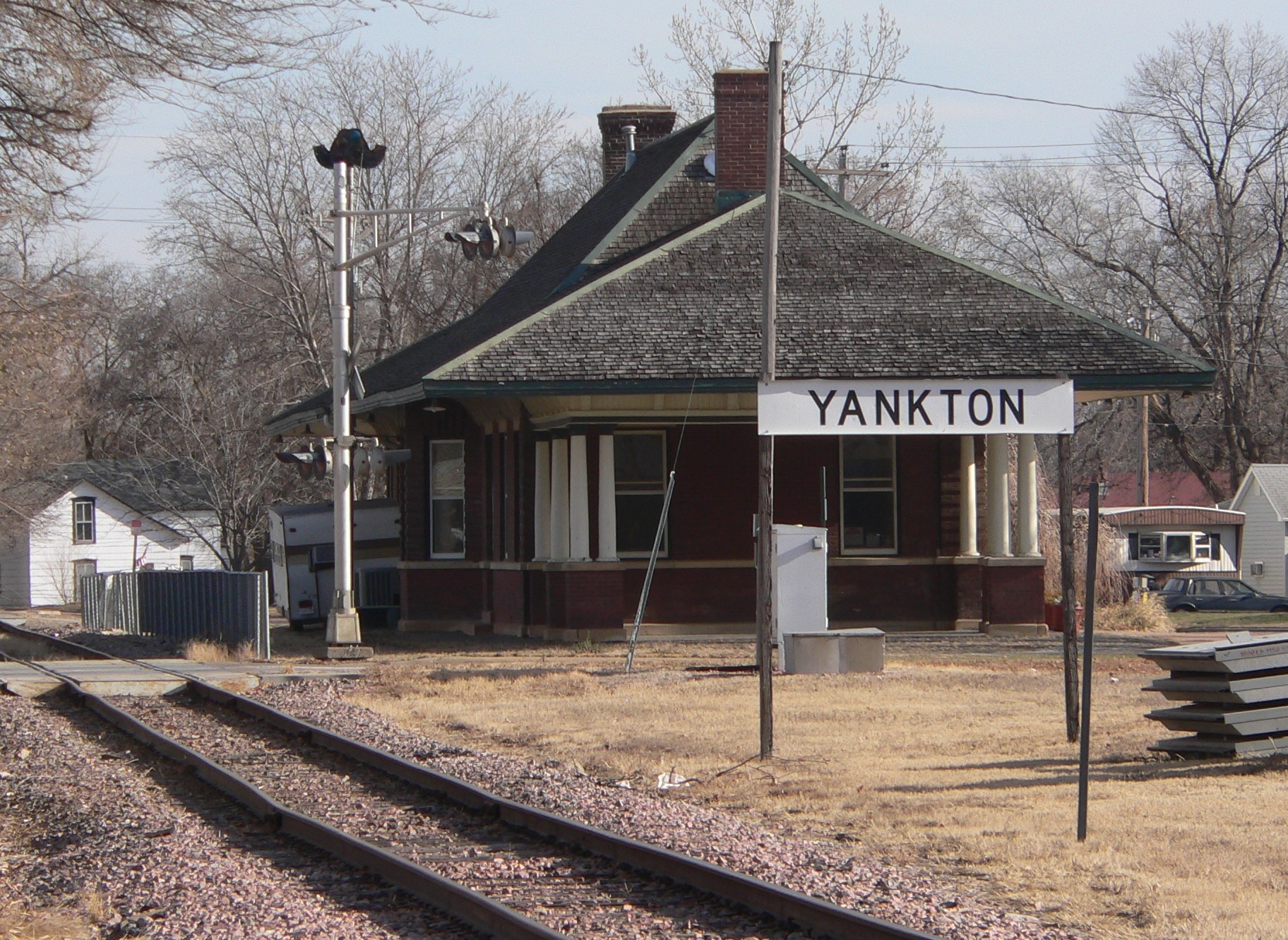
42°52′39″N 97°23′18″W / 42.8775°N 97.388333°WYankton 7 Chicago, Milwaukee and St. Paul Depot 
March 5, 1982 8th and Douglas Sts.
42°52′35″N 97°23′27″W / 42.876389°N 97.390833°WYankton 8 DeJong House April 16, 1980 In Utica
42°58′52″N 97°29′54″W / 42.981111°N 97.498333°WUtica 9 Harold A. (H.A.) Doyle House 
October 25, 1990 712 W. 3rd St.
42°52′13″N 97°24′08″W / 42.870278°N 97.402222°WYankton 10 Arthur C. Ellerman House 
March 5, 1982 708 W. 5th St.
42°52′22″N 97°24′08″W / 42.872778°N 97.402222°WYankton 11 ES Volin Farmstead April 16, 1980 Southeast of Volin
42°57′07″N 97°10′22″W / 42.951944°N 97.172778°WVolin 12 Excelsior Flour Mill November 7, 1976 2nd and Capital
42°52′04″N 97°23′23″W / 42.867778°N 97.389722°WYankton 13 William J. Fantle House 
October 10, 1989 1201 Douglas
42°52′57″N 97°23′31″W / 42.8825°N 97.391944°WYankton 14 Gordon House April 16, 1980 North of Highway 46
43°06′03″N 97°19′13″W / 43.100833°N 97.320278°WIrene 15 Gorsett Farmstead April 16, 1980 North of Volin
42°58′56″N 97°11′11″W / 42.982222°N 97.186389°WVolin 16 Endre B. Gunderson Farmstead April 16, 1980 North of Yankton
42°56′11″N 97°24′59″W / 42.936389°N 97.416389°WYankton 17 Charles Gurney Hotel 
August 3, 1979 3rd and Capital Sts.
42°52′12″N 97°23′26″W / 42.87°N 97.390556°WYankton 18 Bernt Gustad House April 16, 1980 Northwest of Volin
42°58′10″N 97°20′13″W / 42.969444°N 97.336944°WVolin 19 Henjna Farmstead April 16, 1980 North of Highway 50
42°56′31″N 97°33′41″W / 42.941944°N 97.561389°WYankton 20 Hoffman House 
November 20, 2007 307 Green St.
42°52′10″N 97°24′08″W / 42.869444°N 97.402222°WYankton 21 Hoxeng Farmstead April 16, 1980 Northwest of Volin
42°59′16″N 97°12′42″W / 42.987778°N 97.211667°WVolin 22 Human Services Center 
April 16, 1980 Off U.S. Route 81
42°54′52″N 97°25′40″W / 42.914444°N 97.427778°WYankton 23 Ingebrigtsen-Hinseth Farmstead April 16, 1980 West of Irene
43°05′24″N 97°12′30″W / 43.09°N 97.208333°WIrene 24 Jencks Farmstead April 16, 1980 North of Yankton, off U.S. Route 81
42°55′14″N 97°22′40″W / 42.920556°N 97.377778°WYankton 25 Kietzman Farmstead April 16, 1980 Northeast of Utica
43°00′47″N 97°24′35″W / 43.013056°N 97.409722°WYankton 26 Kremer House April 16, 1980 In Lesterville
43°02′26″N 97°35′43″W / 43.040556°N 97.595278°WLesterville 27 Larson-Simonson House April 16, 1980 In Mission Hill
42°55′19″N 97°16′48″W / 42.921944°N 97.28°WMission Hill 28 Mathias Lasele House April 16, 1980 East of Lesterville
43°03′40″N 97°31′51″W / 43.061111°N 97.530833°WLesterville 29 Machacek Homestead April 16, 1980 Southwest of Utica
42°57′35″N 97°30′57″W / 42.959722°N 97.515833°WUtica 30 Marindahl Post Office April 16, 1980 Northwest of Volin
42°59′49″N 97°14′01″W / 42.996944°N 97.233611°WVolin 31 Marindahl Township Hall April 16, 1980 Southwest of Irene
43°02′23″N 97°14′02″W / 43.039722°N 97.233889°WVolin 32 Martin's Evangelical Church April 16, 1980 East of Lesterville
43°02′22″N 97°26′15″W / 43.039444°N 97.4375°WUtica 33 Walker McGregor Farmstead April 16, 1980 Northwest of Volin
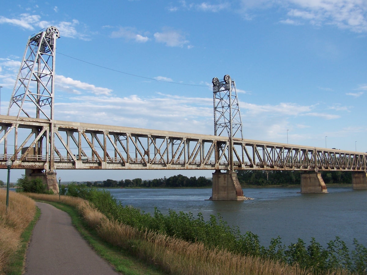
42°58′22″N 97°12′44″W / 42.972778°N 97.212222°WYankton 34 Meridian Bridge 
June 17, 1993 U.S. Route 81 over the Missouri River, just south of Yankton
42°52′05″N 97°23′37″W / 42.868056°N 97.393611°WYankton Extends into Cedar County, Nebraska 35 Nels Merk Farmstead April 16, 1980 Southeast of Center Point
43°08′47″N 97°10′49″W / 43.146389°N 97.180278°WYankton 36 Mathias Merkwan Rubblestone Barn July 6, 1987 East of Tabor
42°57′01″N 97°37′57″W / 42.950278°N 97.6325°WTabor 37 Mueller Homestead April 16, 1980 East of Lesterville
43°02′45″N 97°30′43″W / 43.045833°N 97.511944°WUtica 38 New Hope Farm Polygonal Barn January 28, 2004 30725 444th Ave.
42°57′37″N 97°19′17″W / 42.960278°N 97.321389°WMission Hill 39 New Hope Farm Swine Barn January 28, 2004 30725 444th Ave.
42°55′58″N 97°19′26″W / 42.932778°N 97.323889°WMission Hill 40 Ohlman-Shannon House 
May 28, 1976 205 Green St.
42°52′11″N 97°24′06″W / 42.869722°N 97.401667°WYankton 41 Old Catholic Church April 16, 1980 North of Highway 50
42°54′52″N 97°34′56″W / 42.914444°N 97.582222°WYankton 42 Lewis Olson Log House April 16, 1980 West of Mission Hill
42°55′58″N 97°20′17″W / 42.932778°N 97.338056°WMission Hill 43 Our Savior's Lutheran Church October 7, 2001 29219 431st Ave.
43°09′07″N 97°34′44″W / 43.151944°N 97.578889°WMenno 44 Frantisek Pechan Log House July 6, 1987 North of Highways 50 and 52
42°54′51″N 97°32′23″W / 42.914167°N 97.539722°WTabor 45 Governor John L. Pennington House 
February 8, 1988 410 E. 3rd St.
42°52′12″N 97°23′08″W / 42.87°N 97.385556°WYankton 46 Mathias Peterson Homestead April 16, 1980 Southwest of Volin
42°56′19″N 97°14′03″W / 42.938611°N 97.234167°WMission Hill 47 Pine Street Bridge 
January 14, 2000 Pine Street over Marne Creek
42°52′27″N 97°23′19″W / 42.87425°N 97.388667°WYankton 48 Ripple House April 16, 1980 South of Lesterville
43°01′49″N 97°35′47″W / 43.030278°N 97.596389°WLesterville 49 St. Agnes Church April 16, 1980 East of Lesterville
43°02′20″N 97°25′18″W / 43.038889°N 97.421667°WUtica 50 Schaffer Farmstead April 16, 1980 North of Yankton, off U.S. Route 81
42°55′53″N 97°22′42″W / 42.931389°N 97.378333°WYankton 51 Fred Schnauber House 
January 31, 1985 717 Walnut St.
42°52′34″N 97°23′37″W / 42.876111°N 97.393611°WYankton 52 Simonson Farmstead April 16, 1980 Southwest of Volin
42°56′00″N 97°13′11″W / 42.933333°N 97.219722°WMission Hill 53 John Sloan Homestead April 16, 1980 Southwest of Irene
43°01′28″N 97°11′53″W / 43.024444°N 97.198056°WVolin 54 Jessie Smith Farmstead April 16, 1980 Southwest of Volin
42°55′22″N 97°12′50″W / 42.922778°N 97.213889°WVolin 55 Steingrube Place January 28, 2004 30089 452nd Ave.
43°01′51″N 97°09′39″W / 43.030833°N 97.160833°WWakonda 56 Stribral Homestead and Farmstead April 16, 1980 South of Lesterville
42°57′42″N 97°35′15″W / 42.961667°N 97.5875°WTabor 57 Frank Svatos Rubblestone Barn July 6, 1987 Southeast of Tabor off Highway 50
42°56′08″N 97°37′43″W / 42.935556°N 97.628611°WTabor 58 Dr. John Trierweiler House 
May 7, 1980 301 Spruce St.
42°52′13″N 97°24′15″W / 42.870278°N 97.404167°WYankton 59 United Church of Christ April 16, 1980 In Mission Hill
42°55′26″N 97°16′45″W / 42.923889°N 97.279167°WMission Hill 60 Utica Depot April 16, 1980 In Utica
42°58′50″N 97°29′56″W / 42.980556°N 97.498889°WUtica 61 Utica Fire and City Hall April 16, 1980 In Utica
42°58′50″N 97°29′56″W / 42.980556°N 97.498889°WUtica 62 Utica Public School April 16, 1980 In Utica
42°58′48″N 97°29′56″W / 42.98°N 97.498889°WUtica 63 Van Osdel House April 16, 1980 In Mission Hill
42°55′12″N 97°16′50″W / 42.92°N 97.280556°WMission Hill 64 Vangen Church April 16, 1980 Northeastern Mission Hill
42°55′34″N 97°15′52″W / 42.926111°N 97.264444°WMission Hill 65 Volin School April 16, 1980 In Volin
42°57′39″N 97°10′55″W / 42.960833°N 97.181944°WVolin 66 Volin Town Hall April 16, 1980 In Volin
42°57′31″N 97°10′53″W / 42.958611°N 97.181389°WVolin 67 Louis Volin House April 16, 1980 Northwest of Volin
42°57′25″N 97°10′45″W / 42.956944°N 97.179167°WVolin 68 Walloch Farmstead April 16, 1980 South of Lesterville
43°00′27″N 97°36′44″W / 43.0075°N 97.612222°WLesterville 69 Walshtown School April 16, 1980 South of Highway 46
43°02′22″N 97°19′11″W / 43.039444°N 97.319722°WYankton 70 Western Portland Cement Plant September 19, 1979 West of Yankton
42°52′43″N 97°28′43″W / 42.878611°N 97.478611°WYankton 71 Yankton Carnegie Library 
August 7, 1979 4th and Capitol Sts.
42°52′17″N 97°23′26″W / 42.871389°N 97.390556°WYankton 72 Yankton College Conservatory 
February 24, 1975 Yankton College campus
42°53′23″N 97°23′24″W / 42.889722°N 97.39°WYankton 73 Yankton College Historic District 
March 22, 1982 12th and Douglas Sts.
42°52′49″N 97°23′22″W / 42.880278°N 97.389444°WYankton 74 Yankton High School Historic District 
May 30, 2002 613 Walnut St.
42°52′29″N 97°23′39″W / 42.874722°N 97.394167°WYankton 75 Yankton Historic Commercial District June 23, 1982 Roughly bounded by 2nd, 4th, Pine and Broadway Sts.
42°52′49″N 97°23′22″W / 42.880278°N 97.389444°WYankton 76 Yankton Historic District February 13, 1975 Bounded by Marne Creek and 4th St., and including both sides of Cedar
42°52′22″N 97°23′21″W / 42.872778°N 97.389167°WYankton 77 Zion Lutheran Church April 16, 1980 Northwest of Volin
42°59′47″N 97°13′23″W / 42.996389°N 97.223056°WVolin Former listing
Landmark name Image Date Location City or Town Summary 1 Walnut Street Bridge March 26, 2008 (delisted) Yankton See also
- List of National Historic Landmarks in South Dakota
- National Register of Historic Places listings in South Dakota
References
- ^ The latitude and longitude information provided in this table was derived originally from the National Register Information System, which has been found to be fairly accurate for about 99% of listings. For about 1% of NRIS original coordinates, experience has shown that one or both coordinates are typos or otherwise extremely far off; some corrections may have been made. A more subtle problem causes many locations to be off by up to 150 yards, depending on location in the country: most NRIS coordinates were derived from tracing out latitude and longitudes off of USGS topographical quadrant maps created under North American Datum of 1927, which differs from the current, highly accurate GPS system used by Google maps. Chicago is about right, but NRIS longitudes in Washington are higher by about 4.5 seconds, and are lower by about 2.0 seconds in Maine. Latitudes differ by about 1.0 second in Florida. Some locations in this table may have been corrected to current GPS standards.
- ^ "National Register of Historic Places: Weekly List Actions". National Park Service, United States Department of the Interior. Retrieved on November 10, 2011.
- ^ Numbers represent an ordering by significant words. Various colorings, defined here, differentiate National Historic Landmark sites and National Register of Historic Places Districts from other NRHP buildings, structures, sites or objects.
- ^ "National Register Information System". National Register of Historic Places. National Park Service. . http://nrhp.focus.nps.gov/natreg/docs/All_Data.html.
U.S. National Register of Historic Places Topics Lists by states Alabama • Alaska • Arizona • Arkansas • California • Colorado • Connecticut • Delaware • Florida • Georgia • Hawaii • Idaho • Illinois • Indiana • Iowa • Kansas • Kentucky • Louisiana • Maine • Maryland • Massachusetts • Michigan • Minnesota • Mississippi • Missouri • Montana • Nebraska • Nevada • New Hampshire • New Jersey • New Mexico • New York • North Carolina • North Dakota • Ohio • Oklahoma • Oregon • Pennsylvania • Rhode Island • South Carolina • South Dakota • Tennessee • Texas • Utah • Vermont • Virginia • Washington • West Virginia • Wisconsin • WyomingLists by territories Lists by associated states Other  Category:National Register of Historic Places •
  Portal:National Register of Historic Places
Municipalities and communities of Yankton County, South Dakota County seat: Yankton Cities 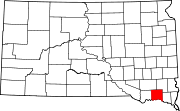
Towns Gayville | Lesterville | Mission Hill | Utica | Volin
Footnotes ‡This populated place also has portions in an adjacent county or counties
Categories:- Yankton County, South Dakota
- National Register of Historic Places in South Dakota by county
- Buildings and structures in Yankton County, South Dakota
-


Wikimedia Foundation. 2010.