- Mission Hill, South Dakota
-
Mission Hill, South Dakota — Town — Location in Yankton County and the state of South Dakota
Coordinates: 42°55′16″N 97°16′46″W / 42.92111°N 97.27944°WCoordinates: 42°55′16″N 97°16′46″W / 42.92111°N 97.27944°W Country United States State South Dakota County Yankton Incorporated 1913[1] Area – Total 0.3 sq mi (0.9 km2) – Land 0.3 sq mi (0.9 km2) – Water 0 sq mi (0 km2) Elevation 1,198 ft (365 m) Population (2010) – Total 177 – Density 590/sq mi (196.7/km2) Time zone Central (CST) (UTC-6) – Summer (DST) CDT (UTC-5) ZIP code 57046 Area code(s) 605 FIPS code 46-42980[2] GNIS feature ID 1256497[3] Mission Hill is a town in Yankton County, South Dakota, United States. The population was 177 at the 2010 census.
Geography
According to the United States Census Bureau, the town has a total area of 0.3 square miles (0.78 km2), all of it land.[4]
Mission Hill has been assigned the ZIP code 57046 and the FIPS place code 42980.
Demographics
As of the 2000 Census,[2] there were 183 people, 71 households, and 57 families residing in the town. The population density was 557.2 people per square mile (215.1/km²). There were 76 housing units at an average density of 231.4 per square mile (88.9/km²).[4] The racial makeup of the town was 96.17% White, 1.09% Native American, 0.55% Asian, 1.09% from other races, and 1.09% from two or more races. Hispanic or Latino of any race were 1.09% of the population.[5]
There were 71 households out of which 33.8% had children under the age of 18 living with them, 64.8% were married couples living together, 5.6% had a female householder with no husband present, and 19.7% were non-families. 16.9% of all households were made up of individuals and 2.8% had someone living alone who was 65 years of age or older. The average household size was 2.58 and the average family size was 2.84.[5]
In the town the population was spread out with 26.8% under the age of 18, 7.7% from 18 to 24, 29.5% from 25 to 44, 21.9% from 45 to 64, and 14.2% who were 65 years of age or older. The median age was 38 years. For every 100 females there were 117.9 males. For every 100 females age 18 and over, there were 119.7 males.[6]
The median income for a household in the town was $35,625, and the median income for a family was $35,625. Males had a median income of $25,313 versus $18,750 for females. The per capita income for the town was $14,405. About 7.5% of families and 12.3% of the population were below the poverty line, including 27.1% of those under the age of eighteen and none of those sixty five or over.[5]
References
- ^ "SD Towns". South Dakota State Historical Society. http://history.sd.gov/Archives/forms/exhibits/SD%20Towns.pdf. Retrieved 2010-02-14.
- ^ a b "American FactFinder". United States Census Bureau. http://factfinder.census.gov. Retrieved 2008-01-31.
- ^ "US Board on Geographic Names". United States Geological Survey. 2007-10-25. http://geonames.usgs.gov. Retrieved 2008-01-31.
- ^ a b U.S. Census Bureau. Census 2000, Summary File 1. GCT-PH1. Population, Housing Units, Area, and Density: 2000 by county subdivision and place, "Yankton County". American FactFinder. <http://factfinder.census.gov>. http://factfinder.census.gov/servlet/GCTTable?_bm=y&-ds_name=DEC_2000_SF1_U&-mt_name=DEC_2000_SF1_U_GCTPH1_CO1&-tree_id=4001&-geo_id=05000US46135&-format=CO-2&-_lang=en GCT-PH1. Population, Housing Units, Area, and Density: 2000 by county subdivision and place,. Retrieved 2008-01-31.
- ^ a b c U.S. Census Bureau. Census 2000. "Census Demographic Profiles, Mission Hill, South Dakota" (PDF). CenStats Databases. <http://censtats.census.gov/data/>. http://censtats.census.gov/data/SD/1604642980.pdf. Retrieved 2009-01-31.
- ^ U.S. Census Bureau. Census 2000. "QT-P1. Age Groups and Sex, Mission Hill, South Dakota". American FactFinder. <http://factfinder.census.gov>. http://factfinder.census.gov/servlet/QTTable?_bm=y&-geo_id=16000US4642980&-qr_name=DEC_2000_SF1_U_QTP1&-ds_name=D&-_lang=en&-redoLog=false. Retrieved 2009-01-31.
Municipalities and communities of Yankton County, South Dakota Cities 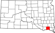
Towns Gayville | Lesterville | Mission Hill | Utica | Volin
Footnotes ‡This populated place also has portions in an adjacent county or counties
Categories:- Towns in South Dakota
- Populated places in Yankton County, South Dakota


Wikimedia Foundation. 2010.