- Miller, South Dakota
-
City of Miller, South Dakota — City — Location in Hand County and the state of South Dakota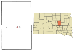
Coordinates: 44°31′12″N 98°59′11″W / 44.52°N 98.98639°WCoordinates: 44°31′12″N 98°59′11″W / 44.52°N 98.98639°W Country United States State South Dakota County Hand Incorporated 1905[1] Government – Mayor Tom McGough (D) Area – Total .9 sq mi (2.5 km2) – Land 0.9 sq mi (2.5 km2) – Water 0.0 sq mi (0.0 km2) Elevation 1,578 ft (481 m) Population (2010) – Total 1,489 – Density 1,654.4/sq mi (595.6/km2) Time zone Central (UTC-6) – Summer (DST) Central Daylight Time (UTC-5) Zip Code 57362 Area code(s) 605 FIPS code 46-42460[2] GNIS feature ID 1256470[3] Miller is a city in Hand County, South Dakota, United States. The population was 1,489 at the 2010 census. It is the county seat of Hand County.[4]
Contents
Geography
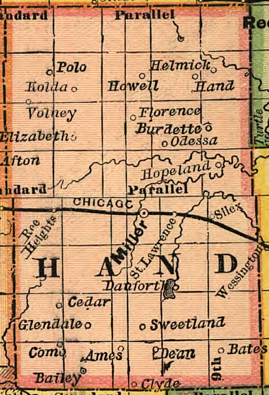
 1892 map of Hand County showing Miller and surrounging villages.
According to the United States Census Bureau, the city has a total area of 0.9 square miles (2.5 km²), all of it land.
Miller has been assigned the ZIP code 57362.
Demographics
As of the census[2] of 2000, there were 1,530 people, 720 households, and 406 families residing in the city. The population density was 1,614.1 people per square mile (621.8/km²). There were 845 housing units at an average density of 891.4 per square mile (343.4/km²). The racial makeup of the city was 99.15% White, 0.07% African American, 0.13% Native American, 0.07% Asian, 0.20% from other races, and 0.39% from two or more races. Hispanic or Latino of any race were 0.26% of the population.
There were 720 households out of which 21.4% had children under the age of 18 living with them, 48.6% were married couples living together, 6.1% had a female householder with no husband present, and 43.5% were non-families. 41.9% of all households were made up of individuals and 26.4% had someone living alone who was 65 years of age or older. The average household size was 2.03 and the average family size was 2.77.
In the city the population was spread out with 19.1% under the age of 18, 4.4% from 18 to 24, 21.1% from 25 to 44, 22.1% from 45 to 64, and 33.3% who were 65 years of age or older. The median age was 49 years. For every 100 females there were 83.7 males. For every 100 females age 18 and over, there were 78.9 males.
The median income for a household in the city was $28,929, and the median income for a family was $39,293. Males had a median income of $25,962 versus $17,216 for females. The per capita income for the city was $18,401. About 4.2% of families and 9.5% of the population were below the poverty line, including 8.2% of those under age 18 and 12.2% of those age 65 or over.
Notable people
- Harlan J. Bushfield, Governor of South Dakota and husband of Vera Bushfield
- Vera C. Bushfield, politician and wife of Harland Bushfield
Popular culture
Miller was the focal point of a “This America Life” episode discussing a racial incident that occurred in the town.[5]
References
- ^ "SD Towns". South Dakota State Historical Society. http://history.sd.gov/Archives/forms/exhibits/SD%20Towns.pdf. Retrieved 2010-02-14.
- ^ a b "American FactFinder". United States Census Bureau. http://factfinder.census.gov. Retrieved 2008-01-31.
- ^ "US Board on Geographic Names". United States Geological Survey. 2007-10-25. http://geonames.usgs.gov. Retrieved 2008-01-31.
- ^ "Find a County". National Association of Counties. http://www.naco.org/Counties/Pages/FindACounty.aspx. Retrieved 2011-06-07.
- ^ http://www.thisamericanlife.org/radio-archives/episode/219/High-Speed-Chase
External links
Municipalities and communities of Hand County, South Dakota County seat: MillerCities Miller | Wessington‡

Towns Townships Alden | Alpha | Bates | Burdette | Campbell | Carlton | Cedar | Como | Florence | Gilbert | Glendale | Grand | Greenleaf | Hiland | Holden | Hulbert | Linn | Logan | Midland | Miller | Mondamin | Ohio | Ontario | Park | Pearl | Plato | Pleasant Valley | Ree Heights | Riverside | Rockdale | Rose Hill | St. Lawrence | Spring Hill | Spring Lake | Wheaton | York
Footnotes ‡This populated place also has portions in an adjacent county or counties
Categories:- Cities in South Dakota
- Populated places in Hand County, South Dakota
- County seats in South Dakota


Wikimedia Foundation. 2010.