- Minnehaha County, South Dakota
-
Minnehaha County, South Dakota 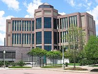 Minnehaha County Courthouse in Sioux Falls, South Dakota
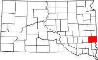
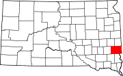
Location in the state of South Dakota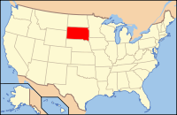
South Dakota's location in the U.S.Founded 1862 Seat Sioux Falls Largest city Sioux Falls Area
- Total
- Land
- Water
814 sq mi (2,107 km²)
810 sq mi (2,097 km²)
4 sq mi (10 km²), 0.49%Population
- (2010)
- Density
169,468
209.2/sq mi (80.8/km²)Time zone Central: UTC-6/-5 Website www.minnehahacounty.org Minnehaha County is a county located in the U.S. state of South Dakota. As of the 2010 census, the population was 169,468, making it the most populous county in South Dakota. Its county seat is Sioux Falls.[1] The county received its name from the Sioux Indian word "Mnihaha", which is often incorrectly translated as "laughing water," but in reality it translates into "rapid water," or "waterfall." The original word was altered to its current spelling, thus making pronunciation easier. Minnehaha County is part of the Sioux Falls, SD, Metropolitan Statistical Area.
Contents
History
In the 1870 census there were 355 people living in the county.
Geography
According to the U.S. Census Bureau, the county has a total area of 814 square miles (2,107 km²), of which 810 square miles (2,097 km²) is land and 4 square miles (10 km²) (0.49%) is water. The Big Sioux River flows through it.
Townships
The county is divided into twenty-four townships: Brandon, Benton, Buffalo, Burk, Clear Lake, Dell Rapids, Edison, Grand Meadow, Hartford, Highland, Humboldt, Logan, Lyons, Mapleton, Palisade, Red Rock, Sioux Falls, Split Rock, Sverdrup, Taopi, Valley Springs, Wall Lake, Wayne, Wellington.
Major Highways
Adjacent Counties
- Moody County, South Dakota - north
- Rock County, Minnesota - east
- Lyon County, Iowa - southeast
- Lincoln County, South Dakota - south
- Turner County, South Dakota - southwest
- McCook County, South Dakota - west
- Lake County, South Dakota - northwest
Lakes
- Beaver Lake
- Buffalo Lake
- Clear Lake
- Covell Lake
- Fenstrman Slough
- Grass Lake
- Loss Lake
- Lost Lake
- Rehfeldt Slough
- Scott Lake
- Wall Lake
Demographics
Historical populations Census Pop. %± 1870 355 — 1880 8,251 2,224.2% 1890 21,879 165.2% 1900 23,926 9.4% 1910 29,631 23.8% 1920 42,490 43.4% 1930 50,872 19.7% 1940 57,697 13.4% 1950 70,910 22.9% 1960 86,575 22.1% 1970 95,209 10.0% 1980 109,435 14.9% 1990 123,809 13.1% 2000 148,281 19.8% 2010 169,468 14.3% U.S. Decennial Census As of the census[2] of 2000, there were 148,281 people, 57,996 households, and 37,581 families residing in the county. The population density was 183 people per square mile (71/km²). There were 60,237 housing units at an average density of 74 per square mile (29/km²). The racial makeup of the county was 93.03% White, 1.51% Black or African American, 1.85% Native American, 1.01% Asian, 0.05% Pacific Islander, 1.04% from other races, and 1.51% from two or more races. 2.15% of the population were Hispanic or Latino of any race.
There were 57,996 households out of which 33.80% had children under the age of 18 living with them, 51.80% were married couples living together, 9.50% had a female householder with no husband present, and 35.20% were non-families. 27.80% of all households were made up of individuals and 8.60% had someone living alone who was 65 years of age or older. The average household size was 2.46 and the average family size was 3.04.
In the county, the population was spread out with 26.20% under the age of 18, 10.80% from 18 to 24, 32.00% from 25 to 44, 20.00% from 45 to 64, and 11.00% who were 65 years of age or older. The median age was 34 years. For every 100 females there were 98.10 males. For every 100 females age 18 and over, there were 95.40 males.
The median income for a household in the county was $42,566, and the median income for a family was $52,031. Males had a median income of $32,208 versus $24,691 for females. The per capita income for the county was $20,713. About 5.00% of families and 7.50% of the population were below the poverty line, including 8.90% of those under age 18 and 7.20% of those age 65 or over.
Cities and towns
- 1. Sioux Falls 153,888[A]
- 2. Brandon 8,785
- 3. Dell Rapids 3,633
- 4. Hartford 2,534
- 5. Crooks 1,269
- 6. Garretson 1,166
- 7. Baltic 1,089
- 8. Valley Springs 759
- 9. Colton 687
- 10. Humboldt 589
- 11. Sherman 78
2010 United States Census population[3]
Other places in Minnehaha County
Historical Townsites
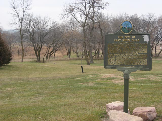
 Sign marking the site of the former town of East Sioux Falls.
- East Sioux Falls
- Eminija
- Huntimer
- South Sioux Falls
- West Sioux Falls
- Wingert
See also
Notes
- A. ^ Sioux Falls is located in both Minnehaha and Lincoln counties.
References
- ^ "Find a County". National Association of Counties. http://www.naco.org/Counties/Pages/FindACounty.aspx. Retrieved 2011-06-07.
- ^ "American FactFinder". United States Census Bureau. http://factfinder.census.gov. Retrieved 2008-01-31.
- ^ "Incorporated Places and Minor Civil Divisions: South Dakota". Population Census. 2010 United States Census. 2011-07-18. http://factfinder2.census.gov/faces/tableservices/jsf/pages/productview.xhtml?pid=DEC_10_PL_GCTPL1.ST13&prodType=table. Retrieved 2011-07-18.
External links

Lake County Moody County McCook County 
Rock County, Minnesota  Minnehaha County, South Dakota

Turner County Lincoln County Lyon County, Iowa Municipalities and communities of Minnehaha County, South Dakota Cities Baltic | Brandon | Colton | Crooks | Dell Rapids | Garretson | Hartford | Sioux Falls‡ | Valley Springs
Towns Unincorporated
communitiesFootnotes ‡This populated place also has portions in an adjacent county or counties
Categories:- South Dakota counties
- Minnehaha County, South Dakota
- 1862 establishments
- Sioux Falls metropolitan area


Wikimedia Foundation. 2010.