- North Eagle Butte, South Dakota
-
North Eagle Butte, South Dakota — CDP — Location in Dewey County and the state of South Dakota
Coordinates: 45°0′23″N 101°13′53″W / 45.00639°N 101.23139°WCoordinates: 45°0′23″N 101°13′53″W / 45.00639°N 101.23139°W Country United States State South Dakota County Dewey Area – Total 12.7 sq mi (33 km2) – Land 12.7 sq mi (32.9 km2) – Water 0 sq mi (0.1 km2) Elevation 2,408 ft (734 m) Population (2010) – Total 1,954 – Density 153.9/sq mi (59.4/km2) Time zone Mountain (MST) (UTC-7) – Summer (DST) MDT (UTC-6) Area code(s) 605 FIPS code 46-45548[1] GNIS feature ID 1259250[2] North Eagle Butte is a census-designated place (CDP) in Dewey County, South Dakota, United States, along the 45th parallel. The population was 1,954 at the 2010 census.
Contents
Geography
North Eagle Butte is located at 45°0′23″N 101°13′53″W / 45.00639°N 101.23139°W (45.006330, -101.231318).[3]
According to the United States Census Bureau, the CDP has a total area of 12.7 square miles (33 km2), of which, 12.7 square miles (33 km2) of it is land and 0.04 square miles (0.10 km2) of it (0.24%) is water.
Demographics
As of the census[1] of 2000, there were 2,163 people, 638 households, and 459 families residing in the CDP. The population density was 170.5 people per square mile (65.8/km²). There were 697 housing units at an average density of 54.9 per square mile (21.2/km²). The racial makeup of the CDP was 6.43% White, 0.09% African American, 92.28% Native American, 0.09% Asian, 0.09% Pacific Islander, 0.18% from other races, and 0.83% from two or more races. Hispanic or Latino of any race were 1.39% of the population.
There were 638 households out of which 45.8% had children under the age of 18 living with them, 27.9% were married couples living together, 31.5% had a female householder with no husband present, and 27.9% were non-families. 23.5% of all households were made up of individuals and 6.6% had someone living alone who was 65 years of age or older. The average household size was 3.24 and the average family size was 3.81.
In the CDP the population was spread out with 41.7% under the age of 18, 10.1% from 18 to 24, 28.7% from 25 to 44, 14.1% from 45 to 64, and 5.4% who were 65 years of age or older. The median age was 24 years. For every 100 females there were 97.4 males. For every 100 females age 18 and over, there were 95.5 males.
The median income for a household in the CDP was $21,701, and the median income for a family was $21,458. Males had a median income of $19,886 versus $20,156 for females. The per capita income for the CDP was $8,175. About 37.5% of families and 39.1% of the population were below the poverty line, including 44.7% of those under age 18 and 51.7% of those age 65 or over.
Education
The Cheyenne-Eagle Butte School school district is headquartered in North Eagle Butte.[4][5]
References
- ^ a b "American FactFinder". United States Census Bureau. http://factfinder.census.gov. Retrieved 2008-01-31.
- ^ "US Board on Geographic Names". United States Geological Survey. 2007-10-25. http://geonames.usgs.gov. Retrieved 2008-01-31.
- ^ "US Gazetteer files: 2010, 2000, and 1990". United States Census Bureau. 2011-02-12. http://www.census.gov/geo/www/gazetteer/gazette.html. Retrieved 2011-04-23.
- ^ "North Eagle butte CDP, South Dakota." U.S. Census Bureau. Retrieved on October 18, 2009.
- ^ Home page. Cheyenne-Eagle Butte School. Retrieved on October 18, 2009.
Municipalities and communities of Dewey County, South Dakota Cities 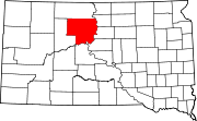
Town CDPs Green Grass | La Plant | North Eagle Butte | Whitehorse
Unincorporated
communitiesIndian reservations Footnotes ‡This populated place also has portions in an adjacent county or counties
Categories:- Populated places in Dewey County, South Dakota
- Census-designated places in South Dakota
- Populated places in South Dakota with Native American majority populations


Wikimedia Foundation. 2010.