- Eagle Butte, South Dakota
Infobox Settlement
official_name = Eagle Butte, South Dakota
other_name =
native_name =
nickname =
settlement_type =City
motto =
imagesize =
image_caption =
flag_size =
image_
seal_size =
image_shield =
shield_size =
image_blank_emblem =
blank_emblem_type =
blank_emblem_size =
imagesize =
image_caption =
flag_size =
image_
seal_size =
image_shield =
shield_size =
image_blank_emblem =
blank_emblem_type =
blank_emblem_size =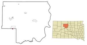
mapsize = 250px
map_caption = Location in Dewey County and the state ofSouth Dakota
mapsize1 =
map_caption1 =
image_dot_
dot_mapsize =
dot_map_caption =
dot_x =
dot_y =
pushpin_
pushpin_label_position =
pushpin_map_caption =
pushpin_mapsize =
subdivision_type = Country
subdivision_name =United States
subdivision_type1 = State
subdivision_name1 =South Dakota
subdivision_type2 = Counties
subdivision_name2 = Dewey, Ziebach
subdivision_type3 =
subdivision_name3 =
subdivision_type4 =
subdivision_name4 =
government_footnotes =
government_type =
leader_title =
leader_name =
leader_title1 =
leader_name1 =
leader_title2 =
leader_name2 =
leader_title3 =
leader_name3 =
leader_title4 =
leader_name4 =
established_title =
established_date =
established_title2 =
established_date2 =
established_title3 =
established_date3 =
area_magnitude =
unit_pref = Imperial
area_footnotes =
area_total_km2 = 2.4
area_land_km2 = 2.4
area_water_km2 = 0
area_total_sq_mi = 0.9
area_land_sq_mi = 0.9
area_water_sq_mi = 0
area_water_percent =
area_urban_km2 =
area_urban_sq_mi =
area_metro_km2 =
area_metro_sq_mi =
area_blank1_title =
area_blank1_km2 =
area_blank1_sq_mi =
population_as_of = 2000
population_footnotes =
population_note =
population_total = 619
population_density_km2 = 257.9
population_density_sq_mi = 687.8
population_metro =
population_density_metro_km2 =
population_density_metro_sq_mi =
population_urban =
population_density_urban_km2 =
population_density_urban_sq_mi =
population_blank1_title =
population_blank1 =
population_density_blank1_km2 =
population_density_blank1_sq_mi =
timezone = Mountain (MST)
utc_offset = -7
timezone_DST = MDT
utc_offset_DST = -6
latd = 44 |latm = 59 |lats = 47 |latNS = N
longd = 101 |longm = 14 |longs = 9 |longEW = W
elevation_footnotes =
elevation_m = 737
elevation_ft = 2418
postal_code_type =ZIP code
postal_code = 57625
area_code = 605
blank_name = FIPS code
blank_info = 46-17620GR|2
blank1_name = GNIS feature ID
blank1_info = 1267668GR|3
website =
footnotes =Eagle Butte is a city in Dewey and Ziebach counties in the
U.S. state ofSouth Dakota . The population was 619 at the 2000 census.Geography
Eagle Butte is located at coor dms|44|59|47|N|101|14|9|W|city (44.996502, -101.235875)GR|1.
According to the
United States Census Bureau , the city has a total area of 0.9square mile s (2.4km² ), all land.Eagle Butte has been assigned the
ZIP code 57625 and theFIPS place code 17620.Demographics
As of the
census GR|2 of 2000, there were 619 people, 227 households, and 140 families residing in the city. Thepopulation density was 675.4 people per square mile (259.8/km²). There were 262 housing units at an average density of 285.9/sq mi (110.0/km²). The racial makeup of the city was 18.26% White, 80.29% Native American, and 1.45% from two or more races. Hispanic or Latino of any race were 1.29% of the population.There were 227 households out of which 43.2% had children under the age of 18 living with them, 29.1% were married couples living together, 26.9% had a female householder with no husband present, and 37.9% were non-families. 33.5% of all households were made up of individuals and 12.3% had someone living alone who was 65 years of age or older. The average household size was 2.72 and the average family size was 3.49.
In the city the population was spread out with 38.8% under the age of 18, 12.8% from 18 to 24, 25.8% from 25 to 44, 14.1% from 45 to 64, and 8.6% who were 65 years of age or older. The median age was 24 years. For every 100 females there were 93.4 males. For every 100 females age 18 and over, there were 77.1 males.
The median income for a household in the city was $18,611, and the median income for a family was $20,313. Males had a median income of $23,125 versus $24,167 for females. The
per capita income for the city was $9,192. About 41.6% of families and 47.9% of the population were below thepoverty line , including 58.9% of those under age 18 and 21.6% of those age 65 or over.Notable Residents
*Birthplace of
Norm Van Brocklin . APro Football Hall of Fame player and coach.*Birthplace of writer
Joshua Prager .References
External links
Wikimedia Foundation. 2010.