- Gettysburg, South Dakota
Infobox Settlement
official_name = Gettysburg, South Dakota
other_name =
native_name =
nickname =
settlement_type =City
motto =
imagesize =
image_caption =
flag_size =
image_
seal_size =
image_shield =
shield_size =
image_blank_emblem =
blank_emblem_type =
blank_emblem_size =
imagesize =
image_caption =
flag_size =
image_
seal_size =
image_shield =
shield_size =
image_blank_emblem =
blank_emblem_type =
blank_emblem_size =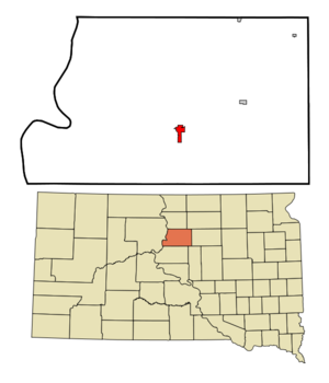
mapsize = 250x200px
map_caption = Location in Potter County and the state ofSouth Dakota
mapsize1 =
map_caption1 =
image_dot_
dot_mapsize =
dot_map_caption =
dot_x =
dot_y =
pushpin_
pushpin_label_position =
pushpin_map_caption =
pushpin_mapsize =
subdivision_type = Country
subdivision_name =United States
subdivision_type1 = State
subdivision_name1 =South Dakota
subdivision_type2 = County
subdivision_name2 = Potter
subdivision_type3 =
subdivision_name3 =
subdivision_type4 =
subdivision_name4 =
government_footnotes =
government_type =
leader_title =
leader_name =
leader_title1 =
leader_name1 =
leader_title2 =
leader_name2 =
leader_title3 =
leader_name3 =
leader_title4 =
leader_name4 =
established_title =
established_date =
established_title2 =
established_date2 =
established_title3 =
established_date3 =
area_magnitude =
unit_pref = Imperial
area_footnotes =
area_total_km2 = 4.8
area_land_km2 = 4.8
area_water_km2 = 0
area_total_sq_mi = 1.9
area_land_sq_mi = 1.9
area_water_sq_mi = 0
area_water_percent =
area_urban_km2 =
area_urban_sq_mi =
area_metro_km2 =
area_metro_sq_mi =
area_blank1_title =
area_blank1_km2 =
area_blank1_sq_mi =
population_as_of = 2000
population_footnotes =
population_note =
population_total = 1352
population_density_km2 = 281.7
population_density_sq_mi = 711.6
population_metro =
population_density_metro_km2 =
population_density_metro_sq_mi =
population_urban =
population_density_urban_km2 =
population_density_urban_sq_mi =
population_blank1_title =
population_blank1 =
population_density_blank1_km2 =
population_density_blank1_sq_mi =
timezone = Central (CST)
utc_offset = -6
timezone_DST = CDT
utc_offset_DST = -5
latd = 45 |latm = 0 |lats = 43 |latNS = N
longd = 99 |longm = 57 |longs = 19 |longEW = W
elevation_footnotes =
elevation_m = 629
elevation_ft = 2064
postal_code_type =ZIP code
postal_code = 57442
area_code = 605
blank_name = FIPS code
blank_info = 46-24260GR|2
blank1_name = GNIS feature ID
blank1_info = 1255235GR|3
website =
footnotes =Gettysburg is a city in Potter County,
South Dakota ,United States . The population was 1,352 at the 2000 census. It is thecounty seat of Potter CountyGR|6. Gettysburg area historical tornado activity is 42% less than the overall U.S. average.Geography
Gettysburg is located at coor dms|45|0|43|N|99|57|19|W|city (45.011819, -99.955386)GR|1.
According to the
United States Census Bureau , the city has a total area of 1.9square mile s (4.8km² ), all of it land.Gettysburg has been assigned the
ZIP code 57442 and theFIPS place code 24260.Demographics
As of the
census GR|2 of 2000, there were 1,352 people, 588 households, and 365 families residing in the city. Thepopulation density was 725.1 people per square mile (280.7/km²). There were 683 housing units at an average density of 366.3/sq mi (141.8/km²). The racial makeup of the city was 97.93% White, 1.26% Native American, 0.07% Asian, and 0.74% from two or more races. Hispanic or Latino of any race were 0.15% of the population.There were 588 households out of which 26.9% had children under the age of 18 living with them, 52.9% were married couples living together, 6.0% had a female householder with no husband present, and 37.9% were non-families. 36.4% of all households were made up of individuals and 20.6% had someone living alone who was 65 years of age or older. The average household size was 2.21 and the average family size was 2.88.
In the city the population was spread out with 23.9% under the age of 18, 4.0% from 18 to 24, 21.8% from 25 to 44, 24.3% from 45 to 64, and 26.0% who were 65 years of age or older. The median age was 45 years. For every 100 females there were 92.0 males. For every 100 females age 18 and over, there were 87.8 males.
The median income for a household in the city was $30,469, and the median income for a family was $37,763. Males had a median income of $26,316 versus $16,979 for females. The
per capita income for the city was $16,516. About 7.9% of families and 10.7% of the population were below thepoverty line , including 14.4% of those under age 18 and 11.3% of those age 65 or over.History
Gettysburg was the eastern terminus of the short-lived
Forest City and Gettysburg Railroad .Gettysburg is the nearest town to the submerged town of Forest City. When the
Oahe Dam was built Forest City was flooded. Forest City had a school run by theBureau of Indian Affairs (BIA). To offset the loss of that school Gettysburg was offered federal funds for a new water source (the existing well source had many problems) and other needs. To obtain these funds Gettysburg would have had to accept the BIA school. Gettysburg did not accept the funds or the school.Gettysburg's sister city is Gettysburg, Pennsylvania.
References
External links
Wikimedia Foundation. 2010.