- Clark, South Dakota
-
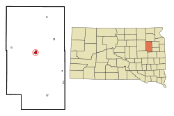
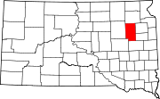
Clark, South Dakota — City — Location in Clark County and the state of South Dakota Coordinates: 44°52′46″N 97°44′3″W / 44.87944°N 97.73417°WCoordinates: 44°52′46″N 97°44′3″W / 44.87944°N 97.73417°W Country United States State South Dakota County Clark Incorporated 1886[1] Area – Total 1.3 sq mi (3.4 km2) – Land 1.3 sq mi (3.4 km2) – Water 0 sq mi (0 km2) Elevation 1,798 ft (548 m) Population (2010) – Total 1,139 – Density 876.1/sq mi (335/km2) Time zone Central (CST) (UTC-6) – Summer (DST) CDT (UTC-5) ZIP code 57225 Area code(s) 605 FIPS code 46-12180[2] GNIS feature ID 1265158[3] Clark is a city in Clark County, South Dakota, United States. The population was 1,139 at the 2010 census. It is the county seat of Clark County.[4]
Contents
Geography
Clark is located at 44°52′46″N 97°44′3″W / 44.87944°N 97.73417°W (44.879459, -97.734182).[5]
According to the United States Census Bureau, the city has a total area of 1.3 square miles (3.4 km2), all of it land.
Clark has been assigned the ZIP code 57225 and the FIPS place code 12180.
Dakota Style potato chips are produced on a farm near Clark.
History
South Dakota's oldest hardware store, Dekker Hardware (formally known as Desnoyers hardware until June 2010) is located on Commercial Street in Clark. The business was founded in 1894 by Henri Desnoyers. It is also Clark's oldest business.[citation needed]
Demographics
As of the census[2] of 2000, there were 1,285 people, 558 households, and 334 families residing in the city. The population density was 979.3 people per square mile (378.7/km²). There were 632 housing units at an average density of 481.6 per square mile (186.3/km²). The racial makeup of the city was 98.68% White, 0.23% African American, 0.39% Native American, 0.31% Asian, 0.08% from other races, and 0.31% from two or more races. Hispanic or Latino of any race were 0.31% of the population.
There were 558 households out of which 24.0% had children under the age of 18 living with them, 50.7% were married couples living together, 6.6% had a female householder with no husband present, and 40.1% were non-families. 37.5% of all households were made up of individuals and 24.2% had someone living alone who was 65 years of age or older. The average household size was 2.19 and the average family size was 2.90.
In the city the population was spread out with 22.8% under the age of 18, 4.4% from 18 to 24, 19.9% from 25 to 44, 23.1% from 45 to 64, and 29.7% who were 65 years of age or older. The median age was 47 years. For every 100 females there were 84.1 males. For every 100 females age 18 and over, there were 80.4 males.
The median income for a household in the city was $29,432, and the median income for a family was $39,167. Males had a median income of $26,771 versus $17,868 for females. The per capita income for the city was $14,758. About 6.3% of families and 9.1% of the population were below the poverty line, including 7.0% of those under age 18 and 18.8% of those age 65 or over.
Notable natives
- Samuel H. Elrod the fifth Governor of South Dakota.
- Urban Odson, NFL player for the Green Bay Packers.
References
- ^ "SD Towns". South Dakota State Historical Society. http://history.sd.gov/Archives/forms/exhibits/SD%20Towns.pdf. Retrieved 2010-02-11.
- ^ a b "American FactFinder". United States Census Bureau. http://factfinder.census.gov. Retrieved 2008-01-31.
- ^ "US Board on Geographic Names". United States Geological Survey. 2007-10-25. http://geonames.usgs.gov. Retrieved 2008-01-31.
- ^ "Find a County". National Association of Counties. http://www.naco.org/Counties/Pages/FindACounty.aspx. Retrieved 2011-06-07.
- ^ "US Gazetteer files: 2010, 2000, and 1990". United States Census Bureau. 2011-02-12. http://www.census.gov/geo/www/gazetteer/gazette.html. Retrieved 2011-04-23.
Municipalities and communities of Clark County, South Dakota County seat: ClarkCities Clark | Willow Lake
Towns Bradley | Garden City | Naples | Raymond | Vienna
Unincorporated
communityCategories:- Cities in South Dakota
- Populated places in Clark County, South Dakota
- County seats in South Dakota
Wikimedia Foundation. 2010.


