- Redfield, South Dakota
Infobox Settlement
official_name = Redfield, South Dakota
other_name =
native_name =
nickname =
settlement_type =City
motto =
imagesize =
image_caption =
flag_size =
image_
seal_size =
image_shield =
shield_size =
image_blank_emblem =
blank_emblem_type =
blank_emblem_size =
imagesize =
image_caption =
flag_size =
image_
seal_size =
image_shield =
shield_size =
image_blank_emblem =
blank_emblem_type =
blank_emblem_size =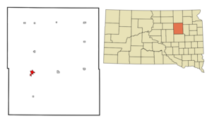
mapsize = 250px
map_caption = Location in Spink County and the state ofSouth Dakota
mapsize1 =
map_caption1 =
image_dot_
dot_mapsize =
dot_map_caption =
dot_x =
dot_y =
pushpin_
pushpin_label_position =
pushpin_map_caption =
pushpin_mapsize =
subdivision_type = Country
subdivision_name =United States
subdivision_type1 = State
subdivision_name1 =South Dakota
subdivision_type2 = County
subdivision_name2 = Spink
subdivision_type3 =
subdivision_name3 =
subdivision_type4 =
subdivision_name4 =
government_footnotes =
government_type =
leader_title =
leader_name =
leader_title1 =
leader_name1 =
leader_title2 =
leader_name2 =
leader_title3 =
leader_name3 =
leader_title4 =
leader_name4 =
established_title =
established_date =
established_title2 =
established_date2 =
established_title3 =
established_date3 =
area_magnitude =
unit_pref = Imperial
area_footnotes =
area_total_km2 = 4.6
area_land_km2 = 4.5
area_water_km2 = 0.1
area_total_sq_mi = 1.7
area_land_sq_mi = 1.7
area_water_sq_mi = 0
area_water_percent =
area_urban_km2 =
area_urban_sq_mi =
area_metro_km2 =
area_metro_sq_mi =
area_blank1_title =
area_blank1_km2 =
area_blank1_sq_mi =
population_as_of = 2000
population_footnotes =
population_note =
population_total = 2897
population_density_km2 = 629.8
population_density_sq_mi = 1704.1
population_metro =
population_density_metro_km2 =
population_density_metro_sq_mi =
population_urban =
population_density_urban_km2 =
population_density_urban_sq_mi =
population_blank1_title =
population_blank1 =
population_density_blank1_km2 =
population_density_blank1_sq_mi =
timezone = Central (CST)
utc_offset = -6
timezone_DST = CDT
utc_offset_DST = -5
latd = 44 |latm = 52 |lats = 31 |latNS = N
longd = 98 |longm = 31 |longs = 4 |longEW = W
elevation_footnotes =
elevation_m = 397
elevation_ft = 1302
postal_code_type =ZIP code
postal_code = 57469
area_code = 605
blank_name = FIPS code
blank_info = 46-53460GR|2
blank1_name = GNIS feature ID
blank1_info = 1265687GR|3
website =
footnotes =Redfield is a city in and the
county seat of Spink County,South Dakota ,United States .GR|6 The population was 2,897 at the 2000 census. Redfield proclaims itself as thepheasant capital of the world. [cite web |url=http://www.roadsideamerica.com/tip/6879 |title=Redfield, South Dakota - Pheasant Statue at Pheasant Capital of the World |accessdate=2008-09-19 |last=Forrider |first=Nathan |date=October 6, 2002 |work=RoadsideAmerica.com |publisher=]Geography
Redfield is located at coor dms|44|52|31|N|98|31|4|W|city (44.875145, -98.517850)GR|1.
According to the
United States Census Bureau , the city has a total area of 1.8square mile s (4.6km² ), of which, 1.7 square miles (4.5 km²) of it is land and 0.04 square miles (0.1 km²) of it (1.70%) is water.Redfield has been assigned the
ZIP code 57469 and theFIPS place code 53460.History
The first settlers arrived in the Redfield area in 1878, and a post office was established two years later under the name "Stennett Junction." The "Redfield" name was adopted in 1881. The town became the seat of Spink County in 1886, following a six year legal and political battle among several Spink County towns. Redfield rapidly became a major town in the region, due in part to its status as a railroad center -- the town was a crossroads of two lines of the
Chicago and North Western Railway , and was also served by the Milwaukee Road Railroad. Railroads brought supplies, people, and animals, and also provided for transportation of crops back East.Redfield College was established in the town in 1887, and operated until 1932. In 1902 the "Northern Hospital for the Insane," a state institution, opened on a campus just north of town. The famous outlaw Robert LeRoy Parker (aka Butch Cassidy) was briefly interred at this facility. That facility remains in operation today as the
South Dakota Developmental Center .Demographics
As of the
census GR|2 of 2000, there were 2,897 people, 1,123 households, and 656 families residing in the city. Thepopulation density was 1,670.3 people per square mile (646.6/km²). There were 1,261 housing units at an average density of 727.1/sq mi (281.4/km²). The racial makeup of the city was 95.37% White, 0.41% African American, 3.00% Native American, 0.10% Asian, 0.03% Pacific Islander, 0.21% from other races, and 0.86% from two or more races. Hispanic or Latino of any race were 0.66% of the population.There were 1,123 households out of which 26.2% had children under the age of 18 living with them, 46.9% were married couples living together, 8.6% had a female householder with no husband present, and 41.5% were non-families. 38.6% of all households were made up of individuals and 23.2% had someone living alone who was 65 years of age or older. The average household size was 2.15 and the average family size was 2.87.
In the city the population was spread out with 21.3% under the age of 18, 7.8% from 18 to 24, 27.2% from 25 to 44, 20.0% from 45 to 64, and 23.7% who were 65 years of age or older. The median age was 41 years. For every 100 females there were 106.8 males. For every 100 females age 18 and over, there were 104.2 males.
The median income for a household in the city was $27,743, and the median income for a family was $37,500. Males had a median income of $27,566 versus $20,938 for females. The
per capita income for the city was $15,505. About 9.6% of families and 10.5% of the population were below thepoverty line , including 9.9% of those under age 18 and 11.8% of those age 65 or over.Noted natives
*
Hallie Flanagan -Director of theFederal Theatre Project .
*Conde McCullough -Bridge engineer.References
External links
Wikimedia Foundation. 2010.