- Doland, South Dakota
-
Doland, South Dakota — City — Motto: Home of Heroes Location in Spink County and the state of South Dakota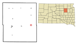
Coordinates: 44°53′39″N 98°6′3″W / 44.89417°N 98.10083°WCoordinates: 44°53′39″N 98°6′3″W / 44.89417°N 98.10083°W Country United States State South Dakota County Spink Incorporated 1909[1] Government – Mayor David Bucholz Area – Total 0.6 sq mi (1.5 km2) – Land 0.6 sq mi (1.5 km2) – Water 0 sq mi (0 km2) Elevation 1,352 ft (412 m) Population (2010) – Total 180 – Density 300/sq mi (120/km2) Time zone Central (CST) (UTC-6) – Summer (DST) CDT (UTC-5) ZIP code 57436 Area code(s) 605 FIPS code 46-16820[2] GNIS feature ID 1254722[3] Doland is a city in Spink County, South Dakota, United States. The population was 180 at the 2010 census.
Contents
Notable people
- Doland was the hometown of Hubert Humphrey, who served as a U.S. Senator from Minnesota from 1949 to 1965 and 1971 to 1978. From 1965 to 1969 Humphrey was the Vice-President of the United States. In 1968 he was the Democratic Party's candidate for President; he lost narrowly to Republican Richard Nixon. Humphrey's father ran a pharmacy in Doland from 1915 to 1929, and served as the town's mayor for several years.
- Tim Miles, basketball coach
- Jon Madsen, a ufc fighter who went 4-1 in the ufc
Geography
Doland is located at 44°53′39″N 98°6′3″W / 44.89417°N 98.10083°W (44.894083, -98.100817).[4]
According to the United States Census Bureau, the city has a total area of 0.6 square miles (1.6 km2), all of it land.
Doland has been assigned the ZIP code 57436 and the FIPS place code 16820.
Demographics
As of the census[2] of 2000, there were 297 people, 120 households, and 75 families residing in the city. The population density was 504.0 people per square mile (194.4/km²). There were 159 housing units at an average density of 269.8 per square mile (104.1/km²). The racial makeup of the city was 96.97% White, 0.67% African American, 1.35% Native American, 0.34% from other races, and 0.67% from two or more races. Hispanic or Latino of any race were 0.67% of the population.
There were 120 households out of which 33.3% had children under the age of 18 living with them, 55.0% were married couples living together, 5.0% had a female householder with no husband present, and 36.7% were non-families. 34.2% of all households were made up of individuals and 19.2% had someone living alone who was 65 years of age or older. The average household size was 2.48 and the average family size was 3.22.
In the city the population was spread out with 30.3% under the age of 18, 5.7% from 18 to 24, 29.0% from 25 to 44, 20.2% from 45 to 64, and 14.8% who were 65 years of age or older. The median age was 37 years. For every 100 females there were 95.4 males. For every 100 females age 18 and over, there were 97.1 males.
The median income for a household in the city was $30,313, and the median income for a family was $35,625. Males had a median income of $24,375 versus $20,357 for females. The per capita income for the city was $17,437. About 20.3% of families and 19.9% of the population were below the poverty line, including 28.4% of those under the age of eighteen and 14.3% of those sixty five or over.
References
- ^ "SD Towns". South Dakota State Historical Society. http://history.sd.gov/Archives/forms/exhibits/SD%20Towns.pdf. Retrieved 2010-02-11.
- ^ a b "American FactFinder". United States Census Bureau. http://factfinder.census.gov. Retrieved 2008-01-31.
- ^ "US Board on Geographic Names". United States Geological Survey. 2007-10-25. http://geonames.usgs.gov. Retrieved 2008-01-31.
- ^ "US Gazetteer files: 2010, 2000, and 1990". United States Census Bureau. 2011-02-12. http://www.census.gov/geo/www/gazetteer/gazette.html. Retrieved 2011-04-23.
Municipalities and communities of Spink County, South Dakota Cities 
Towns Brentford | Northville | Tulare | Turton
Townships Antelope | Athol | Belle Plaine | Belmont | Benton | Beotia | Buffalo | Capitola | Clifton | Conde | Cornwall | Crandon | Exline | Frankfort | Garfield | Great Bend | Groveland | Harmony | Harrison | Jefferson | Lake | La Prairie | Lincoln | Lodi | Mellette | Northville | Olean | Prairie Center | Redfield | Richfield | Spring | Summer | Tetonka | Three Rivers | Tulare | Turton | Union
Categories:- Cities in South Dakota
- Populated places in Spink County, South Dakota


Wikimedia Foundation. 2010.