- National Register of Historic Places listings in Spink County, South Dakota
-
 Location of Spink County in South Dakota
This is a list of the National Register of Historic Places listings in Spink County, South Dakota.
This is intended to be a complete list of the properties and districts on the National Register of Historic Places in Spink County, South Dakota, United States. The locations of National Register properties and districts for which the latitude and longitude coordinates are included below, may be seen in a Google map.[1]
There are 25 properties and districts listed on the National Register in the county. Two previously listed sites have been removed.
-
- This National Park Service list is complete through NPS recent listings posted November 10, 2011.[2]
Current listings
[3] Landmark name [4] Image Date listed Location City or town Summary 1 William F. Bruell House October 12, 2000 Address Restricted Redfield 2 Chicago and Northwestern Depot November 21, 1980 U.S. Route 212
44°52′30″N 98°31′19″W / 44.875°N 98.521944°WRedfield 3 First Congregational Church September 14, 1979 Oak and 2nd Sts.
45°03′01″N 98°05′46″W / 45.050278°N 98.096111°WTurton 4 Harlow Farmstead February 26, 1982 Southwest of Turton
44°57′20″N 98°13′40″W / 44.955556°N 98.227778°WFrankfort 5 Markham Farmstead September 13, 1990 Junction of County Roads 4 and 7
45°12′01″N 98°12′30″W / 45.200278°N 98.208333°WConde 6 Old Spink Colony June 30, 1982 On the James River
44°44′49″N 98°17′35″W / 44.746944°N 98.293056°WFrankfort 7 Edbert and Josie Opitz House December 2, 1998 204 E. 2nd St.
44°52′50″N 98°30′54″W / 44.880556°N 98.515°WRedfield 8 Redfield Carnegie Library February 17, 1978 5 E. 5th Ave.
44°52′34″N 98°31′19″W / 44.876111°N 98.521944°WRedfield 9 Old Redfield City Hall February 21, 1997 517 N. Main St.
44°52′07″N 98°30′32″W / 44.868611°N 98.508889°WRedfield 10 Redfield Light Plant and Fire Station March 21, 1978 614 1st St., E.
44°52′35″N 98°31′01″W / 44.876389°N 98.516944°WRedfield 11 Salem Church September 3, 1997 208 Ohio St.
44°44′13″N 98°30′27″W / 44.736944°N 98.5075°WTulare 12 Site 39SP2 February 1, 1984 Address Restricted Frankfort 13 Site 39SP4 June 8, 2005 Address Restricted Tulare 14 Site 39SP12 February 1, 1984 Address Restricted Ashton 15 Site 39SP19 February 1, 1984 Address Restricted Spink Colony 16 Site 39SP37 February 1, 1984 Address Restricted Crandon 17 Site 39SP46 February 1, 1984 Address Restricted Crandon 18 South Dakota Dept. of Transportation Bridge No. 58-010-376 December 9, 1993 Local road over Wolf Creek
44°41′54″N 98°41′11″W / 44.698333°N 98.686389°WTulare 19 South Dakota Dept. of Transportation Bridge No. 58-021-400 December 9, 1993 Local road over Turtle Creek
44°39′46″N 98°39′51″W / 44.662778°N 98.664167°WTulare 20 South Dakota Dept. of Transportation Bridge No. 58-025-370 December 9, 1993 Local road over Turtle Creek
44°42′24″N 98°39′19″W / 44.706667°N 98.655278°WTulare 21 South Dakota Dept. of Transportation Bridge No. 58-062-270 December 9, 1993 Local road over Turtle Creek
44°51′02″N 98°34′54″W / 44.850556°N 98.581667°WRedfield 22 South Dakota Dept. of Transportation Bridge No. 58-120-231 December 9, 1993 Local road over the James River
45°57′19″N 98°28′16″W / 45.955278°N 98.471111°WRedfield 23 South Dakota Dept. of Transportation Bridge No. 58-140-224 December 9, 1993 Local road over the James River
45°53′14″N 98°25′27″W / 45.887222°N 98.424167°WRedfield 24 South Dakota Dept. of Transportation Bridge No. 58-218-360 December 9, 1993 Local road over the James River
44°43′11″N 98°15′59″W / 44.719722°N 98.266389°WFrankfort 25 Spink County Courthouse November 8, 2001 210 E. 7th Ave.
44°52′31″N 98°30′51″W / 44.875278°N 98.514167°WRedfield Formerly listed
[3] Landmark name Image Date listed Location City or town Summary 1 Ashton Methodist Church July 17, 2009[5] Northeastern corner of 2nd Ave. and 2nd St.
44°59′39″N 98°29′55″W / 44.99417°N 98.49861°WAshton Added on June 17, 1982.[4] 2 Hall Bridge March 16, 2008[6] Local road over Snake Creek Ashton Added on December 9, 1993.[4] See also
- List of National Historic Landmarks in South Dakota
- National Register of Historic Places listings in South Dakota
References
- ^ The latitude and longitude information provided in this table was derived originally from the National Register Information System, which has been found to be fairly accurate for about 99% of listings. For about 1% of NRIS original coordinates, experience has shown that one or both coordinates are typos or otherwise extremely far off; some corrections may have been made. A more subtle problem causes many locations to be off by up to 150 yards, depending on location in the country: most NRIS coordinates were derived from tracing out latitude and longitudes off of USGS topographical quadrant maps created under North American Datum of 1927, which differs from the current, highly accurate GPS system used by Google maps. Chicago is about right, but NRIS longitudes in Washington are higher by about 4.5 seconds, and are lower by about 2.0 seconds in Maine. Latitudes differ by about 1.0 second in Florida. Some locations in this table may have been corrected to current GPS standards.
- ^ "National Register of Historic Places: Weekly List Actions". National Park Service, United States Department of the Interior. Retrieved on November 10, 2011.
- ^ a b Numbers represent an ordering by significant words. Various colorings, defined here, differentiate National Historic Landmark sites and National Register of Historic Places Districts from other NRHP buildings, structures, sites or objects.
- ^ a b c "National Register Information System". National Register of Historic Places. National Park Service. . http://nrhp.focus.nps.gov/natreg/docs/All_Data.html.
- ^ "Weekly List". National Park Service. July 24, 2009. http://www.nps.gov/history/nr/listings/20090724.HTM. Retrieved July 25, 2009.
- ^ "Weekly List". National Park Service. April 4, 2008. http://www.nps.gov/history/nr/listings/20080404.HTM. Retrieved July 25, 2009.
U.S. National Register of Historic Places Topics Lists by states Alabama • Alaska • Arizona • Arkansas • California • Colorado • Connecticut • Delaware • Florida • Georgia • Hawaii • Idaho • Illinois • Indiana • Iowa • Kansas • Kentucky • Louisiana • Maine • Maryland • Massachusetts • Michigan • Minnesota • Mississippi • Missouri • Montana • Nebraska • Nevada • New Hampshire • New Jersey • New Mexico • New York • North Carolina • North Dakota • Ohio • Oklahoma • Oregon • Pennsylvania • Rhode Island • South Carolina • South Dakota • Tennessee • Texas • Utah • Vermont • Virginia • Washington • West Virginia • Wisconsin • WyomingLists by territories Lists by associated states Other  Category:National Register of Historic Places •
  Portal:National Register of Historic Places
Municipalities and communities of Spink County, South Dakota County seat: Redfield Cities 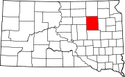
Towns Brentford | Northville | Tulare | Turton
Townships Antelope | Athol | Belle Plaine | Belmont | Benton | Beotia | Buffalo | Capitola | Clifton | Conde | Cornwall | Crandon | Exline | Frankfort | Garfield | Great Bend | Groveland | Harmony | Harrison | Jefferson | Lake | La Prairie | Lincoln | Lodi | Mellette | Northville | Olean | Prairie Center | Redfield | Richfield | Spring | Summer | Tetonka | Three Rivers | Tulare | Turton | Union
Categories:- Spink County, South Dakota
- National Register of Historic Places in South Dakota by county
- Buildings and structures in Spink County, South Dakota
-

Wikimedia Foundation. 2010.