- Sisseton, South Dakota
Infobox Settlement
official_name = Sisseton, South Dakota
other_name =
native_name =
nickname =
settlement_type =City
motto =
imagesize = 250px
image_caption =
flag_size =
image_
seal_size =
image_shield =
shield_size =
image_blank_emblem =
blank_emblem_type =
blank_emblem_size =
flag_size =
image_
seal_size =
image_shield =
shield_size =
image_blank_emblem =
blank_emblem_type =
blank_emblem_size =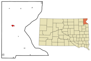
mapsize = 250px
map_caption = Location in Roberts County and the state ofSouth Dakota
mapsize1 =
map_caption1 =
image_dot_
dot_mapsize =
dot_map_caption =
dot_x =
dot_y =
pushpin_
pushpin_label_position =
pushpin_map_caption =
pushpin_mapsize =
subdivision_type = Country
subdivision_name =United States
subdivision_type1 = State
subdivision_name1 =South Dakota
subdivision_type2 = County
subdivision_name2 = Roberts
subdivision_type3 =
subdivision_name3 =
subdivision_type4 =
subdivision_name4 =
government_footnotes =
government_type =
leader_title =
leader_name =
leader_title1 =
leader_name1 =
leader_title2 =
leader_name2 =
leader_title3 =
leader_name3 =
leader_title4 =
leader_name4 =
established_title =
established_date =
established_title2 =
established_date2 =
established_title3 =
established_date3 =
area_magnitude =
unit_pref = Imperial
area_footnotes =
area_total_km2 = 4.1
area_land_km2 = 4.1
area_water_km2 = 0
area_total_sq_mi = 1.6
area_land_sq_mi = 1.6
area_water_sq_mi = 0
area_water_percent =
area_urban_km2 =
area_urban_sq_mi =
area_metro_km2 =
area_metro_sq_mi =
area_blank1_title =
area_blank1_km2 =
area_blank1_sq_mi =
population_as_of = 2000
population_footnotes =
population_note =
population_total = 2572
population_density_km2 = 627.3
population_density_sq_mi = 1607.5
population_metro =
population_density_metro_km2 =
population_density_metro_sq_mi =
population_urban =
population_density_urban_km2 =
population_density_urban_sq_mi =
population_blank1_title =
population_blank1 =
population_density_blank1_km2 =
population_density_blank1_sq_mi =
timezone = Central (CST)
utc_offset = -6
timezone_DST = CDT
utc_offset_DST = -5
latd = 45 |latm = 39 |lats = 48 |latNS = N
longd = 97 |longm = 2 |longs = 57 |longEW = W
elevation_footnotes =
elevation_m = 373
elevation_ft = 1224
postal_code_type =ZIP code
postal_code = 57262
area_code = 605
blank_name = FIPS code
blank_info = 46-59260GR|2
blank1_name = GNIS feature ID
blank1_info = 1258093GR|3
website =
footnotes =Sisseton is a city on the
Lake Traverse Indian Reservation in Roberts County,South Dakota ,United States . The population was 2,572 at the 2000 census. It is thecounty seat of Roberts CountyGR|6. Sisseton is home to a number of attractions including the Nicollett Tower and the "Song to the Great Spirit" Building on the campus ofSisseton Wahpeton College . Named after the Sisseton (orSissetowan ) division of the Sioux the city is located a few miles north of the tribal seat of theSisseton-Wahpeton Sioux Tribe at Old Agency, South Dakota.Geography
Sisseton is located at coor dms|45|39|48|N|97|2|57|W|city (45.663259, -97.049040)GR|1.
According to the
United States Census Bureau , the city has a total area of 1.6square mile s (4.1km² ), all of it land.Sisseton has been assigned the
ZIP code 57262 and theFIPS place code 59260.Demographics
As of the
census GR|2 of 2000, there were 2,572 people, 1,003 households, and 631 families residing in the city. Thepopulation density was 1,636.7 people per square mile (632.5/km²). There were 1,093 housing units at an average density of 695.5/sq mi (268.8/km²). The racial makeup of the city was 56.07% White, 0.12% African American, 40.86% Native American, 0.27% Asian, 0.04% from other races, and 2.64% from two or more races. Hispanic or Latino of any race were 1.09% of the population.There were 1,003 households out of which 31.9% had children under the age of 18 living with them, 38.9% were married couples living together, 16.9% had a female householder with no husband present, and 37.0% were non-families. 34.6% of all households were made up of individuals and 16.2% had someone living alone who was 65 years of age or older. The average household size was 2.46 and the average family size was 3.12.
In the city the population was spread out with 29.3% under the age of 18, 8.2% from 18 to 24, 23.3% from 25 to 44, 20.8% from 45 to 64, and 18.4% who were 65 years of age or older. The median age was 36 years. For every 100 females there were 88.8 males. For every 100 females age 18 and over, there were 86.2 males.
The median income for a household in the city was $26,698, and the median income for a family was $33,977. Males had a median income of $27,393 versus $20,586 for females. The
per capita income for the city was $14,019. About 14.9% of families and 18.4% of the population were below thepoverty line , including 23.6% of those under age 18 and 16.4% of those age 65 or over.Notable natives
*
Gabriel Renville - Last Chief of the Sisseton-Wahpeton Sioux Tribe.
*Joe Robbie - Original owner of theMiami Dolphins .
*"Mean" Gene Okerlund - Professional wrestling personality.
*Floyd Westerman , actorReferences
External links
* [http://www.sisseton.com/ Sissteton, South Dakota]
Wikimedia Foundation. 2010.