- Moody County, South Dakota
-
Moody County, South Dakota 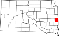
Location in the state of South Dakota
South Dakota's location in the U.S.Founded information needed Named for Gideon C. Moody Seat Flandreau Area
- Total
- Land
- Water
521 sq mi (1,350 km²)
520 sq mi (1,346 km²)
1 sq mi (4 km²), 0.27%Population
- (2010)
- Density
6,486
5/sq mi (2/km²)Time zone Central: UTC-6/-5 Website http://www.moodycounty.net/ Moody County is a county located in the U.S. state of South Dakota in the United States. The population was 6,486 at the 2010 census. Its county seat is Flandreau.[1]
Contents
Geography
According to the U.S. Census Bureau, the county has a total area of 521 square miles (1,350 km2), of which 520 square miles (1,300 km2) is land and 1 square mile (2.6 km2) (0.27%) is water.
Townships
The county is divided into sixteen townships: Alliance, Blinsmon, Clare, Colman, Egan, Enterprise, Flandreau, Fremont, Grovena, Jefferson, Lone Rock, Lynn, Riverview, Spring Creek, Union, Ward.
Major highways
Adjacent counties
- Brookings County, South Dakota - north
- Pipestone County, Minnesota - east
- Minnehaha County, South Dakota - south
- Lake County, South Dakota - west
Demographics
Historical populations Census Pop. %± 1880 3,915 — 1890 5,941 51.7% 1900 8,326 40.1% 1910 8,695 4.4% 1920 9,742 12.0% 1930 9,603 −1.4% 1940 9,341 −2.7% 1950 9,252 −1.0% 1960 8,810 −4.8% 1970 7,622 −13.5% 1980 6,692 −12.2% 1990 6,507 −2.8% 2000 6,595 1.4% 2010 6,486 −1.7% U.S. Decennial Census As of the census[2] of 2000, there were 6,595 people, 2,526 households, and 1,763 families residing in the county. The population density was 13 people per square mile (5/km²). There were 2,745 housing units at an average density of 5 per square mile (2/km²). The racial makeup of the county was 84.91% White, 0.29% Black or African American, 12.01% Native American, 0.56% Asian, 0.06% from other races, and 2.17% from two or more races. 0.76% of the population were Hispanic or Latino of any race.
There were 2,526 households out of which 35.60% had children under the age of 18 living with them, 56.70% were married couples living together, 8.50% had a female householder with no husband present, and 30.20% were non-families. 26.40% of all households were made up of individuals and 12.20% had someone living alone who was 65 years of age or older. The average household size was 2.58 and the average family size was 3.12.
In the county, the population was spread out with 29.10% under the age of 18, 7.20% from 18 to 24, 26.40% from 25 to 44, 22.30% from 45 to 64, and 14.90% who were 65 years of age or older. The median age was 37 years. For every 100 females there were 99.80 males. For every 100 females age 18 and over, there were 97.00 males.
The median income for a household in the county was $35,467, and the median income for a family was $41,623. Males had a median income of $27,391 versus $20,472 for females. The per capita income for the county was $16,541. About 7.30% of families and 9.60% of the population were below the poverty line, including 11.40% of those under age 18 and 10.90% of those age 65 or over.
Cities and towns
See also
References
- ^ "Find a County". National Association of Counties. http://www.naco.org/Counties/Pages/FindACounty.aspx. Retrieved 2011-06-07.
- ^ "American FactFinder". United States Census Bureau. http://factfinder.census.gov. Retrieved 2008-01-31.

Brookings County Lake County 
Pipestone County, Minnesota  Moody County, South Dakota

Minnehaha County Municipalities and communities of Moody County, South Dakota Cities 
Towns Indian reservations Flandreau Indian Reservation
Categories:- South Dakota counties
- Moody County, South Dakota


Wikimedia Foundation. 2010.