- Brandon, South Dakota
Infobox Settlement
official_name = City of Brandon, South Dakota
other_name =
native_name =
nickname =
settlement_type =City
motto = "Building a Better Life"
imagesize =
image_caption =
flag_size =
image_
seal_size =
image_shield =
shield_size =
image_blank_emblem =
blank_emblem_type =
blank_emblem_size =
imagesize =
image_caption =
flag_size =
image_
seal_size =
image_shield =
shield_size =
image_blank_emblem =
blank_emblem_type =
blank_emblem_size =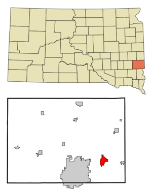
mapsize = 250px
map_caption = Location in Minnehaha County and the state ofSouth Dakota
mapsize1 =
map_caption1 =
image_dot_
dot_mapsize =
dot_map_caption =
dot_x =
dot_y =
pushpin_
pushpin_label_position =
pushpin_map_caption =
pushpin_mapsize =
subdivision_type = Country
subdivision_name =United States
subdivision_type1 = State
subdivision_name1 =South Dakota
subdivision_type2 = County
subdivision_name2 = Minnehaha
subdivision_type3 =
subdivision_name3 =
subdivision_type4 =
subdivision_name4 =
government_footnotes =
government_type =
leader_title =Mayor
leader_name =Larry Beesley
leader_title1 =
leader_name1 =
leader_title2 =
leader_name2 =
leader_title3 =
leader_name3 =
leader_title4 =
leader_name4 =
established_title =
established_date =
established_title2 =
established_date2 =
established_title3 =
established_date3 =
area_magnitude = 1 E9
unit_pref = Imperial
area_footnotes =
area_total_km2 = 9.8
area_land_km2 = 9.8
area_water_km2 = 0.0
area_total_sq_mi = 3.8
area_land_sq_mi = 3.8
area_water_sq_mi = 0.0
area_water_percent =
area_urban_km2 =
area_urban_sq_mi =
area_metro_km2 =
area_metro_sq_mi =
area_blank1_title =
area_blank1_km2 =
area_blank1_sq_mi =
population_as_of = 2007
population_footnotes =
population_note = City of Brandon estimate
population_total = 7840
population_density_km2 = 579.5
population_density_sq_mi = 1500.8
population_metro =
population_density_metro_km2 =
population_density_metro_sq_mi =
population_urban =
population_density_urban_km2 =
population_density_urban_sq_mi =
population_blank1_title =
population_blank1 =
population_density_blank1_km2 =
population_density_blank1_sq_mi =
timezone = Central
utc_offset = -6
timezone_DST = Central
utc_offset_DST = -5
latd = 43 |latm = 35 |lats = 30 |latNS = N
longd = 96 |longm = 34 |longs = 50 |longEW = W
elevation_footnotes =
elevation_m = 413
elevation_ft = 1355
postal_code_type =ZIP code
postal_code = 57005
area_code = 605
blank_name = FIPS code
blank_info = 46-06840GR|2
blank1_name = GNIS feature ID
blank1_info = 1254042GR|3
website = [http://www.brandonsd.com/ www.brandonsd.com]
footnotes =Brandon is a city in Minnehaha County,
South Dakota ,United States and is the largest suburb of Sioux Falls. The population was 5,693 at the 2000 census.Geography
Brandon is located at coor dms|43|35|30|N|96|34|50|W|city (43.591580, -96.580685)GR|1, along the
Big Sioux River . [DeLorme (2001). "South Dakota Atlas & Gazetteer". Yarmouth, Maine: DeLorme. ISBN 0-89933-330-3]According to the
United States Census Bureau , the city has a total area of 3.8square mile s (9.8km² ), all of it land.Brandon has been assigned the
ZIP code 57005, and theFIPS place code 06840. Brandon is also the seat of Brandon Township of Minnehaha County.The
Great Bear Recreation Park is located 2 1/2 miles to the west of Brandon.Transportation
Interstate 90 is a major east/west route on the northern edge of the city.South Dakota Highway 11 runs a north/south route through the city as well.Demographics
As of the
census GR|2 of 2000, there were 5,693 people, 1,909 households, and 1,592 families residing in the city. Thepopulation density was 1,500.8 people per square mile (580.0/km²). There were 1,976 housing units at an average density of 520.9/sq mi (201.3/km²). The racial makeup of the city was 98.23% White, 0.42% African American, 0.39% Native American, 0.23% Asian, 0.04% Pacific Islander, 0.09% from other races, and 0.61% from two or more races. Hispanic or Latino of any race were 0.42% of the population.USCensusPop
1950 = 200
1960 = 696
1970 = 1837
1980 = 2589
1990 = 3545
2000 = 5693There were 1,909 households out of which 53.2% had children under the age of 18 living with them, 71.0% were married couples living together, 10.0% had a female householder with no husband present, and 16.6% were non-families. 13.4% of all households were made up of individuals and 4.3% had someone living alone who was 65 years of age or older. The average household size was 2.96 and the average family size was 3.26.
In the city the population was spread out with 34.5% under the age of 18, 6.6% from 18 to 24, 34.9% from 25 to 44, 17.2% from 45 to 64, and 6.8% who were 65 years of age or older. The median age was 31 years. For every 100 females there were 97.0 males. For every 100 females age 18 and over, there were 92.4 males.
The median income for a household in the city was $58,421, and the median income for a family was $60,472. Males had a median income of $36,354 versus $25,302 for females. The
per capita income for the city was $19,869. About 2.5% of families and 2.3% of the population were below thepoverty line , including 3.0% of those under age 18 and 3.7% of those age 65 or over.References
External links
* [http://www.brandonsd.com/ Brandon Chamber of Commerce]
Wikimedia Foundation. 2010.