- Lemmon, South Dakota
Infobox Settlement
official_name = Lemmon, South Dakota
other_name =
native_name =
nickname =
settlement_type =City
motto =
imagesize =
image_caption =
flag_size =
image_
seal_size =
image_shield =
shield_size =
image_blank_emblem =
blank_emblem_type =
blank_emblem_size =
imagesize =
image_caption =
flag_size =
image_
seal_size =
image_shield =
shield_size =
image_blank_emblem =
blank_emblem_type =
blank_emblem_size =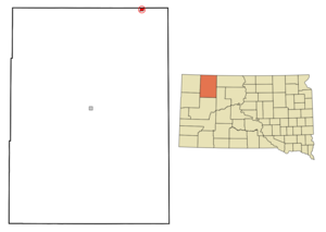
mapsize = 250px
map_caption = Location in Perkins County and the state ofSouth Dakota
mapsize1 =
map_caption1 =
image_dot_
dot_mapsize =
dot_map_caption =
dot_x =
dot_y =
pushpin_
pushpin_label_position =
pushpin_map_caption =
pushpin_mapsize =
subdivision_type = Country
subdivision_name =United States
subdivision_type1 = State
subdivision_name1 =South Dakota
subdivision_type2 = County
subdivision_name2 = Perkins
subdivision_type3 =
subdivision_name3 =
subdivision_type4 =
subdivision_name4 =
government_footnotes =
government_type =
leader_title =
leader_name =
leader_title1 =
leader_name1 =
leader_title2 =
leader_name2 =
leader_title3 =
leader_name3 =
leader_title4 =
leader_name4 =
established_title =
established_date =
established_title2 =
established_date2 =
established_title3 =
established_date3 =
area_magnitude =
unit_pref = Imperial
area_footnotes =
area_total_km2 = 2.6
area_land_km2 = 2.6
area_water_km2 = 0
area_total_sq_mi = 1
area_land_sq_mi = 1
area_water_sq_mi = 0
area_water_percent =
area_urban_km2 =
area_urban_sq_mi =
area_metro_km2 =
area_metro_sq_mi =
area_blank1_title =
area_blank1_km2 =
area_blank1_sq_mi =
population_as_of = 2000
population_footnotes =
population_note =
population_total = 1398
population_density_km2 = 537.7
population_density_sq_mi = 1398
population_metro =
population_density_metro_km2 =
population_density_metro_sq_mi =
population_urban =
population_density_urban_km2 =
population_density_urban_sq_mi =
population_blank1_title =
population_blank1 =
population_density_blank1_km2 =
population_density_blank1_sq_mi =
timezone = Mountain (MST)
utc_offset = -7
timezone_DST = MDT
utc_offset_DST = -6
latd = 45 |latm = 56 |lats = 22 |latNS = N
longd = 102 |longm = 9 |longs = 36 |longEW = W
elevation_footnotes =
elevation_m = 783
elevation_ft = 2569
postal_code_type =ZIP code
postal_code = 57638
area_code = 605
blank_name = FIPS code
blank_info = 46-36340GR|2
blank1_name = GNIS feature ID
blank1_info = 1256086GR|3
website =
footnotes =Lemmon is a city in Perkins County,
South Dakota ,United States . The population was 1,398 at the 2000 census.Geography
Lemmon is located at coor dms|45|56|22|N|102|9|36|W|city (45.939375, -102.160128)GR|1.
According to the
United States Census Bureau , the city has a total area of 1.0square mile s (2.6km² ), all of it land.Lemmon has been assigned the
ZIP code 57638 and theFIPS place code 36340.Demographics
As of the
census GR|2 of 2000, there were 1,398 people, 623 households, and 356 families residing in the city. Thepopulation density was 1,378.7 people per square mile (534.4/km²). There were 776 housing units at an average density of 765.3/sq mi (296.6/km²). The racial makeup of the city was 95.99% White, 0.14% African American, 2.65% Native American, 0.36% Asian, 0.29% from other races, and 0.57% from two or more races. Hispanic or Latino of any race were 0.50% of the population.There were 623 households out of which 25.2% had children under the age of 18 living with them, 47.5% were married couples living together, 7.9% had a female householder with no husband present, and 42.7% were non-families. 40.3% of all households were made up of individuals and 22.2% had someone living alone who was 65 years of age or older. The average household size was 2.15 and the average family size was 2.91.
In the city the population was spread out with 22.9% under the age of 18, 6.3% from 18 to 24, 24.7% from 25 to 44, 18.7% from 45 to 64, and 27.5% who were 65 years of age or older. The median age was 42 years. For every 100 females there were 84.2 males. For every 100 females age 18 and over, there were 81.2 males.
The median income for a household in the city was $28,109, and the median income for a family was $37,813. Males had a median income of $27,426 versus $17,813 for females. The
per capita income for the city was $17,272. About 8.0% of families and 12.0% of the population were below thepoverty line , including 12.1% of those under age 18 and 16.0% of those age 65 or over.ites of interest
Lemmon is home to the world’s largest Petrified Wood Park. This tourist attraction fills an entire block of the downtown area and is built entirely of petrified wood, fossils and stone. Construction began in 1930 and continued until 1932 under the supervision of Ole S. Quammen. It was in private ownership until 1954 when it was donated to the city by the heirs of Quamman. The park features a wishing well, waterfall and castle. The castle weighs in at 300 tons and boasts towering spires and turrets. Also in the park are two separate museums. They are both built entirely of petrified wood. The largest of the two is circular has a petrified gras floor along with petrified logs. If you look close you can find dinosaur claws, bird tracks and fossilized snakes in the petrified wood. Also in the museum you can find antiques and artificts from the Lemmon area. The formations in the park number to over 100 and some of them tower up to 20 feet tall.
The Grand River Museum is located on Highway 12. The Museum features exhibits on creation science, fossils, Native Americans, cowboys and ranch life, a full-scale tipi and a model of the Ark. Admission is free.
Lemmon has a 9-hole golf course, an airport, two convenience stores, a Ben Franklin variety store, a hardware store, a grocery store, and many other businesses.
Lemmon is home to the Powderhorn family restaurant, the Sugar Shack, the Alaska Cafe, Benny's steakhouse, and the Chinese Garden.
Many Lemmonites are employed at Wheeler's Manufacturing, which produces jewelry products. Gregorian, Inc., and Dakota Woodcrafts also employ manufacturing workers. Other major employers are the school system and ranches.
Lemmon is 3 hours from Sturgis, SD, home of the Sturgis Bike Rally, and 3.5 hours from Mt. Rushmore.
Lemmon is home to 7 churches, 3 financial institutions, a library, and a movie theater.
Lemmon has a clinic, a nursing home, an eye clinic, and a dentistry office.
chools
Lemmon's school district includes a high school, an elementary school, and the Progress country school in Meadow.
Lemmon's high school football team won its first ever playoff game in 2006, but lost to
Eureka -Bowdle in the next round.City Government
The mayor of Lemmon is currently Neal Pinnow, elected in April 2008 to replace outgoing mayor Wally Dauwen. There are eight members of the city council.
References
External links
Wikimedia Foundation. 2010.