- Dell Rapids, South Dakota
-
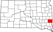
Dell Rapids, South Dakota — City —  Location in Minnehaha County and the state of South Dakota
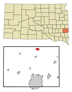
Coordinates: 43°49′30″N 96°42′40″W / 43.825°N 96.71111°WCoordinates: 43°49′30″N 96°42′40″W / 43.825°N 96.71111°W Country United States State South Dakota County Minnehaha Founded 1871[1] Incorporated 1888[2] Area - Total 2 sq mi (5.2 km2) - Land 2 sq mi (5.1 km2) - Water 0 sq mi (0.1 km2) Elevation 1,509 ft (460 m) Population (2010) - Total 3,633 - Density 1,816.5/sq mi (712.3/km2) Time zone Central (CST) (UTC-6) - Summer (DST) CDT (UTC-5) ZIP code 57022 Area code(s) 605 FIPS code 46-15980[3] GNIS feature ID 1265635[4] Dell Rapids is a city in Minnehaha County, South Dakota, United States. The population was 3,633 at the 2010 census. It is known as "The little city with the big attractions."
Contents
Geography
Dell Rapids is located at 43°49′30″N 96°42′40″W / 43.825°N 96.71111°W (43.824883, -96.711158),[5] along the Big Sioux River.[6]
According to the United States Census Bureau, the city has a total area of 2.0 square miles (5.2 km2), of which, 2.0 square miles (5.2 km2) of it is land and 0.04 square miles (0.10 km2) of it (1.51%) is water.
Dell Rapids has been assigned the ZIP code 57022 and the FIPS place code 15980.
Demographics
As of the 2010 census, there were 3,633 people residing in the city.
As of the census[3] of 2000, there were 2,980 people, 1,127 households, and 793 families residing in the city. The population density was 1,519.9 people per square mile (587.0/km²). There were 1,181 housing units at an average density of 602.3 per square mile (232.6/km²). The racial makeup of the city was 98.69% White, 0.13% African American, 0.47% Native American, 0.20% Asian, 0.07% from other races, and 0.44% from two or more races. Hispanic or Latino of any race were 0.64% of the population.
There were 1,127 households out of which 36.7% had children under the age of 18 living with them, 60.5% were married couples living together, 7.2% had a female householder with no husband present, and 29.6% were non-families. 26.0% of all households were made up of individuals and 13.5% had someone living alone who was 65 years of age or older. The average household size was 2.55 and the average family size was 3.09.
In the city the population was spread out with 28.4% under the age of 18, 6.5% from 18 to 24, 27.3% from 25 to 44, 19.4% from 45 to 64, and 18.3% who were 65 years of age or older. The median age was 36 years. For every 100 females there were 91.4 males. For every 100 females age 18 and over, there were 90.3 males.
The median income for a household in the city was $42,572, and the median income for a family was $49,536. Males had a median income of $31,867 versus $24,333 for females. The per capita income for the city was $17,731. About 1.9% of families and 4.0% of the population were below the poverty line, including 2.3% of those under age 18 and 12.7% of those age 65 or over.
Education
Dell Rapids is home to two separate school systems: The Dell Rapids public school system and St. Mary, a private Catholic school.
The public school system includes Dell Rapids High School, a middle school, and elementary as well as "Strive High", an alternative secondary-education institution. The mascot of the public school district is the "Quarriers", named after the large rose quartz rock quarry that is also in Dell Rapids. St. Mary's school also includes St. Mary High School, a middle school, and elementary school. The mascot of the St. Mary school district is the "Cardinals".
Notable Dell Rapids residents, past and present
- Dennis Daugaard, Current Governor of South Dakota
References
- ^ Thompson (ed.), p. 167.
- ^ "SD Towns". South Dakota State Historical Society. http://history.sd.gov/Archives/forms/exhibits/SD%20Towns.pdf. Retrieved 2010-02-11.
- ^ a b "American FactFinder". United States Census Bureau. http://factfinder.census.gov. Retrieved 2008-01-31.
- ^ "US Board on Geographic Names". United States Geological Survey. 2007-10-25. http://geonames.usgs.gov. Retrieved 2008-01-31.
- ^ "US Gazetteer files: 2010, 2000, and 1990". United States Census Bureau. 2011-02-12. http://www.census.gov/geo/www/gazetteer/gazette.html. Retrieved 2011-04-23.
- ^ DeLorme (2001). South Dakota Atlas & Gazetteer. Yarmouth, Maine: DeLorme. ISBN 0-89933-330-3
Bibliography
- Thompson, Harry F. (ed.) (2009). A New South Dakota History (Second ed.). Sioux Falls, SD: Center for Western Studies - Augustana College. ISBN 978-0-931170-00-3.
External links
Municipalities and communities of Minnehaha County, South Dakota Cities Baltic | Brandon | Colton | Crooks | Dell Rapids | Garretson | Hartford | Sioux Falls‡ | Valley Springs
Towns Unincorporated
communitiesFootnotes ‡This populated place also has portions in an adjacent county or counties
Categories:- Cities in South Dakota
- Populated places in Minnehaha County, South Dakota
- Sioux Falls metropolitan area


Wikimedia Foundation. 2010.