- Humboldt, South Dakota
Infobox Settlement
official_name = Humboldt, South Dakota
other_name =
native_name =
nickname =
settlement_type =Town
motto =
imagesize =
image_caption =
flag_size =
image_
seal_size =
image_shield =
shield_size =
image_blank_emblem =
blank_emblem_type =
blank_emblem_size =
imagesize =
image_caption =
flag_size =
image_
seal_size =
image_shield =
shield_size =
image_blank_emblem =
blank_emblem_type =
blank_emblem_size =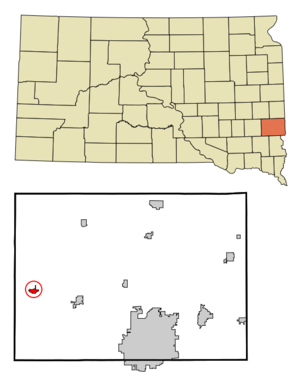
mapsize = 250px
map_caption = Location in Minnehaha County and the state ofSouth Dakota
mapsize1 =
map_caption1 =
image_dot_
dot_mapsize =
dot_map_caption =
dot_x =
dot_y =
pushpin_
pushpin_label_position =
pushpin_map_caption =
pushpin_mapsize =
subdivision_type = Country
subdivision_name =United States
subdivision_type1 = State
subdivision_name1 =South Dakota
subdivision_type2 = County
subdivision_name2 = Minnehaha
subdivision_type3 =
subdivision_name3 =
subdivision_type4 =
subdivision_name4 =
government_footnotes =
government_type =
leader_title =
leader_name =
leader_title1 =
leader_name1 =
leader_title2 =
leader_name2 =
leader_title3 =
leader_name3 =
leader_title4 =
leader_name4 =
established_title =
established_date =
established_title2 =
established_date2 =
established_title3 =
established_date3 =
area_magnitude =
unit_pref = Imperial
area_footnotes =
area_total_km2 = 1.6
area_land_km2 = 1.6
area_water_km2 = 0
area_total_sq_mi = 0.6
area_land_sq_mi = 0.6
area_water_sq_mi = 0
area_water_percent =
area_urban_km2 =
area_urban_sq_mi =
area_metro_km2 =
area_metro_sq_mi =
area_blank1_title =
area_blank1_km2 =
area_blank1_sq_mi =
population_as_of = 2000
population_footnotes =
population_note =
population_total = 521
population_density_km2 = 325.6
population_density_sq_mi = 868.3
population_metro =
population_density_metro_km2 =
population_density_metro_sq_mi =
population_urban =
population_density_urban_km2 =
population_density_urban_sq_mi =
population_blank1_title =
population_blank1 =
population_density_blank1_km2 =
population_density_blank1_sq_mi =
timezone = Central (CST)
utc_offset = -6
timezone_DST = CDT
utc_offset_DST = -5
latd = 43 |latm = 38 |lats = 42 |latNS = N
longd = 97 |longm = 4 |longs = 28 |longEW = W
elevation_footnotes =
elevation_m = 519
elevation_ft = 1703
postal_code_type =ZIP code
postal_code = 57035
area_code = 605
blank_name = FIPS code
blank_info = 46-30900GR|2
blank1_name = GNIS feature ID
blank1_info = 1255710GR|3
website =
footnotes =Humboldt is a town in Minnehaha County,
South Dakota ,United States . The population was 521 at the 2000 census.Geography
Humboldt is located at coor dms|43|38|42|N|97|4|28|W|city (43.644933, -97.074320)GR|1.
According to the
United States Census Bureau , the town has a total area of 0.6square mile s (1.6km² ), all of it land.Humboldt has been assigned the
ZIP code 57035 and theFIPS place code 30900.Lost Lake lies 2 miles North of the town.
Demographics
As of the
census GR|2 of 2000, there were 521 people, 200 households, and 148 families residing in the town. Thepopulation density was 831.0 people per square mile (319.3/km²). There were 210 housing units at an average density of 335.0/sq mi (128.7/km²). The racial makeup of the town was 96.74% White, 1.73% Native American, 0.58% Asian, 0.19% from other races, and 0.77% from two or more races. Hispanic or Latino of any race were 0.19% of the population.There were 200 households out of which 42.0% had children under the age of 18 living with them, 62.0% were married couples living together, 7.0% had a female householder with no husband present, and 26.0% were non-families. 25.5% of all households were made up of individuals and 15.0% had someone living alone who was 65 years of age or older. The average household size was 2.61 and the average family size was 3.09.
In the town the population was spread out with 31.7% under the age of 18, 6.7% from 18 to 24, 31.1% from 25 to 44, 15.9% from 45 to 64, and 14.6% who were 65 years of age or older. The median age was 32 years. For every 100 females there were 98.9 males. For every 100 females age 18 and over, there were 100.0 males.
The median income for a household in the town was $39,250, and the median income for a family was $45,000. Males had a median income of $27,426 versus $22,083 for females. The
per capita income for the town was $16,455. About 5.8% of families and 6.1% of the population were below thepoverty line , including 8.2% of those under age 18 and 5.1% of those age 65 or over.Notable residents
*Karl Mundt, United States Congressman and Senator, was born in Humboldt and spent part of his childhood there.
*Larry Pressler , United States Congressman and Senator, was born in Humboldt and attended elementary and high school there. [http://www.larrypressler.com/biography.html]References
External links
Wikimedia Foundation. 2010.