- National Register of Historic Places listings in Cedar County, Nebraska
-
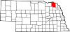
 Location of Cedar County in Nebraska
This is a list of the National Register of Historic Places listings in Cedar County, Nebraska. It is intended to be a complete list of the properties and districts on the National Register of Historic Places in Cedar County, Nebraska, United States. The locations of National Register properties and districts for which the latitude and longitude coordinates are included below, may be seen in a Google map.[1]
There are 13 properties and districts listed on the National Register in the county.
-
- This National Park Service list is complete through NPS recent listings posted November 10, 2011.[2]
Listings county-wide
[3] Landmark name Image Date listed Location City or town Summary 1 Bow Valley Mills 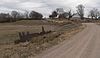
November 17, 1978 North of Wynot
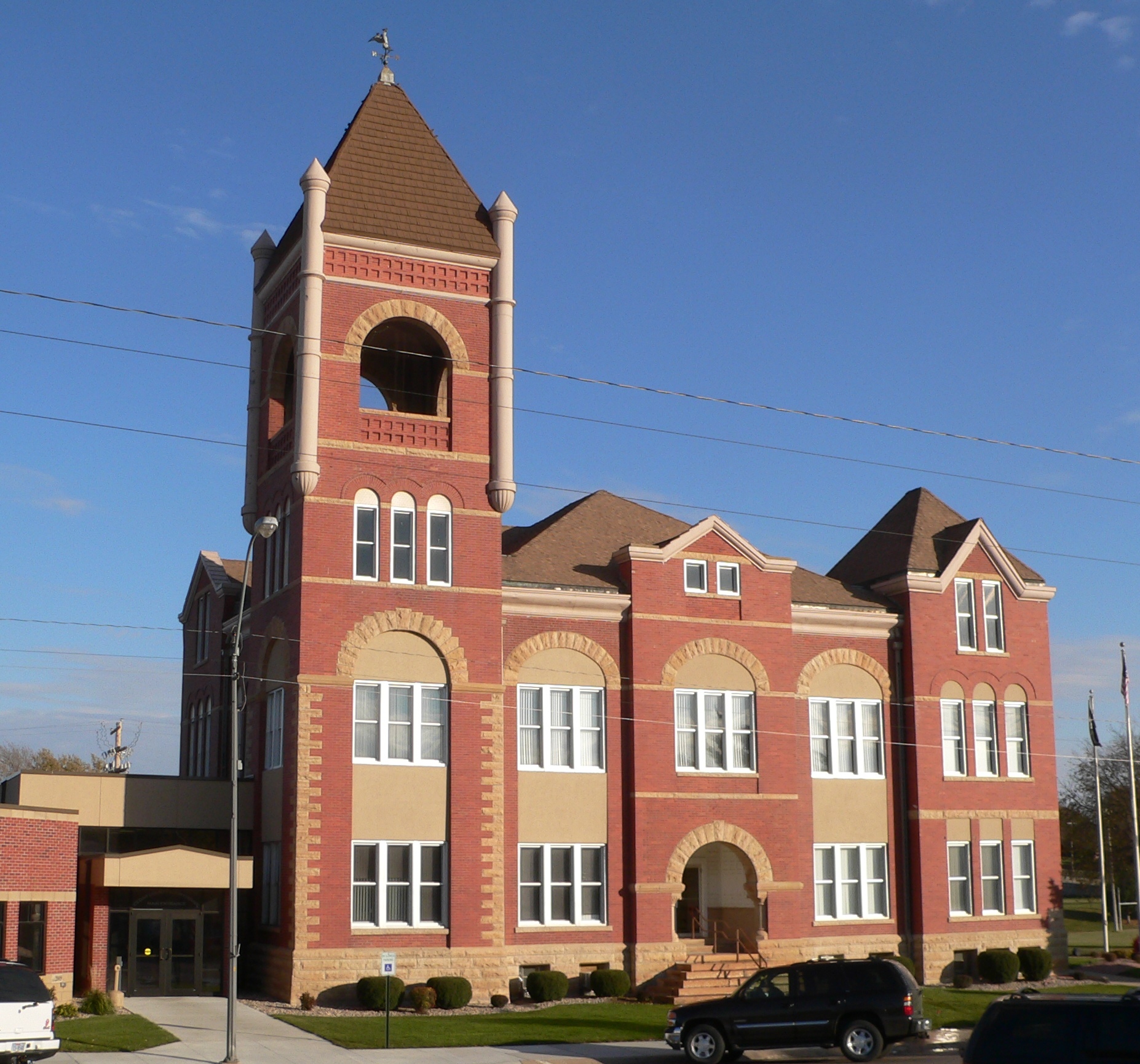
42°45′43″N 97°10′02″W / 42.761944°N 97.167222°WWynot Mill building no longer at site; concrete spillway across road is still present. 2 Cedar County Courthouse 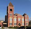
January 10, 1990 Broadway Ave. between Centre and Franklin Sts.
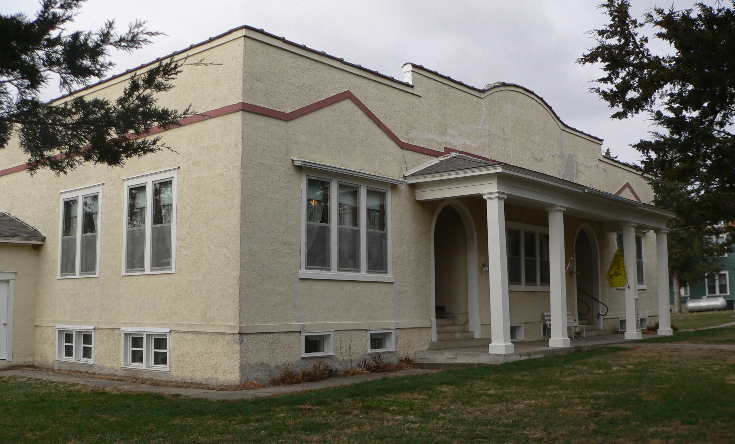
42°37′12″N 97°15′50″W / 42.62°N 97.263889°WHartington 3 Hartington City Hall and Auditorium 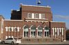
July 21, 1983 101 N. Broadway
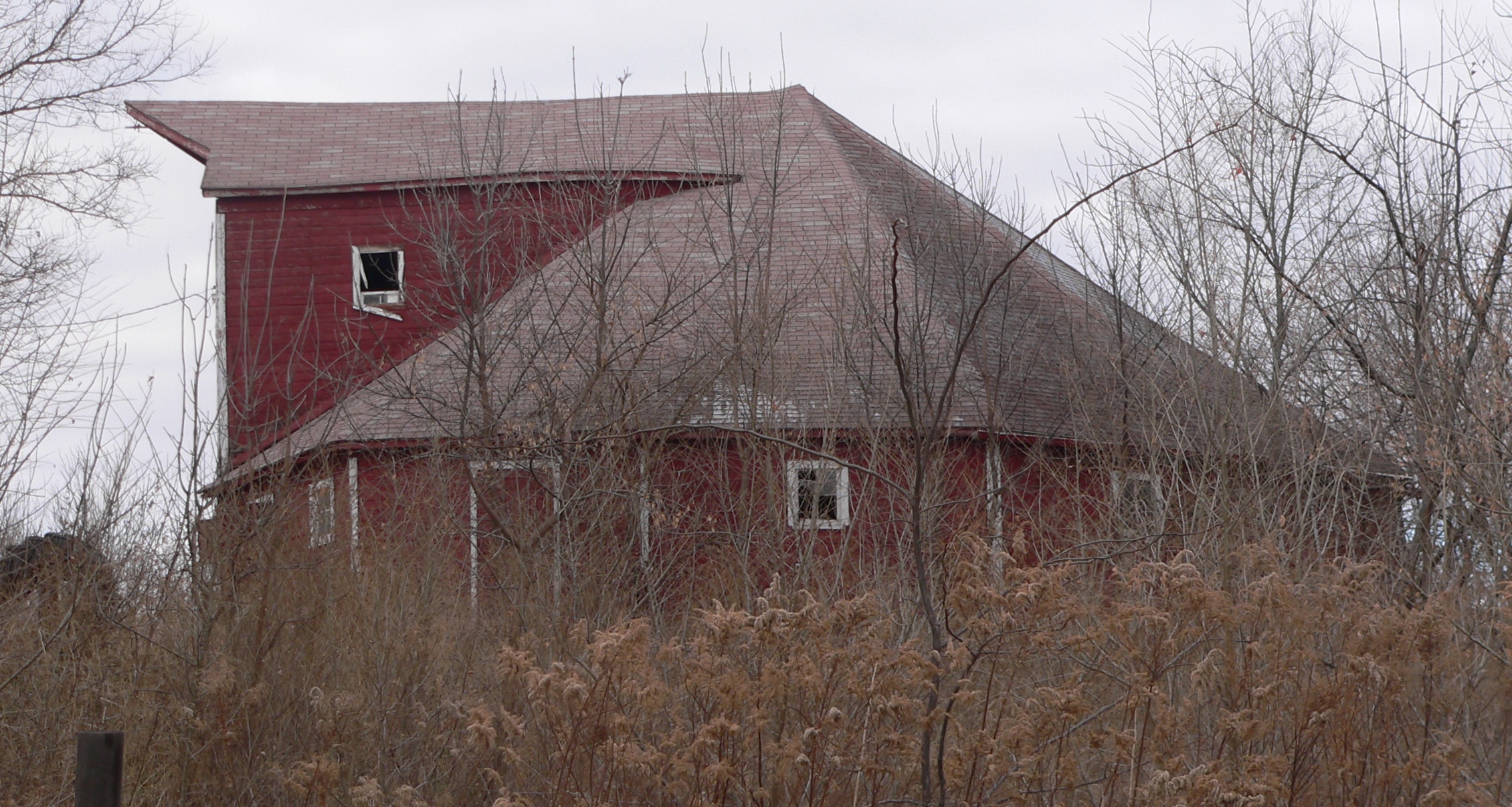
42°37′15″N 97°15′49″W / 42.620833°N 97.263611°WHartington A Prairie School multi-use municipal building designed by William L. Steele. 4 Couser Barn 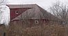
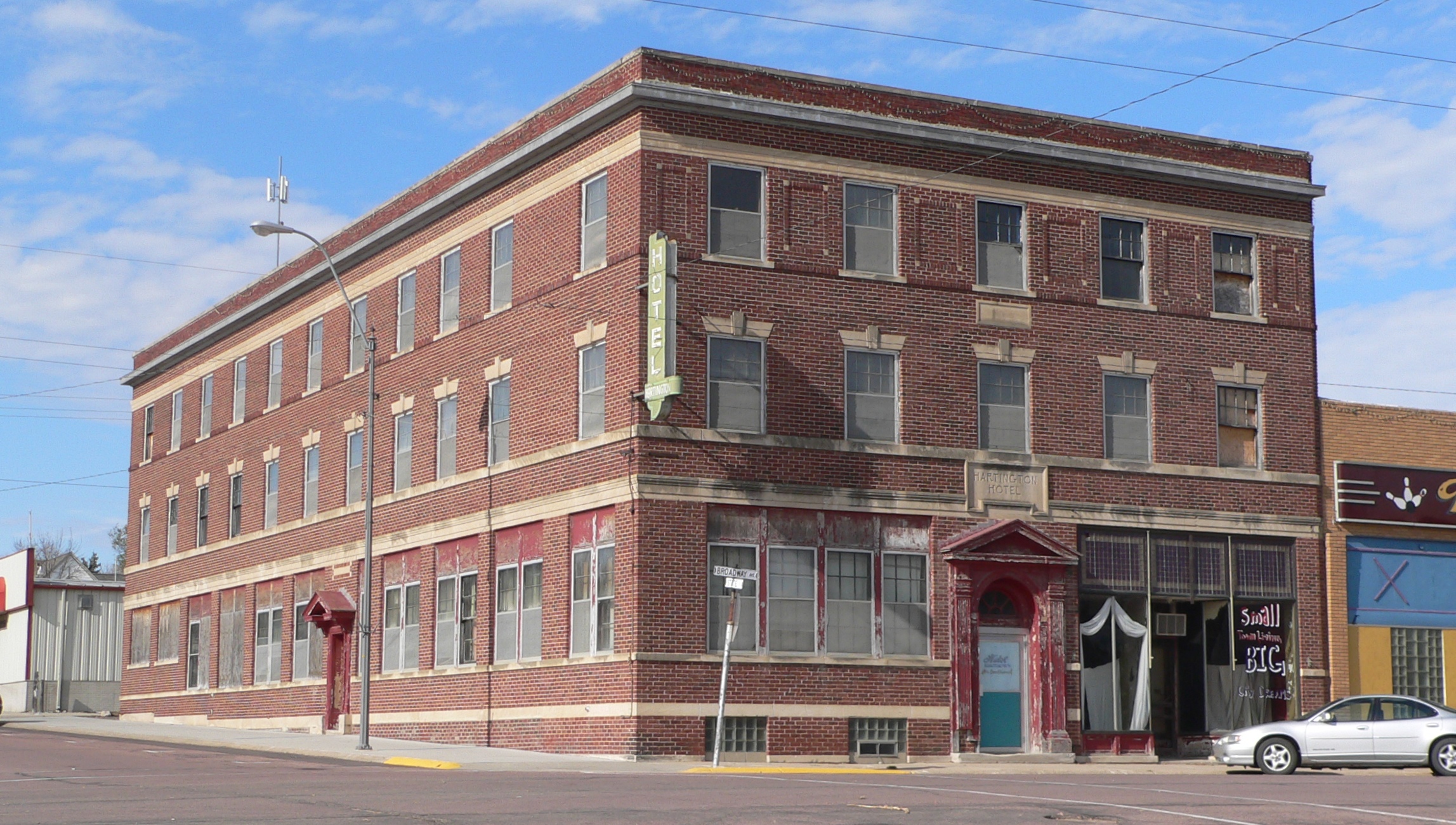
July 17, 1986 Address Restricted Laurel 5 Hartington Hotel 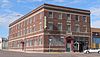
November 26, 2003 202 North Broadway
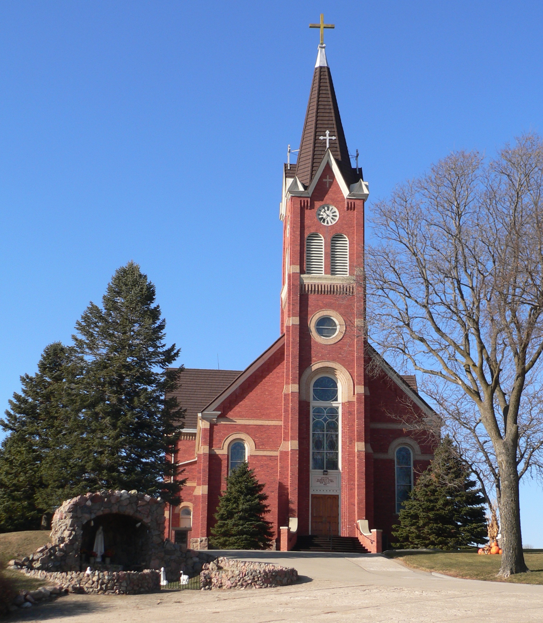
42°37′18″N 97°15′53″W / 42.621667°N 97.264722°WHartington 6 Immaculate Conception Catholic Church and Rectory 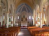
July 5, 2001 102 and 108 E. 9th St.
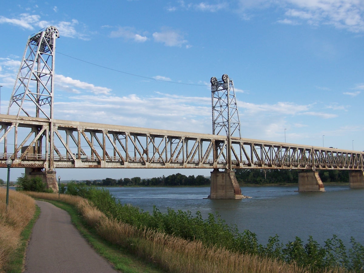
42°48′33″N 97°14′52″W / 42.809167°N 97.247778°WSt. Helena 7 Meridian Bridge 
June 17, 1993 U.S. Route 81 over the Missouri River, just south of Yankton, South Dakota
42°52′05″N 97°23′37″W / 42.868056°N 97.393611°WSouth Yankton Extends into Yankton County, South Dakota 8 St. Boniface Catholic Church Complex 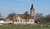
July 21, 1983 Main St.
42°47′10″N 97°22′25″W / 42.786111°N 97.373611°WMenominee 9 Saints Peter and Paul Catholic Church Complex 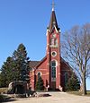
July 5, 2000 106 W. 889th Rd.
42°42′53″N 97°15′03″W / 42.714722°N 97.250833°WBow Valley 10 Saints Philip and James Parochial School 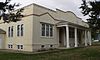
November 26, 2003 89039 570 Ave.
42°44′03″N 97°08′37″W / 42.734167°N 97.143611°WWynot 11 Schulte Archeological Site July 30, 1974 Address Restricted St. Helena 12 Wiseman Archeological Site December 2, 1974 Address Restricted Wynot 13 Franz Zavadil Farmstead 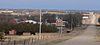
January 31, 1985 Address Restricted Menominee See also
- List of National Historic Landmarks in Nebraska
- National Register of Historic Places listings in Nebraska
References
- ^ The latitude and longitude information provided in this table was derived originally from the National Register Information System, which has been found to be fairly accurate for about 99% of listings. For about 1% of NRIS original coordinates, experience has shown that one or both coordinates are typos or otherwise extremely far off; some corrections may have been made. A more subtle problem causes many locations to be off by up to 150 yards, depending on location in the country: most NRIS coordinates were derived from tracing out latitude and longitudes off of USGS topographical quadrant maps created under the North American Datum of 1927, which differs from the current, highly accurate WGS84 GPS system used by Google maps. Chicago is about right, but NRIS longitudes in Washington are higher by about 4.5 seconds, and are lower by about 2.0 seconds in Maine. Latitudes differ by about 1.0 second in Florida. Some locations in this table may have been corrected to current GPS standards.
- ^ "National Register of Historic Places: Weekly List Actions". National Park Service, United States Department of the Interior. Retrieved on November 10, 2011.
- ^ Numbers represent an ordering by significant words. Various colorings, defined here, differentiate National Historic Landmark sites and National Register of Historic Places Districts from other NRHP buildings, structures, sites or objects.
U.S. National Register of Historic Places Topics Lists by states Alabama • Alaska • Arizona • Arkansas • California • Colorado • Connecticut • Delaware • Florida • Georgia • Hawaii • Idaho • Illinois • Indiana • Iowa • Kansas • Kentucky • Louisiana • Maine • Maryland • Massachusetts • Michigan • Minnesota • Mississippi • Missouri • Montana • Nebraska • Nevada • New Hampshire • New Jersey • New Mexico • New York • North Carolina • North Dakota • Ohio • Oklahoma • Oregon • Pennsylvania • Rhode Island • South Carolina • South Dakota • Tennessee • Texas • Utah • Vermont • Virginia • Washington • West Virginia • Wisconsin • WyomingLists by territories Lists by associated states Other Municipalities and communities of Cedar County, Nebraska Cities Hartington | Laurel | Randolph
Villages Categories:- National Register of Historic Places in Nebraska by county
- Cedar County, Nebraska
- Buildings and structures in Cedar County, Nebraska
-


Wikimedia Foundation. 2010.