- National Register of Historic Places listings in Buffalo County, Nebraska
-
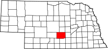 Location of Buffalo County in Nebraska
This is a list of the National Register of Historic Places listings in Buffalo County, Nebraska.
This is intended to be a complete list of the properties and districts on the National Register of Historic Places in Buffalo County, Nebraska, United States. The locations of National Register properties and districts for which the latitude and longitude coordinates are included below, may be seen in a Google map.[1]
There are 18 properties and districts listed on the National Register in the county.
-
- This National Park Service list is complete through NPS recent listings posted November 10, 2011.[2]
Current listings
[3] Landmark name [4] Image Date listed Location City or town Summary 1 John Barnd House 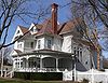
March 31, 1983 320 E. 31st St.
40°42′23″N 99°04′34″W / 40.706389°N 99.076111°WKearney 2 John J. and Lenora Bartlett House 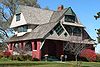
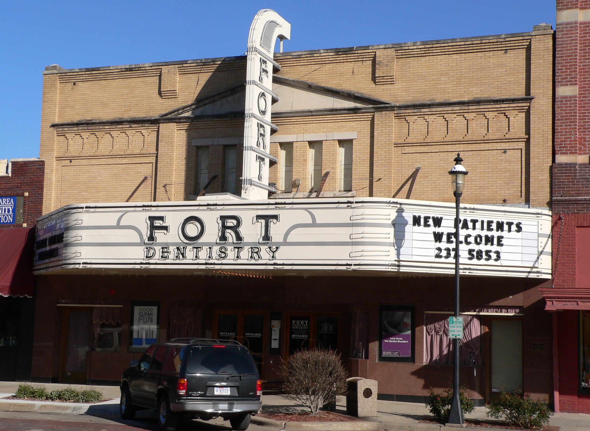
December 27, 2007 1402 9th Ave.
40°41′19″N 99°05′39″W / 40.688611°N 99.094167°WKearney 3 Fort Theater 
July 12, 2006 2205 Central Ave.
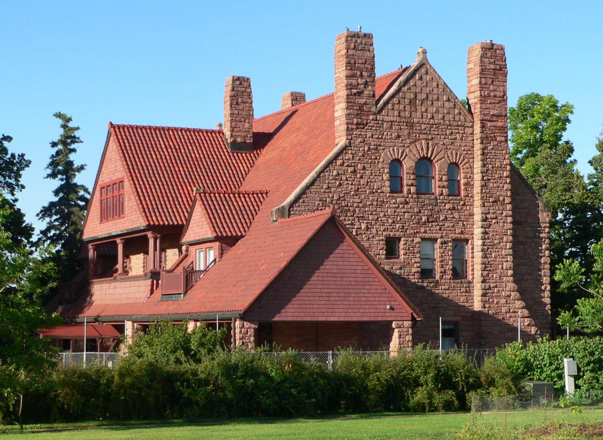
40°41′52″N 99°04′52″W / 40.697778°N 99.081111°WKearney 4 George W. Frank House 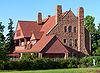
February 23, 1973 University of Nebraska at Kearney
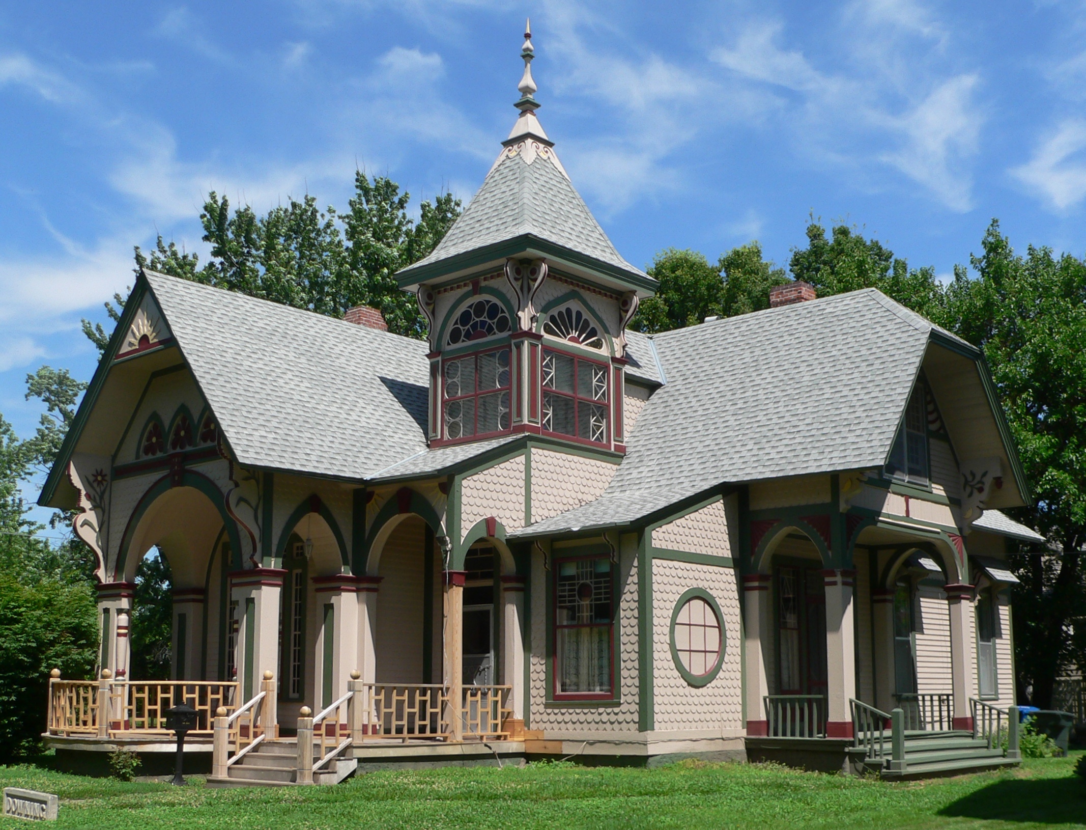
40°42′03″N 99°06′30″W / 40.700833°N 99.108333°WKearney 5 Hanson-Downing House 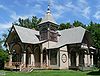
December 10, 1980 723 W. 22nd St.
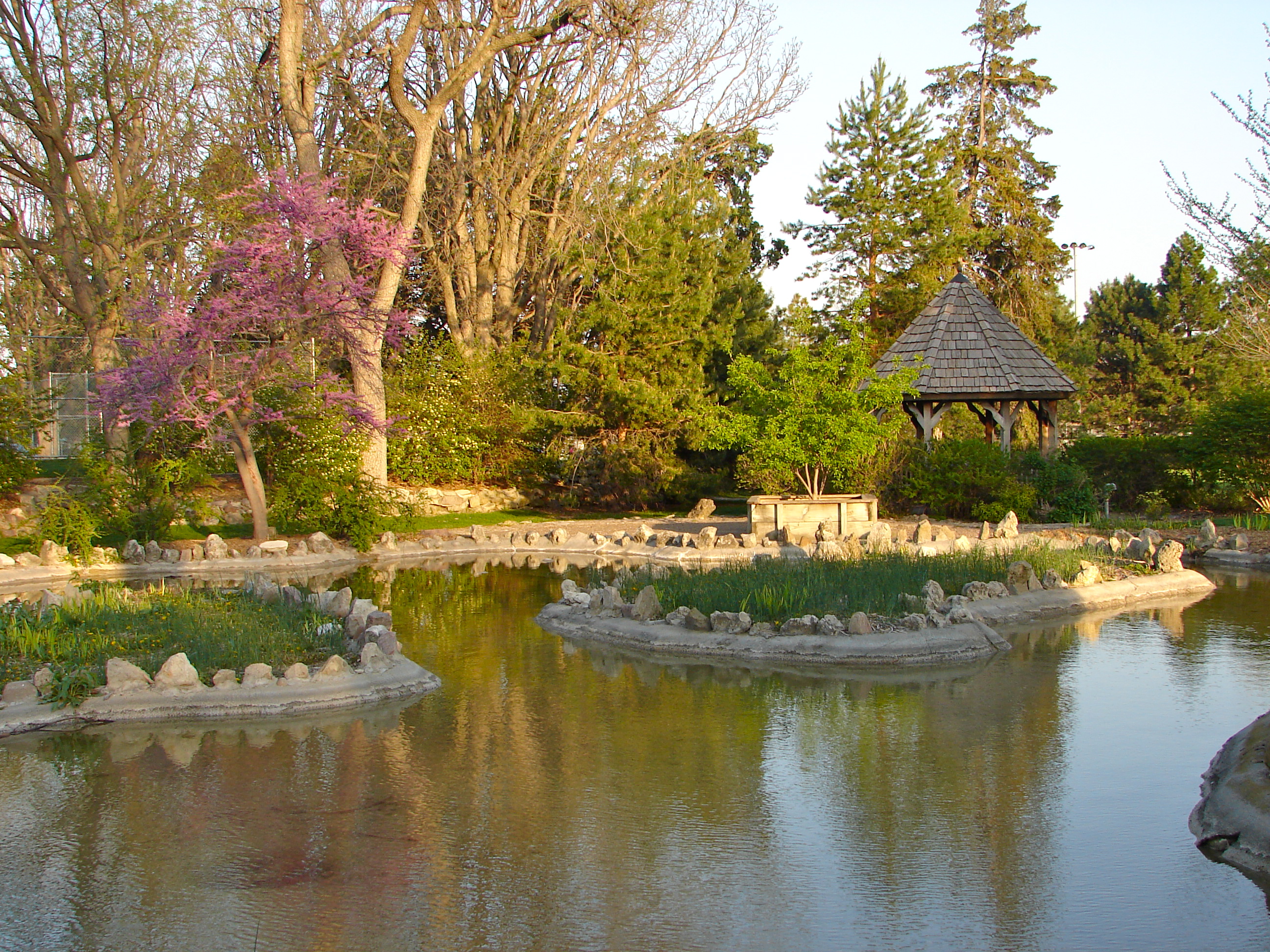
40°41′53″N 99°05′32″W / 40.698056°N 99.092222°WKearney 6 Harmon Park 
December 10, 2010 Roughly bounded by 29th and 33rd Sts. and 5th and 7th Aves.
40°42′24″N 99°05′23″W / 40.706667°N 99.089722°WKearney 7 Kearney Junior High School 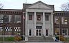
July 5, 2000 300 W. 24th St.
40°41′57″N 99°05′09″W / 40.699167°N 99.085833°WKearney 8 Kearney National Guard Armory 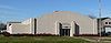
July 16, 2009 1600 Central Ave.
40°41′25″N 99°04′55″W / 40.690328°N 99.081928°WKearney 9 Kilgore Bridge 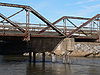
June 29, 1992 Nebraska Highway 10 over the North Channel Platte River, 7.1 miles southeast of Kearney
40°41′02″N 98°57′03″W / 40.683889°N 98.950833°WKearney 10 Klehm House 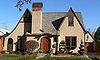
March 25, 1999 2215 9th Ave.
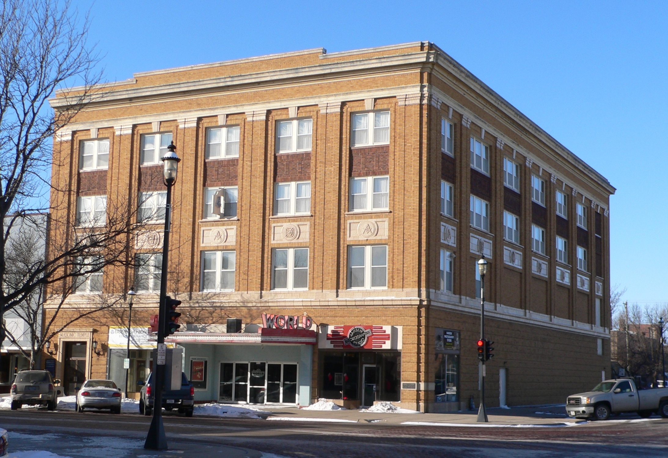
40°41′54″N 99°05′39″W / 40.698333°N 99.094167°WKearney 11 Masonic Temple and World Theater Building 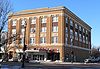
November 10, 2009 2318 Central Ave.
40°41′56″N 99°04′54″W / 40.698822°N 99.081675°WKearney 12 Meisner Bank Building 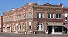
March 25, 1999 128 C St.
40°46′50″N 98°44′02″W / 40.780556°N 98.733889°WShelton 13 George Meisner House 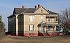
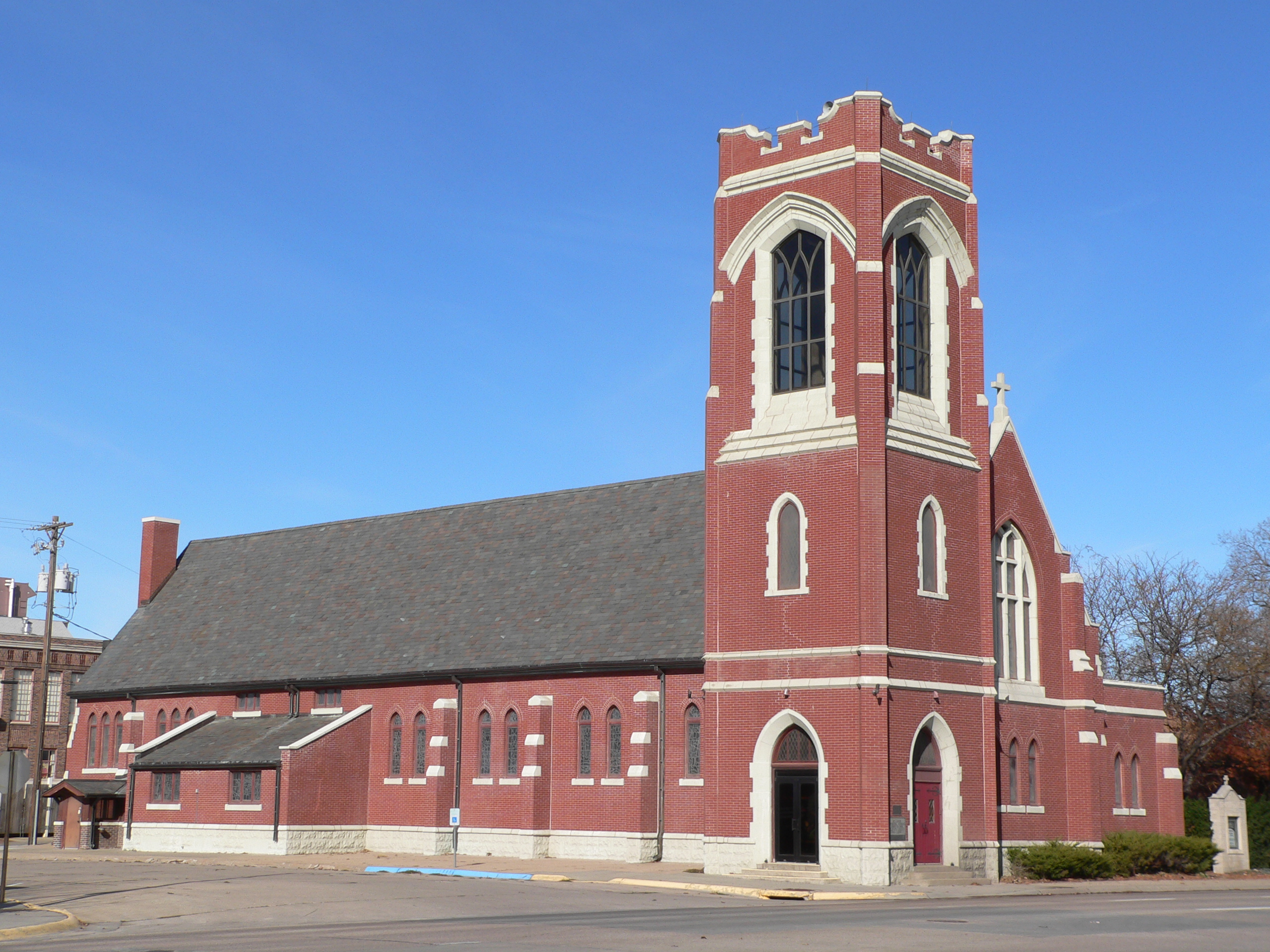
June 23, 1988 Address Restricted Shelton 14 Saint Luke's Protestant Episcopal Church 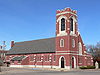
December 1, 1986 2304 2nd Ave.
40°42′20″N 99°05′35″W / 40.705556°N 99.093056°WKearney 15 Sweetwater Archeological Site 
July 29, 1974 Address Restricted Sweetwater 16 Sweetwater Mill Bridge 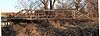
June 29, 1992 County road over Mud Creek
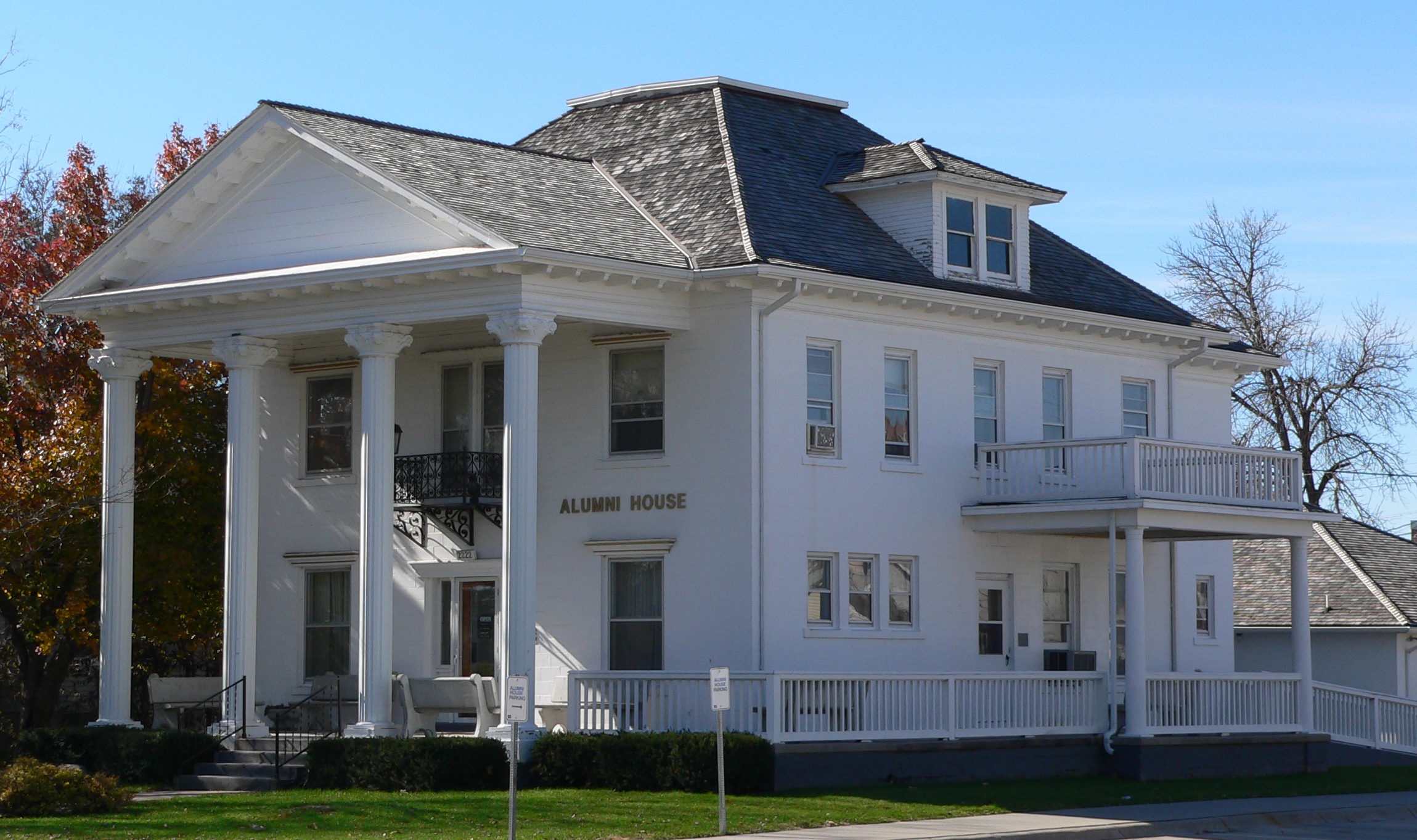
41°02′27″N 99°00′27″W / 41.040833°N 99.0075°WSweetwater 17 Dr. A.O. Thomas House 
February 28, 1980 2222 9th Ave.
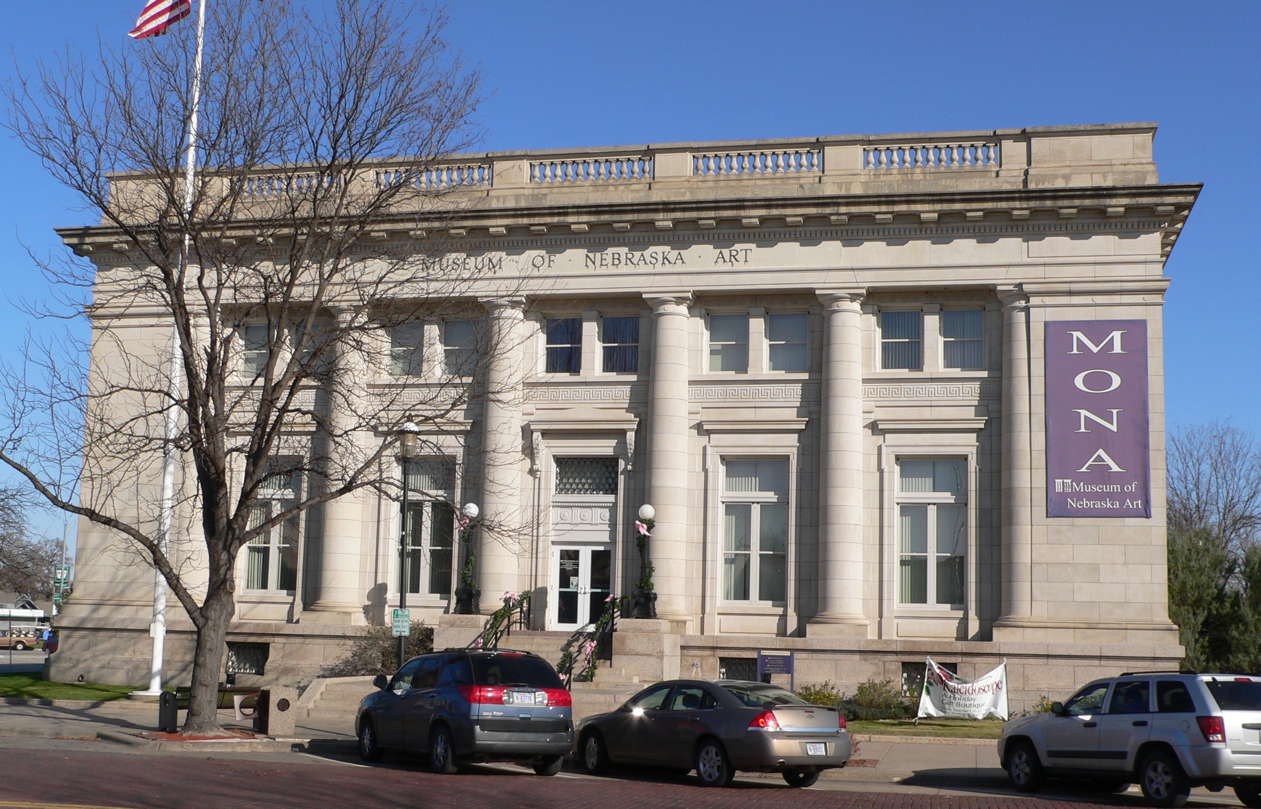
40°41′55″N 99°05′39″W / 40.698611°N 99.094167°WKearney 18 U.S. Post Office 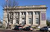
September 17, 1981 2401 Central Ave.
40°41′59″N 99°04′52″W / 40.699722°N 99.081111°WKearney See also
- List of National Historic Landmarks in Nebraska
- National Register of Historic Places listings in Nebraska
References
- ^ The latitude and longitude information provided in this table was derived originally from the National Register Information System, which has been found to be fairly accurate for about 99% of listings. For about 1% of NRIS original coordinates, experience has shown that one or both coordinates are typos or otherwise extremely far off; some corrections may have been made. A more subtle problem causes many locations to be off by up to 150 yards, depending on location in the country: most NRIS coordinates were derived from tracing out latitude and longitudes off of USGS topographical quadrant maps created under the North American Datum of 1927, which differs from the current, highly accurate WGS84 GPS system used by Google maps. Chicago is about right, but NRIS longitudes in Washington are higher by about 4.5 seconds, and are lower by about 2.0 seconds in Maine. Latitudes differ by about 1.0 second in Florida. Some locations in this table may have been corrected to current GPS standards.
- ^ "National Register of Historic Places: Weekly List Actions". National Park Service, United States Department of the Interior. Retrieved on November 10, 2011.
- ^ Numbers represent an ordering by significant words. Various colorings, defined here, differentiate National Historic Landmark sites and National Register of Historic Places Districts from other NRHP buildings, structures, sites or objects.
- ^ "National Register Information System". National Register of Historic Places. National Park Service. . http://nrhp.focus.nps.gov/natreg/docs/All_Data.html.
U.S. National Register of Historic Places Topics Lists by states Alabama • Alaska • Arizona • Arkansas • California • Colorado • Connecticut • Delaware • Florida • Georgia • Hawaii • Idaho • Illinois • Indiana • Iowa • Kansas • Kentucky • Louisiana • Maine • Maryland • Massachusetts • Michigan • Minnesota • Mississippi • Missouri • Montana • Nebraska • Nevada • New Hampshire • New Jersey • New Mexico • New York • North Carolina • North Dakota • Ohio • Oklahoma • Oregon • Pennsylvania • Rhode Island • South Carolina • South Dakota • Tennessee • Texas • Utah • Vermont • Virginia • Washington • West Virginia • Wisconsin • WyomingLists by territories Lists by associated states Other Municipalities and communities of Buffalo County, Nebraska Cities 
Villages Unincorporated
communitiesTownships Categories:- National Register of Historic Places in Nebraska by county
- Buffalo County, Nebraska
- Buildings and structures in Buffalo County, Nebraska
-


Wikimedia Foundation. 2010.