- National Register of Historic Places listings in Buffalo County, South Dakota
-
 Location of Buffalo County in South Dakota
This is a list of the National Register of Historic Places listings in Buffalo County, South Dakota.
This is intended to be a complete list of the properties and districts on the National Register of Historic Places in Buffalo County, South Dakota, United States. The locations of National Register properties and districts for which the latitude and longitude coordinates are included below, may be seen in a Google map.[1]
There are 6 properties and districts listed on the National Register in the county, including 2 National Historic Landmarks. Another property was once listed but has been removed.
-
- This National Park Service list is complete through NPS recent listings posted November 10, 2011.[2]
Current listings
[3] Landmark name [4] Image Date listed Location City or town Summary 1 Bank of Buffalo County February 12, 1999 Main St.
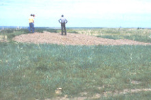
44°01′59″N 98°59′11″W / 44.033056°N 98.986389°WGann Valley 2 Crow Creek Site 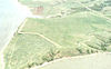
October 15, 1966 Eastern bank of the Missouri River, north of Chamberlain
43°58′36″N 99°19′48″W / 43.97667°N 99.33°W[5]Chamberlain 3 Duncan Church February 12, 1999 Southwest of Crow Creek, 2 miles south of the county line
44°10′50″N 99°04′09″W / 44.180556°N 99.069167°WGann Valley 4 Fort Thompson Archeological District August 14, 1986 Address Restricted Fort Thompson 5 Fort Thompson Mounds 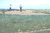
October 15, 1966 Address Restricted Fort Thompson 6 Talking Crow Archeological Site June 2, 2003 Address Restricted Fort Thompson Former listing
Landmark name Image Date Location City or Town Summary 1 Old Buffalo County Courthouse and Jail House March 26, 2008 (delisted) Gann Valley See also
- List of National Historic Landmarks in South Dakota
- National Register of Historic Places listings in South Dakota
References
- ^ The latitude and longitude information provided in this table was derived originally from the National Register Information System, which has been found to be fairly accurate for about 99% of listings. For about 1% of NRIS original coordinates, experience has shown that one or both coordinates are typos or otherwise extremely far off; some corrections may have been made. A more subtle problem causes many locations to be off by up to 150 yards, depending on location in the country: most NRIS coordinates were derived from tracing out latitude and longitudes off of USGS topographical quadrant maps created under North American Datum of 1927, which differs from the current, highly accurate GPS system used by Google maps. Chicago is about right, but NRIS longitudes in Washington are higher by about 4.5 seconds, and are lower by about 2.0 seconds in Maine. Latitudes differ by about 1.0 second in Florida. Some locations in this table may have been corrected to current GPS standards.
- ^ "National Register of Historic Places: Weekly List Actions". National Park Service, United States Department of the Interior. Retrieved on November 10, 2011.
- ^ Numbers represent an ordering by significant words. Various colorings, defined here, differentiate National Historic Landmark sites and National Register of Historic Places Districts from other NRHP buildings, structures, sites or objects.
- ^ "National Register Information System". National Register of Historic Places. National Park Service. . http://nrhp.focus.nps.gov/natreg/docs/All_Data.html.
- ^ Location derived from its NHL profile and from the GNIS feature record for the mouth of Crow Creek; the NRIS lists the site as "Address Restricted"
U.S. National Register of Historic Places Topics Lists by states Alabama • Alaska • Arizona • Arkansas • California • Colorado • Connecticut • Delaware • Florida • Georgia • Hawaii • Idaho • Illinois • Indiana • Iowa • Kansas • Kentucky • Louisiana • Maine • Maryland • Massachusetts • Michigan • Minnesota • Mississippi • Missouri • Montana • Nebraska • Nevada • New Hampshire • New Jersey • New Mexico • New York • North Carolina • North Dakota • Ohio • Oklahoma • Oregon • Pennsylvania • Rhode Island • South Carolina • South Dakota • Tennessee • Texas • Utah • Vermont • Virginia • Washington • West Virginia • Wisconsin • WyomingLists by territories Lists by associated states Other Municipalities and communities of Buffalo County, South Dakota CDP 
Unincorporated
communityTownship Elvira
Unorganized
territoriesCrow Creek | North Buffalo | Southeast Buffalo
Indian reservation Footnotes ‡This populated place also has portions in an adjacent county or counties
Categories:- Buffalo County, South Dakota
- National Register of Historic Places in South Dakota by county
-


Wikimedia Foundation. 2010.