- National Register of Historic Places listings in Harper County, Oklahoma
-
 Location of Harper County in Oklahoma
This is a list of the National Register of Historic Places listings in Harper County, Oklahoma.
This is intended to be a complete list of the properties and districts on the National Register of Historic Places in Harper County, Oklahoma, United States. The locations of National Register properties and districts for which the latitude and longitude coordinates are included below, may be seen in a Google map.[1]
There are 17 properties and districts listed on the National Register in the county.
-
- This National Park Service list is complete through NPS recent listings posted November 10, 2011.[2]
Current listings
[3] Landmark name [4] Image Date listed Location City or town Summary 1 Beagley-Stinson Archeological Site November 16, 1978 Address Restricted Laverne 2 Buffalo City Park Pavilion September 8, 1988 U.S. Route 64
36°49′42″N 99°38′04″W / 36.828333°N 99.634444°WBuffalo 3 Clover Hotel March 8, 1984 Main St. and Oklahoma Ave.
36°42′34″N 99°53′41″W / 36.709444°N 99.894722°WLaverne 4 Cooper Bison Kill Site October 7, 2002 Address Restricted Fort Supply 5 Farmers' Co-op Elevator October 7, 1983 Off U.S. Route 64
36°50′03″N 99°37′34″W / 36.834167°N 99.626111°WBuffalo 6 Feuquay Elevator October 7, 1983 Off U.S. Route 64
36°50′09″N 99°37′15″W / 36.835833°N 99.620833°WBuffalo 7 Fox Hotel January 30, 1978 Broadway and NE 1st St.
36°42′40″N 99°53′34″W / 36.711111°N 99.892778°WLaverne 8 Harper County Courthouse August 23, 1984 Elm, Maple, 1st, and 2nd Sts., SE.
36°49′59″N 99°37′41″W / 36.833056°N 99.628056°WBuffalo 9 I.O.O.F. Building of Buffalo July 14, 1983 110 W. Turner St.
36°50′07″N 99°37′53″W / 36.835278°N 99.631389°WBuffalo 10 Laverne's North Main Street District March 8, 1984 Main St. and Broadway
36°42′36″N 99°53′37″W / 36.71°N 99.893611°WLaverne 11 M. K. and T. Depot in Laverne March 8, 1984 Main St.
36°42′36″N 99°53′28″W / 36.71°N 99.891111°WLaverne 12 Monhollow Artificial Stone House July 14, 1983 Off U.S. Route 183
36°49′34″N 99°37′41″W / 36.826111°N 99.628056°WBuffalo 13 Old Settler's Irrigation Ditch July 27, 1983 Intersects U.S. Route 283 north of Rosston
36°56′55″N 99°57′47″W / 36.948611°N 99.963056°WRosston 14 Page Soddy March 24, 1983 Southeast of Buffalo
36°46′08″N 99°32′51″W / 36.768889°N 99.5475°WBuffalo 15 Patsy's Island Site December 6, 2004 Address Restricted Woodward 16 Sharp Lumberyard March 8, 1984 124 N. Broadway
36°42′38″N 99°53′36″W / 36.710556°N 99.893333°WLaverne 17 Smith No. 2 Site December 6, 2004 Address Restricted Woodward See also
- List of National Historic Landmarks in Oklahoma
- National Register of Historic Places listings in Oklahoma
References
- ^ The latitude and longitude information provided in this table was derived originally from the National Register Information System, which has been found to be fairly accurate for about 99% of listings. For about 1% of NRIS original coordinates, experience has shown that one or both coordinates are typos or otherwise extremely far off; some corrections may have been made. A more subtle problem causes many locations to be off by up to 150 yards, depending on location in the country: most NRIS coordinates were derived from tracing out latitude and longitudes off of USGS topographical quadrant maps created under North American Datum of 1927, which differs from the current, highly accurate GPS system used by Google maps. Chicago is about right, but NRIS longitudes in Washington are higher by about 4.5 seconds, and are lower by about 2.0 seconds in Maine. Latitudes differ by about 1.0 second in Florida. Some locations in this table may have been corrected to current GPS standards.
- ^ "National Register of Historic Places: Weekly List Actions". National Park Service, United States Department of the Interior. Retrieved on November 10, 2011.
- ^ Numbers represent an ordering by significant words. Various colorings, defined here, differentiate National Historic Landmark sites and National Register of Historic Places Districts from other NRHP buildings, structures, sites or objects.
- ^ "National Register Information System". National Register of Historic Places. National Park Service. . http://nrhp.focus.nps.gov/natreg/docs/All_Data.html.
U.S. National Register of Historic Places Topics Lists by states Alabama • Alaska • Arizona • Arkansas • California • Colorado • Connecticut • Delaware • Florida • Georgia • Hawaii • Idaho • Illinois • Indiana • Iowa • Kansas • Kentucky • Louisiana • Maine • Maryland • Massachusetts • Michigan • Minnesota • Mississippi • Missouri • Montana • Nebraska • Nevada • New Hampshire • New Jersey • New Mexico • New York • North Carolina • North Dakota • Ohio • Oklahoma • Oregon • Pennsylvania • Rhode Island • South Carolina • South Dakota • Tennessee • Texas • Utah • Vermont • Virginia • Washington • West Virginia • Wisconsin • WyomingLists by territories Lists by associated states Other  Category:National Register of Historic Places •
  Portal:National Register of Historic Places
Municipalities and communities of Harper County, Oklahoma County seat: Buffalo Towns 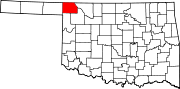
Unincorporated
communitiesLovedale | Selman
Ghost towns Categories:- Harper County, Oklahoma
- National Register of Historic Places in Oklahoma by county
-

Wikimedia Foundation. 2010.