- National Register of Historic Places listings in Platte County, Nebraska
-
 Location of Platte County in Nebraska
This is a list of the National Register of Historic Places listings in Platte County, Nebraska. It is intended to be a complete list of the properties and districts on the National Register of Historic Places in Platte County, Nebraska, United States. The locations of National Register properties and districts for which the latitude and longitude coordinates are included below, may be seen in a Google map.[1]
There are 21 properties and districts listed on the National Register in the county.
-
- This National Park Service list is complete through NPS recent listings posted November 10, 2011.[2]
Current listings
[3] Landmark name [4] Image Date listed Location City or town Summary 1 Walter and Ruby Behlen House 
March 11, 2003 2555 Pershing Rd.
41°26′27″N 97°21′07″W / 41.440833°N 97.351944°WColumbus 2 Columbus Commercial Historic District 
November 21, 1996 Roughly bounded by 11th and 14th Sts. and 23rd and 28th Aves.
41°25′44″N 97°21′31″W / 41.428889°N 97.358611°WColumbus 3 Columbus Izaak Walton League Lodge 
November 29, 2001 U.S. Route 81
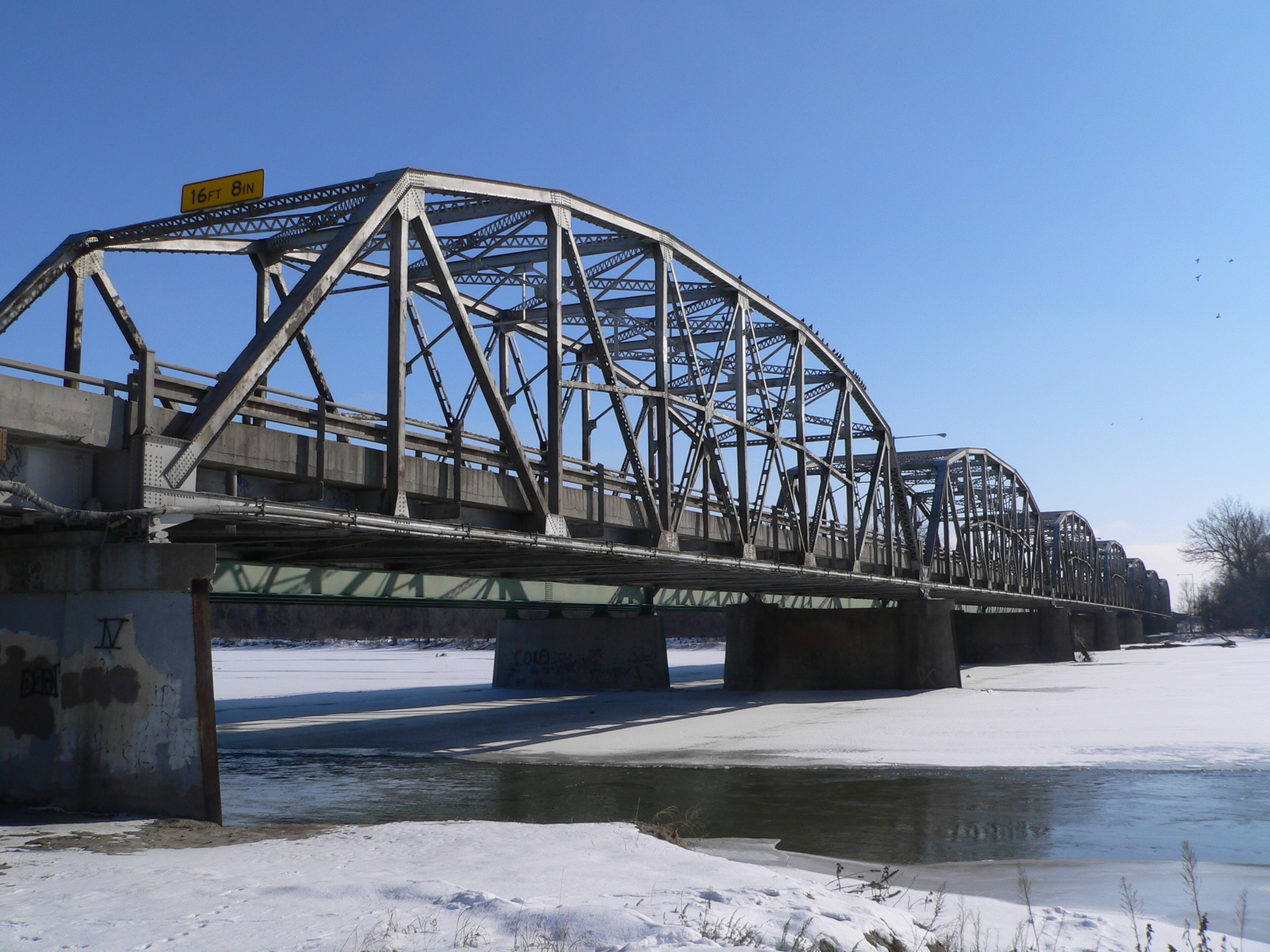
41°24′27″N 97°22′09″W / 41.4075°N 97.369167°WColumbus 4 Columbus Loup River Bridge 
June 29, 1992 U.S. Route 30 over the Loup River
41°25′01″N 97°22′04″W / 41.416944°N 97.367778°WColumbus 5 Dr. Carroll D. and Lorena R. North Evans House 
March 14, 1991 2204 14th St.
41°25′49″N 97°21′15″W / 41.430278°N 97.354167°WColumbus 6 Feye Archeological Site 
January 21, 1974 Address Restricted Creston 7 First Welsh Calvinistic Methodist Church and Cemetery 
June 25, 1999 Platte County 385 Ave. south of 370 St.
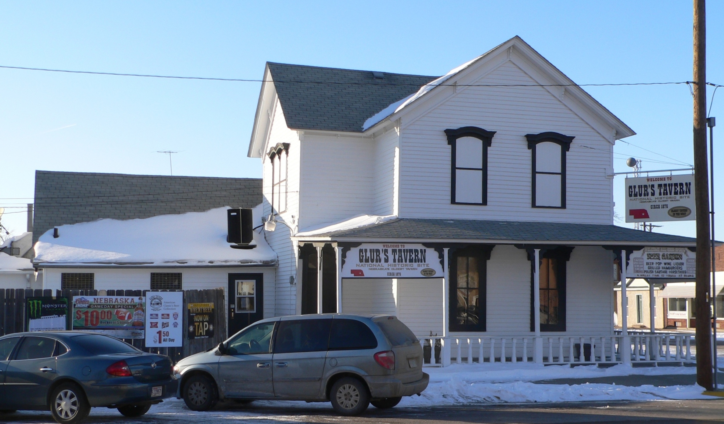
41°35′48″N 97°37′10″W / 41.596667°N 97.619444°WMonroe 8 Glur's Tavern 
July 30, 1975 2301 11th St.
41°25′37″N 97°21′20″W / 41.426944°N 97.355556°WColumbus 9 Frederick L. and L. Frederick Gottschalk Houses 
June 25, 1982 2022 17th St.
41°25′59″N 97°21′08″W / 41.433056°N 97.352222°WColumbus 10 Hill-Rupp Site September 30, 1985 Address Restricted Monroe 11 Humphrey City Hall 
June 21, 1996 407 S. 4th St.
41°41′27″N 97°29′09″W / 41.690833°N 97.485833°WHumphrey 12 Hanna Larson Archeological Site February 20, 1975 Address Restricted Monroe 13 Lincoln Highway-Duncan West 
July 3, 2007 North Boulevard in Duncan along rural 145th St.
41°23′31″N 97°29′14″W / 41.391944°N 97.487222°WDuncan and Butler Township 14 Lincoln Highway-Gardiner Station 
July 3, 2007 115th St. between 340th and 355th Aves.
41°21′40″N 97°33′30″W / 41.361111°N 97.558333°WButler Township 15 Monroe Congregational Church and New Hope Cemetery 
November 28, 1990 Platte County 310 St. between 400 and 415 Aves.
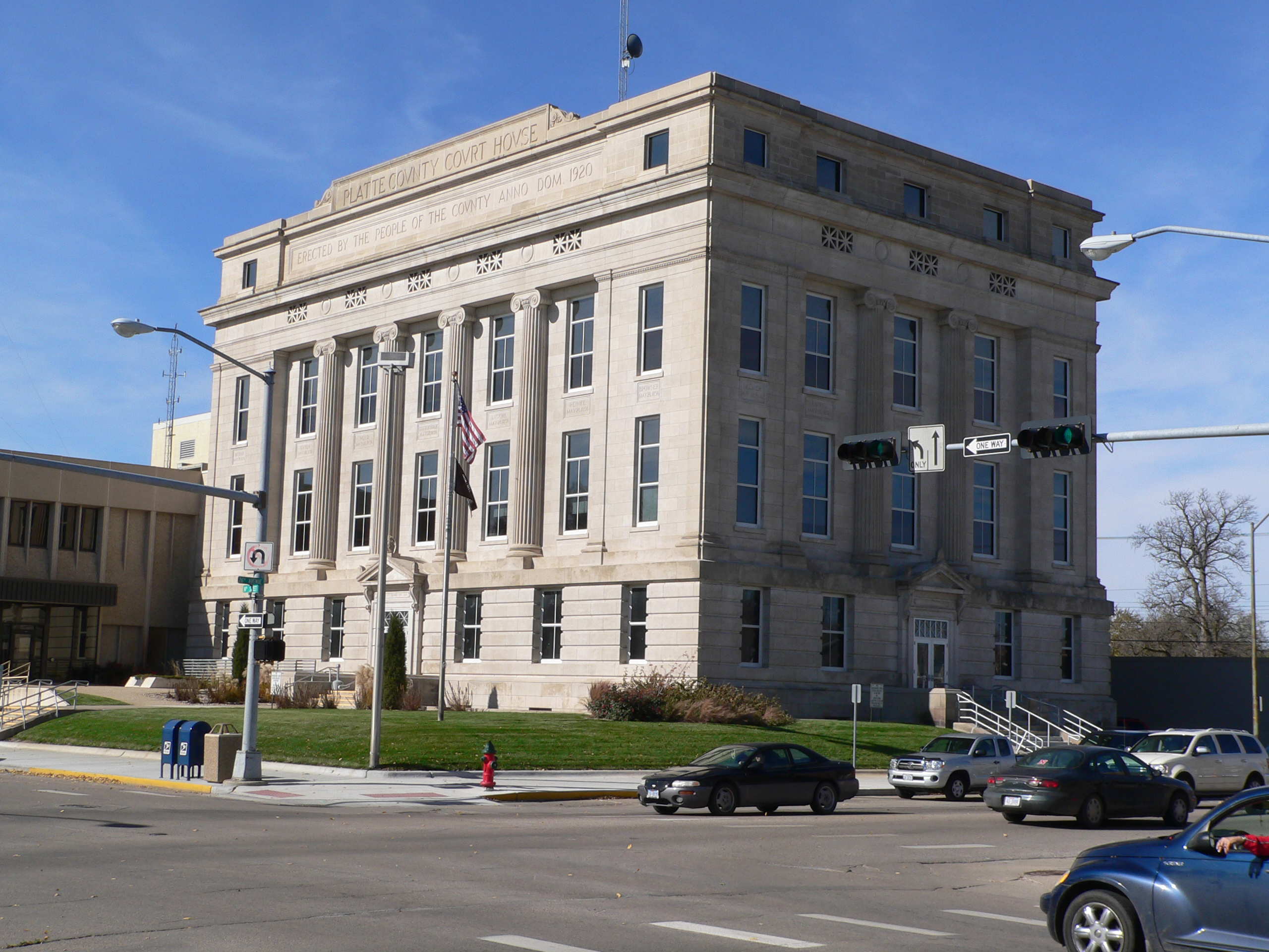
41°32′28″N 97°39′06″W / 41.541111°N 97.651667°WMonroe 16 Platte County Courthouse 
January 10, 1990 2610 14th St.
41°25′50″N 97°21′34″W / 41.430556°N 97.359444°WColumbus 17 C. Segelke Building 
June 25, 1982 1065 17th Ave.
41°25′36″N 97°20′52″W / 41.426667°N 97.347778°WColumbus 18 H.E. Snyder House 
July 10, 1986 2522 16th St.
41°25′56″N 97°21′32″W / 41.432222°N 97.358889°WColumbus 19 St. Michael's Catholic Church 
November 28, 1990 Junction of 3rd and Cedar Sts.
41°37′00″N 97°30′15″W / 41.616667°N 97.504167°WTarnov 20 Albert and Lina Stenger House 
December 27, 2007 815 Lovers Ln.
41°24′57″N 97°20′11″W / 41.415833°N 97.336389°WColumbus 21 Wurdeman-Lawson Archeological Site July 12, 1974 Address Restricted Creston See also
- List of National Historic Landmarks in Nebraska
- National Register of Historic Places listings in Nebraska
References
- ^ The latitude and longitude information provided in this table was derived originally from the National Register Information System, which has been found to be fairly accurate for about 99% of listings. For about 1% of NRIS original coordinates, experience has shown that one or both coordinates are typos or otherwise extremely far off; some corrections may have been made. A more subtle problem causes many locations to be off by up to 150 yards, depending on location in the country: most NRIS coordinates were derived from tracing out latitude and longitudes off of USGS topographical quadrant maps created under the North American Datum of 1927, which differs from the current, highly accurate WGS84 GPS system used by Google maps. Chicago is about right, but NRIS longitudes in Washington are higher by about 4.5 seconds, and are lower by about 2.0 seconds in Maine. Latitudes differ by about 1.0 second in Florida. Some locations in this table may have been corrected to current GPS standards.
- ^ "National Register of Historic Places: Weekly List Actions". National Park Service, United States Department of the Interior. Retrieved on November 10, 2011.
- ^ Numbers represent an ordering by significant words. Various colorings, defined here, differentiate National Historic Landmark sites and National Register of Historic Places Districts from other NRHP buildings, structures, sites or objects.
- ^ "National Register Information System". National Register of Historic Places. National Park Service. . http://nrhp.focus.nps.gov/natreg/docs/All_Data.html.
U.S. National Register of Historic Places Topics Lists by states Alabama • Alaska • Arizona • Arkansas • California • Colorado • Connecticut • Delaware • Florida • Georgia • Hawaii • Idaho • Illinois • Indiana • Iowa • Kansas • Kentucky • Louisiana • Maine • Maryland • Massachusetts • Michigan • Minnesota • Mississippi • Missouri • Montana • Nebraska • Nevada • New Hampshire • New Jersey • New Mexico • New York • North Carolina • North Dakota • Ohio • Oklahoma • Oregon • Pennsylvania • Rhode Island • South Carolina • South Dakota • Tennessee • Texas • Utah • Vermont • Virginia • Washington • West Virginia • Wisconsin • WyomingLists by territories Lists by associated states Other Municipalities and communities of Platte County, Nebraska Cities Columbus | Humphrey | Newman Grove‡
Villages Townships Bismark | Burrows | Butler | Columbus | Creston | Grand Prairie | Granville | Humphrey | Joliet | Lost Creek | Loup | Monroe | Oconee | St. Bernard | Shell Creek | Sherman | Walker | Woodville
Footnotes ‡This populated place also has portions in an adjacent county or counties
Categories:- National Register of Historic Places in Nebraska by county
- Platte County, Nebraska
- Buildings and structures in Platte County, Nebraska
-


Wikimedia Foundation. 2010.