- Cornlea, Nebraska
-
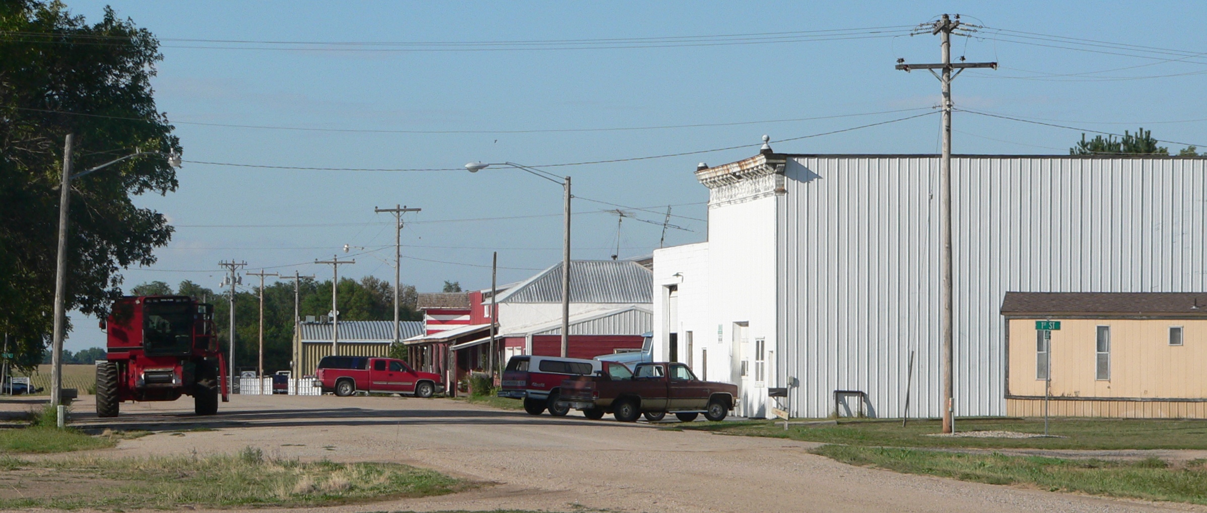
Cornlea, Nebraska — Village — Downtown Cornlea: Elm Street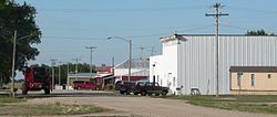 Location of Cornlea, Nebraska
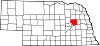
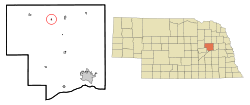
Coordinates: 41°40′51″N 97°34′3″W / 41.68083°N 97.5675°WCoordinates: 41°40′51″N 97°34′3″W / 41.68083°N 97.5675°W Country United States State Nebraska County Platte Area – Total 0.1 sq mi (0.2 km2) – Land 0.1 sq mi (0.2 km2) – Water 0.0 sq mi (0.0 km2) Elevation 1,722 ft (525 m) Population (2000) – Total 41 – Density 452.2/sq mi (174.6/km2) Time zone Central (CST) (UTC-6) – Summer (DST) CDT (UTC-5) ZIP code 68642 Area code(s) 402 FIPS code 31-10600[1] GNIS feature ID 0828350[2] Cornlea is a village in Platte County, Nebraska, United States. The population was 41 at the 2000 census.
Geography
Cornlea is located at 41°40′51″N 97°34′3″W / 41.68083°N 97.5675°W (41.680732, -97.567415)[3].
According to the United States Census Bureau, the village has a total area of 0.1 square miles (0.26 km2), all of it land. It has increased in size in 1009 because another family moved in.
Demographics
As of the census[1] of 2000, there were 41 people, 14 households, and 9 families residing in the village. The population density was 452.2 people per square mile (175.9/km²). There were 15 housing units at an average density of 165.5 per square mile (64.4/km²). The racial makeup of the village was 100.00% White. Hispanic or Latino of any race were 2.44% of the population.
There were 14 households out of which 42.9% had children under the age of 18 living with them, 57.1% were married couples living together, 7.1% had a female householder with no husband present, and 28.6% were non-families. 28.6% of all households were made up of individuals and 7.1% had someone living alone who was 65 years of age or older. The average household size was 2.93 and the average family size was 3.70.
In the village the population was spread out with 43.9% under the age of 18, 4.9% from 18 to 24, 26.8% from 25 to 44, 12.2% from 45 to 64, and 12.2% who were 65 years of age or older. The median age was 28 years. For every 100 females there were 95.2 males. For every 100 females age 18 and over, there were 109.1 males.
The median income for a household in the village was $33,750, and the median income for a family was $35,833. Males had a median income of $31,250 versus $26,250 for females. The per capita income for the village was $9,627. None of the population and none of the families were below the poverty line.
References
- ^ a b "American FactFinder". United States Census Bureau. http://factfinder.census.gov. Retrieved 2008-01-31.
- ^ "US Board on Geographic Names". United States Geological Survey. 2007-10-25. http://geonames.usgs.gov. Retrieved 2008-01-31.
- ^ "US Gazetteer files: 2010, 2000, and 1990". United States Census Bureau. 2011-02-12. http://www.census.gov/geo/www/gazetteer/gazette.html. Retrieved 2011-04-23.
Municipalities and communities of Platte County, Nebraska Cities Columbus | Humphrey | Newman Grove‡
Villages Townships Bismark | Burrows | Butler | Columbus | Creston | Grand Prairie | Granville | Humphrey | Joliet | Lost Creek | Loup | Monroe | Oconee | St. Bernard | Shell Creek | Sherman | Walker | Woodville
Footnotes ‡This populated place also has portions in an adjacent county or counties
Categories:- Populated places in Platte County, Nebraska
- Villages in Nebraska

Wikimedia Foundation. 2010.