- List of Nebraska Connecting Link, Spur, and Recreation Highways
-

Nebraska Connecting Link, Nebraska Spur, and Nebraska Recreation Road highways are a secondary part of the Nebraska highway system. They connect small towns and state parks to the primary Nebraska highway system. All of these highways are maintained by the Nebraska Department of Roads.
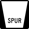
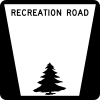
A connecting link, or simply a link, highway connects two primary highways. A spur highway is a highway which goes from a primary highway to a city or state park not on any other highway. A recreation road is a road in a state park, which is designated as such by the Nebraska Game and Parks Commission, though maintained by NDOR.
Highways are generally marked in the format of S-x-Y or L-x-Y, where S or L indicates whether it is a spur or a link, x is the county the highway is in, with ranking in alphabetical order (1 is Adams County, while 93 is York County), and Y is the letter which "numbers" the highway. Recreation Roads are typically unsigned.
Contents
History
In 1955, the Nebraska Legislature passed a law requiring all incorporated communities with a population over 100 to be included in the state highway system. Originally, the numbering system required placing a single digit in front of the highway number it was connecting with. In 1971, the system was changed to the current system.
Highway List
-
This transport-related list is incomplete; you can help by expanding it.
Connecting Links
County Name Length (miles) [1][2] West or south terminus East or north terminus Notes Adams L-1E 0.21 NE 74 east of Ayr U.S. 281 east of Ayr Unsigned turning lane Boone L-6A 0.10 NE 14 near Albion NE 39 near Albion Turning lane from NE 14 to NE 39 Box Butte L-7E 10.27 NE 2 in Hemingford NE 87 north of Alliance Highway formerly an alignment of NE 87; segment east of U.S. 385 previously a segment of U.S. 385 Buffalo L-10B 1.98 I-80 (exit 263) south of Odessa U.S. 30 in Odessa L-10C 3.89 I-80 (exit 285) south of Gibbon U.S. 30 in Gibbon L-10D 3.99 I-80 (exit 291) south of Shelton U.S. 30 in Shelton L-10E 0.30 U.S. 30 in Elm Creek U.S. 183 in Elm Creek Turning lane from U.S. 30 to U.S. 183 Cheyenne L-17B 0.72 I-80 (exit 38) south of Potter U.S. 30 in Potter L-17C 1.07 I-80 (exit 48) south of Brownson U.S. 30 west of Brownson L-17E 3.05 I-80 (exit 69) south of Sunol U.S. 30 in Sunol L-17F 2.31 I-80 (exit 76) south of Lodgepole U.S. 30 east of Lodgepole L-17J 2.43 I-80 (exit 59) in Sidney U.S. 30 in Sidney Connection between I-80 and North U.S. 385 Cuming L-20A 5.37 U.S. 275 in Beemer NE 51 north of Beemer Dawes L-23D 0.26 U.S. 20 west of Chadron U.S. 385 west of Chadron Turning lane from U.S. 20 to U.S. 385 Dawson L-24A 1.80 I-80 (exit 231) west of Lexington U.S. 30/NE 21 west of Lexington L-24B 3.88 I-80 (exit 248) south of Overton U.S. 30 in Overton L-24D 0.28 U.S. 30 in Gothenburg NE 47 in Gothenburg Follows Avenue D, then 11th Street in Gothenburg Deuel L-25A 0.63 I-80 (exit 85) south of Chappell U.S. 385 south of Chappell L-25B 1.10 I-80 (exit 107) south of Big Springs U.S. 138 in Big Springs Dixon L-26D 0.35 S-26B west of Concord NE 116 west of Concord Turning lane from NE 116 to S-26B Douglas L-28B 3.39 U.S. 275 south of Waterloo U.S. 6/NE 31 in Omaha Highway is freeway for entire length. L-28E 0.53 NE 92 south of Waterloo U.S. 275 south of Waterloo Highway marked as West NE 92 westbound and West US 275 eastbound L-28H 0.25 U.S. 75 in Omaha I-680 (exit 13) in Omaha 31st Street in Omaha L-28K 3.36 NE 133 in Omaha NE 64 in Omaha From west to east, follows Blair High Road, Military Road, and Northwest Radial Highway in Omaha Franklin L-31D 1.20 U.S. 136 west of Franklin U.S. 136/NE 10 in Franklin Gage L-34H 0.31 NE 112 west of Blue Springs U.S. 77 west of Blue Springs Turning lane from U.S. 77 to NE 112 Hall L-40C 5.60 I-80 (exit 305) south of Alda U.S. 30 in Alda Hamilton L-41D 4.12 I-80 (exit 338) south of Hampton U.S. 34 in Hampton Hitchcock L-44C 0.81 U.S. 6 west of Culbertson U.S. 6/U.S. 34 west of Culbertson Turning lane from U.S. 6 to U.S. 6 and U.S. 34 Holt L-45B 5.74 U.S. 275 in Ewing U.S. 20 north of Ewing Kearney L-50A 7.02 NE 44 south of Kearney NE 10 north of Minden Access road to Fort Kearny State Historical Park Keith L-51A 1.10 I-80 (exit 117) south of Brule U.S. 30 in Brule L-51B 1.00 I-80 (exit 133) south of Roscoe U.S. 30 east of Roscoe L-51C 1.05 I-80 (exit 145) south of Paxton U.S. 30 in Paxton Kimball L-53A 1.12 I-80 (exit 29) south of Dix U.S. 30 in Dix L-53B 0.41 I-80 (exit 1) east of Pine Bluffs U.S. 30 east of Pine Bluffs Highway contains a portion of Business Loop 80 L-53C 2.72 I-80 (exit 8) south of Bushnell U.S. 30 in Bushnell L-53E 1.50 I-80 (exit 22) southeast of Kimball U.S. 30 east of Kimball Lancaster L-55K 0.70 U.S. 6 in Lincoln I-80 (exit 395) west of Lincoln L-55W 2.28 U.S. 77 in Lincoln NE 2 in Lincoln L-55X 2.67 U.S. 6 in Lincoln I-80/U.S. 77 (exit 405) north of Lincoln Lincoln L-56C 1.98 I-80 (exit 164) south of Hershey U.S. 30 in Hershey L-56D 2.27 I-80 (exit 199) south of Brady U.S. 30 in Brady L-56G 2.02 I-80 (exit 179) in North Platte U.S. 30 in North Platte Commemorative name of "Twist" Newberry Access Highway Madison L-59B 0.35 NE 45 north of Newman Grove NE 32 north of Newman Grove Turning lane from NE 45 to NE 32 Merrick L-61D 0.18 NE 92 southwest of Clarks U.S. 30 southwest of Clarks Turning lane from U.S. 30 to NE 92 Morrill L-62A 9.08 U.S. 26 north of Bayard U.S. 385 north of Bridgeport Nance L-63A 3.11 NE 39 northwest of Genoa NE 22 northeast of Genoa Pawnee L-67E 0.25 NE 50 west of Table Rock NE 4 west of Table Rock Turning lane from NE 50 to NE 4 Saline L-76E 0.93 NE 33 in Dorchester U.S. 6/NE 15 north of Dorchester Scotts Bluff L-79E 2.14 NE 92 in Melbeta U.S. 26 west of Minatare Seward L-80E 11.72 U.S. 6 in Friend I-80 (exit 369) north of Beaver Crossing Highway extends into Saline County and also serves Beaver Crossing L-80F 5.70 I-80 (exit 366) south of Utica U.S. 34 north of Utica L-80G 5.65 I-80 (exit 373) south of Goehner U.S. 34 northeast of Tamora L-80H 0.68 U.S. 6 north of Milford I-80 north of Milford Sherman L-82A 3.01 NE 10 east of Hazard NE 68 west of Rockville Thayer L-85F 0.60 U.S. 81 south of Hebron U.S. 136 south of Hebron Webster L-91D 0.25 NE 4 south of Blue Hill U.S. 281 south of Blue Hill York L-93B 5.62 I-80 (exit 360) south of Waco U.S. 34 in Waco L-93E 4.68 I-80 (exit 348) west of York U.S. 34 west of York Spurs
County Name Length (miles)[1] West or south terminus East or north terminus Notes Adams S-1A 3.01 U.S. 6/U.S. 34 south of Kenesaw Kenesaw S-1B 1.01 U.S. 6/U.S. 34 south of Juniata Juniata S-1C 1.15 U.S. 6/U.S. 34 west of Hastings Hastings Correctional Center S-1D 5.46 U.S. 34/U.S. 281 west of Trumbull Trumbull Antelope S-2B 0.51 Brunswick U.S. 20 north of Brunswick Banner S-4A 4.08 Harrisburg NE 71 east of Harrisburg Blaine S-5A 0.10 Dunning NE 2 east of Dunning Boyd S-8A 0.24 NE 12 south of Naper Naper Brown S-9A 0.50 Long Pine U.S. 20/U.S. 183/NE 7 north of Long Pine Burt S-11A 0.53 Craig NE 32 north of Craig Butler S-12A 7.26 NE 15 south of Schuyler Linwood S-12B 13.10 NE 15 north of David City Abie Highway goes east from NE 15 to Bruno, then north from Bruno to Abie S-12C 5.10 Ulysses NE 15/NE 66 east of Ulysses S-12D 0.25 NE 66 south of Dwight Dwight S-12E 5.92 Surprise NE 92 west of Rising City S-12F 1.21 Brainard NE 92 north of Brainard Cass S-13A 0.72 NE 1 south of Murdock Murdock S-13C 1.04 Avoca U.S. 34 north of Avoca S-13D 0.93 U.S. 34 south of Nehawka Nehawka S-13F 0.50 NE 50 west of Manley Manley S-13H 2.65 NE 66 south of Cedar Creek Cedar Creek S-13K 1.88 NE 50 west of Weeping Water Weeping Water Cedar S-14A 2.17 Fordyce NE 12 north of Fordyce S-14B 0.27 NE 12 south of Wynot Wynot S-14C 0.81 Magnet NE 59 north of Magnet S-14H 5.37 NE 12 south of St. Helena St. Helena Chase S-15A 6.70 Champion U.S. 6 in Imperial Highway also serves Champion Mill State Historical Park Cherry S-16A 0.12 NE 12 northeast of Valentine Fort Niobrara National Wildlife Refuge S-16B 13.47 Valentine National Wildlife Refuge U.S. 83 south of Valentine S-16F 18.90 Samuel R. McKelvie National Forest U.S. 20 in Nenzel Clay S-18A 2.41 U.S. 6 south of Harvard Harvard S-18B 4.01 NE 14 west of Edgar Edgar S-18C 5.03 Deweese NE 14 east of Deweese S-18D 4.71 U.S. Meat Animal Research Center west of Clay Center NE 14/NE 41 in Clay Center S-18E 4.51 NE 74 south of Glenvil Glenvil S-18F 1.46 Ong NE 74 north of Ong S-18G 1.26 U.S. 6 south of Saronville Saronville Colfax S-19A 0.19 Leigh NE 91 north of Leigh S-19B 0.25 NE 91 south of Clarkson Clarkson S-19C 0.25 NE 91 south of Howells Howells Custer S-21A 6.25 NE 2 in Anselmo Victoria Springs State Recreation Area S-21B 0.72 NE 40 south of Callaway Callaway S-21C 7.36 U.S. 183 west of Comstock Comstock Dawes S-23A 1.93 U.S. 20 south of Whitney Whitney Dawson S-24C 0.11 NE 40 southwest of Eddyville Eddyville Dixon S-26A 1.29 Waterbury U.S. 20 north of Waterbury S-26B 2.76 NE 116 west of Concord University of Nebraska Northeast Experimental Station east of Concord Passes through Concord S-26E 2.21 NE 12 in Ponca Ponca State Park Dodge S-27A 0.26 NE 91 south of Dodge Dodge S-27D 0.55 U.S. 275/NE 91 south of Hooper Hooper Douglas S-28J 1.29 NE 36 south of Washington Washington Highway enters Washington County Fillmore S-30B 0.33 Shickley NE 74 north of Shickley S-30C 0.33 Ohiowa NE 74 north of Ohiowa S-30D 0.31 Strang NE 74 north of Strang S-30H 0.38 Milligan NE 41 north of Milligan Franklin S-31A 2.61 NE 10 west of Upland Upland S-31B 4.51 Hildreth NE 10 east of Hildreth S-31C 1.68 Naponee U.S. 136 north of Naponee Gage S-34A 2.59 NE 8 south of Liberty Liberty S-34B 4.65 NE 41 south of Firth Firth Highway enters Lancaster County S-34C 0.24 Adams NE 41 north of Adams S-34D 0.59 U.S. 77 west of Pickrell Pickrell Hall S-40D 6.09 Prosser NE 11/I-80 (exit 300) south of Wood River Highway enters Adams County Hamilton S-41A 1.51 U.S. 34 south of Phillips Phillips S-41B 6.71 Giltner U.S. 34 west of Aurora Highway intersects I-80 at Exit 324 S-41C 0.38 Marquette NE 14 east of Marquette Harlan S-42A 4.15 U.S. 183 west of Huntley Huntley Hayes S-43A 0.23 U.S. 6 south of Hamlet Hamlet Holt S-45A 4.22 U.S. 20 south of Page Page Howard S-47A 0.15 Farwell NE 92 north of Farwell Jefferson S-48A 0.38 Steele City NE 8 north of Steele City Johnson S-49A 0.83 NE 50 west of Cook Cook S-49B 0.23 NE 62 south of Elk Creek Elk Creek S-49C 0.23 U.S. 136 west of Crab Orchard Crab Orchard Knox S-54A 0.24 Verdigre NE 14/NE 84 east of Verdigre S-54B 3.04 NE 59 south of Winnetoon Winnetoon S-54D 8.38 NE 12 east of Niobrara Santee Lancaster S-55A 5.11 Denton U.S. 6 west of Lincoln S-55B 1.75 Sprague NE 33 north of Sprague S-55C 0.75 Lincoln Air Park U.S. 34 northwest of Lincoln S-55D 0.50 Panama NE 43 east of Panama S-55E 1.40 Davey U.S. 77 east of Davey S-55F 2.28 U.S. 77/NE 33 west of Roca Roca S-55G 3.82 U.S. 77 west of Hickman Hickman S-55H 3.90 Hallam U.S. 77 north of Cortland S-55J 0.49 NE 79 west of Raymond Raymond S-55M 2.33 Malcolm U.S. 34 southeast of Malcolm Lincoln S-56A 3.88 Fort McPherson National Cemetery U.S. 30 in Maxwell Highway intersects Interstate 80 at Exit 190 Logan S-57A 2.25 U.S. 83/NE 92 west of Gandy Gandy Merrick S-61A 1.75 NE 92 south of Palmer Palmer Nemaha S-64A 0.48 Julian U.S. 75 east of Julian Highway on Nemaha County-Otoe County border S-64B 0.44 NE 105 west of Johnson Johnson S-64E 4.86 NE 67 northeast of Shubert Indian Cave State Park Highway lies on border with Richardson County and also enters it briefly S-64G 0.62 NE 67 south of Peru Peru Nuckolls S-65A 5.19 Oak NE 4 north of Oak Otoe S-66A 8.02 Douglas NE 2 at Palmyra S-66C 2.79 NE 50 west of Otoe Otoe S-66D 0.50 Talmage NE 67 east of Talmage S-66E 6.18 Burr NE 50 east of Burr Pawnee S-67A 0.20 Lewiston NE 4 north of Lewiston S-67B 2.59 Steinauer NE 50 east of Steinauer S-67C 3.03 southwest of Pawnee City NE 65 south of Pawnee City Highway is gravel Pierce S-70A 1.25 U.S. 20 south of McLean McLean Platte S-71A 0.92 Humphrey U.S. 81 east of Humphrey S-71B 0.97 Platte Center U.S. 81 east of Platte Center S-71C 0.25 Creston NE 91 north of Creston S-71F 1.30 Cornlea NE 91 north of Cornlea Saline S-76A 4.35 U.S. 6 south of Cordova Cordova Highway enters Seward County S-76C 0.76 Western NE 15 east of Western S-76D 7.01 Swanton NE 41 north of Swanton Saunders S-78B 0.60 NE 66 south of Ithaca Ithaca S-78C 0.29 Memphis NE 66 east of Memphis S-78D 0.67 Weston NE 92 north of Weston S-78E 4.03 NE 92 south of Malmo Malmo S-78F 0.25 Mead NE 92 at Mead S-78H 0.58 Cedar Bluffs NE 109 east of Cedar Bluffs S-78J 0.74 NE 64 south of Leshara Leshara Scotts Bluff S-79H 2.07 Terrytown NE 92 in Scottsbluff Former alignment of Nebraska Highway 71 Seward S-80B 2.01 NE 15 west of Bee Bee S-80C 3.54 Staplehurst NE 15 east of Staplehurst S-80D 3.47 U.S. 34 south of Garland Garland Thayer S-85A 0.75 Byron NE 8 north of Byron S-85B 0.28 Hubbell NE 8 north of Hubbell S-85C 0.25 U.S. 81 west of Bruning Bruning S-85D 0.94 U.S. 81 west of Belvidere Belvidere S-85E 0.16 Deshler U.S. 136 north of Deshler S-85H 0.17 Hebron U.S. 81 east of Hebron Thomas S-86A 0.46 NE 2 south of Seneca Seneca S-86B 3.44 Nebraska National Forest (Bessey Ranger District) NE 2 west of Halsey Thurston S-87A 1.07 NE 9 west of Thurston Thurston S-87B 2.51 Rosalie U.S. 77 east of Rosalie Washington S-89A 0.08 U.S. 30 south of Kennard Kennard Wayne S-90A 0.25 NE 35 south of Hoskins Hoskins S-90B 0.18 NE 35 west of Winside Winside Webster S-91A 1.86 NE 4 south of Bladen Bladen S-91B 3.60 U.S. 281 west of Cowles Cowles York S-93A 7.00 Henderson U.S. 34 west of Bradshaw Intersects Interstate 80 at Exit 342 S-93C 0.30 Benedict U.S. 81 east of Benedict S-93D 0.55 Nebraska Correctional Center for Women near York U.S. 81 near York S-93F 0.27 McCool Junction U.S. 81 north of McCool Junction Recreation Roads
County Name Road[2] State Park[3] Antelope R-2A Grove Lake Recreation Road Ashfall Fossil Beds State Historical Park R-2D Ashfall State Historical Park Recreation Road Ashfall Fossil Beds State Historical Park Box Butte R-7B Box Butte Recreation Road Box Butte Reservoir State Recreation Area Brown R-9B Long Pine Recreation Road Long Pine State Recreation Area Buffalo R-10H Windmill State Recreation Road Windmill State Recreation Area Cass R-13L Louisville Lakes Recreation Road Louisville State Recreation Area R-13M Plattsmouth Waterfowl Area Recreation Road Schilling Wildlife Management Area R-13N Platte River Recreation Road Platte River State Park R-13P Eugene T. Mahoney State Park Recreation Road Eugene T. Mahoney State Park Chase R-15B Enders Lake Recreation Road Enders Reservoir State Recreation Area R-15C Champion Mill State Historical Park Recreation Road Champion Mill State Historical Park Cherry R-16C Merritt Reservoir Recreation Road Merritt Reservoir State Recreation Area R-16D Valentine Fish Hatchery Recreation Road Minnechaduza Creek Dawes R-23E Chadron State Park Recreation Road Chadron State Park R-23F Smiley Canyon State Wildlife Area Road Fort Robinson State Park R-23G Fort Robinson State Park Recreation Road Fort Robinson State Park Dodge R-27B Fremont Lakes Recreation Road Fremont Lakes State Recreation Area R-27C Dead Timber Recreation Road Dead Timber State Recreation Area Douglas R-28C Two Rivers Recreation Road Two Rivers State Recreation Area Frontier R-32A Red Willow Reservoir Recreation Road Red Willow Reservoir State Recreation Area Gage R-34J Rockford Lake Recreation Road Rockford State Recreation Area R-34K Big Indian Reservoir Recreation Road Big Indian Creek Reservoir 12-1[4] R-34L Big Indian Reservoir Recreation Road Big Indian Creek Reservoir 12-1[4] Garden R-35A Ash Hollow State Historical Park Recreation Road Ash Hollow State Historical Park R-35B Windlass Hill Recreation Road Ash Hollow State Historical Park Gosper R-37A Johnson Lake Recreation Road Johnson Lake State Recreation Area Hall R-40E Mormon Island Recreation Road Mormon Island State Recreation Area Hitchcock R-44A Macklin Bay Recreation Road Swanson Reservoir State Recreation Area R-44B Swanson Reservoir Recreation Road Swanson Reservoir State Recreation Area Jefferson R-48B Rock Creek Station Recreation Road Rock Creek Station State Historical Park Kearney R-50B Fort Kearney Recreation Area Road Fort Kearny State Recreation Area R-50C Fort Kearney State Historical Park Recreation Road Fort Kearny State Historical Park Keith R-51E Lake McConaughy South Recreation Road Lake McConaughy State Recreation Area R-51F Lake Ogallala Recreation Road Lake Ogallala State Recreation Area R-51G Martin Bay Recreation Road Lake McConaughy State Recreation Area R-51H Cedar Vue Recreation Road Lake McConaughy State Recreation Area Knox R-54C Wiegand Recreation Road Lewis and Clark State Recreation Area R-54F Niobrara State Park Recreation Road Niobrara State Park Lancaster R-55N Blue Stem Lake Recreation Area Road Bluestem State Recreation Area R-55P Wagon Train Lake Recreation Area Road Wagon Train State Recreation Area R-55R Conestoga Lake Recreation Area Road Conestoga State Recreation Area R-55T Branched Oak Lake Recreation Road Branched Oak State Recreation Area R-55U Pawnee Lake Recreation Road Pawnee State Recreation Area R-55V Kildeer Lake Recreation Road Kildeer State Special Use Area Lincoln R-56E Scouts Rest Ranch Recreation Road Buffalo Bill Ranch State Historical Park R-56F Maloney Reservoir Recreation Road Buffalo Bill Ranch State Historical Park Morrill R-62B Bridgeport Recreation Road Bridgeport State Recreation Area R-62F Chimney Rock Recreation Road Chimney Rock National Historic Site[5] Nemaha R-64F Indian Cave Recreation Road Indian Cave State Park R-64H Brownville Recreation Road Brownville State Recreation Area Pawnee R-67D Burchard Lake Recreation Road Burchard Lake State Park[6] Phelps R-69A Sacramento Game Farm Recreation Road Sacramento-Wilcox Wildlife Management Area Platte R-71G Lake North Recreation Road Lake North Campground[7] Red Willow R-73A Medicine Creek Reservoir Recreation Road Medicine Creek State Recreation Area Saunders R-78K Memphis Lake Recreation Road Memphis State Recreation Area Sherman R-82B Sherman Lake Recreation Road Sherman Reservoir State Recreation Area Thayer R-85G Alexandria Lakes Recreation Road Alexandria State Recreation Area Valley R-88B Fort Hartsuff Recreation Road Fort Hartsuff State Historical Park Washington R-89B Fort Atkinson State Historical Park Recreation Road Fort Atkinson State Historical Park Wheeler R-92A Pibel Lake Recreation Road Pibel Lake State Recreation Area See also
References
Categories:- State highways in Nebraska
- Nebraska-related lists
-


Wikimedia Foundation. 2010.